Country:
 Canada
Region:
City:
Latitude and Longitude:
Time Zone:
Postal Code:
IP information under different IP Channel
ip-api
Country
Region
City
ASN
Time Zone
ISP
Blacklist
Proxy
Latitude
Longitude
Postal
Route
IPinfo
Country
Region
City
ASN
Time Zone
ISP
Blacklist
Proxy
Latitude
Longitude
Postal
Route
MaxMind
Country
Region
City
ASN
Time Zone
ISP
Blacklist
Proxy
Latitude
Longitude
Postal
Route
Luminati
Country
CARegion
on
City
caledon
ASN
Time Zone
America/Toronto
ISP
OXIO-ASN-01
Latitude
Longitude
Postal
db-ip
Country
Region
City
ASN
Time Zone
ISP
Blacklist
Proxy
Latitude
Longitude
Postal
Route
ipdata
Country
Region
City
ASN
Time Zone
ISP
Blacklist
Proxy
Latitude
Longitude
Postal
Route
Popular places and events near this IP address
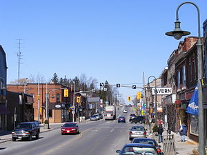
Caledonia, Ontario
Unincorporated community in Ontario, Canada
Distance: Approx. 5503 meters
Latitude and longitude: 43.89808333,-79.95508333
Caledonia is a community located on the Grand River in Haldimand County, Ontario, Canada. It had a population of 12,179 as of the 2021 Canadian Census. Caledonia is within Ward 3 of Haldimand County.

CIDC-FM
Radio station in Orangeville, Ontario
Distance: Approx. 7594 meters
Latitude and longitude: 43.91194444,-79.9375
CIDC-FM (103.5 FM, Z103.5) is a radio station licensed to Orangeville, Ontario, Canada. Owned by Evanov Communications, the station broadcasts a rhythmic contemporary format targeting the Greater Toronto Area. Its studios are located on Dundas Street West in the Eatonville neighbourhood in the Etobicoke district of Toronto.
Greenbelt (Golden Horseshoe)
Protected area in Southern Ontario, Canada
Distance: Approx. 2104 meters
Latitude and longitude: 43.88,-80
The Greenbelt is a protected area of green space, farmland, forests, wetlands, and watersheds, located in Southern Ontario, Canada. It surrounds a significant portion of the Golden Horseshoe. Created by legislation passed by the Government of Ontario in 2005, the Greenbelt is considered a prevention of urban development and sprawl on environmentally sensitive land in the province.
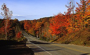
Caledon Township, Ontario
Geographic township in Ontario, Canada
Distance: Approx. 1143 meters
Latitude and longitude: 43.85083333,-80.00083333
Caledon Township, Ontario was a historic incorporated township and is a present-day geographic township in the modern Region of Peel, Ontario, Canada. The township forms the northwest section of Caledon, Ontario. Caledon Township was likely named by settlers, like Edward Ellis or by public voting.

Forks of the Credit Provincial Park
Provincial park in Ontario, Canada
Distance: Approx. 5103 meters
Latitude and longitude: 43.816,-80.012
Forks of the Credit Provincial Park, located in Caledon, Ontario, Canada, is part of the Ontario Parks system and is part of the Niagara Escarpment biosphere. The park is on the Bruce Trail. The Credit River runs through the park.

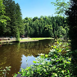
Caledon Lake
Lake in Caledon, Ontario, Canada
Distance: Approx. 8731 meters
Latitude and longitude: 43.880534,-80.106006
Caledon Lake is a lake in Caledon, Peel Region, Ontario, Canada. Caledon Lake is within the Greater Toronto Area Greenbelt.
Orangeville/Rosehill Aerodrome
Airport in Orangeville, Ontario
Distance: Approx. 4916 meters
Latitude and longitude: 43.90194444,-80.02388889
Orangeville/Rosehill Aerodrome (TC LID: COR8) is located adjacent to Orangeville, Ontario Canada.
The Hill Academy
Independent school in Canada
Distance: Approx. 6460 meters
Latitude and longitude: 43.8787,-80.0773
The Hill Academy is an independent school in Ontario, Canada, for student athletes in Grades K -12/PG with a focus on hockey, lacrosse and golf. It is co-ed, and serves grades K-12.
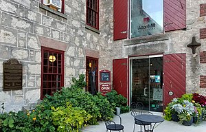
Alton, Ontario
Community in Ontario, Canada
Distance: Approx. 5460 meters
Latitude and longitude: 43.86027778,-80.06861111
Alton is a community located in Caledon, Ontario. It is also part of the Region of Peel. It was established in 1820.
Belfountain, Ontario
Community in Ontario, Canada
Distance: Approx. 7530 meters
Latitude and longitude: 43.79416667,-80.01416667
Belfountain is a community located within the borders of the town of Caledon, in Peel Region, Ontario, Canada.

Brimstone, Caledon, Ontario
Hamlet in Ontario, Canada
Distance: Approx. 6775 meters
Latitude and longitude: 43.80027778,-79.9975
Brimstone, also known locally as Brimstone Point, is a small hamlet located within the town of Caledon in the Peel Region of Ontario, Canada. The population was 53 people in the 2006 census.
Cataract, Ontario
Hamlet in Ontario, Canada
Distance: Approx. 4434 meters
Latitude and longitude: 43.82444444,-80.02222222
Cataract is a hamlet located within the town of Caledon in the regional municipality of Peel, Ontario, Canada. As of 2006, it had a population of 106 people.
Weather in this IP's area
scattered clouds
16 Celsius
16 Celsius
15 Celsius
17 Celsius
1017 hPa
74 %
1017 hPa
967 hPa
10000 meters
0.53 m/s
1.01 m/s
124 degree
36 %
07:03:13
19:24:52