Country:
Region:
City:
Latitude and Longitude:
Time Zone:
Postal Code:
IP information under different IP Channel
ip-api
Country
Region
City
ASN
Time Zone
ISP
Blacklist
Proxy
Latitude
Longitude
Postal
Route
Luminati
Country
Region
il
City
elkgrovevillage
ASN
Time Zone
America/Chicago
ISP
TEAM-CYMRU
Latitude
Longitude
Postal
IPinfo
Country
Region
City
ASN
Time Zone
ISP
Blacklist
Proxy
Latitude
Longitude
Postal
Route
db-ip
Country
Region
City
ASN
Time Zone
ISP
Blacklist
Proxy
Latitude
Longitude
Postal
Route
ipdata
Country
Region
City
ASN
Time Zone
ISP
Blacklist
Proxy
Latitude
Longitude
Postal
Route
Popular places and events near this IP address

Elk Grove Village, Illinois
Village in Illinois, United States
Distance: Approx. 2647 meters
Latitude and longitude: 42.00305556,-87.99638889
Elk Grove Village is a village in Cook and DuPage counties in the U.S. state of Illinois. Per the 2020 census, the population was 32,812. Located 20 miles (32 km) northwest of Chicago along the Golden Corridor, the Village of Elk Grove Village was incorporated on July 17, 1956.

Wood Dale, Illinois
City in Illinois, United States
Distance: Approx. 4551 meters
Latitude and longitude: 41.96305556,-87.97833333
Wood Dale is a city in Addison Township, DuPage County, Illinois, United States. Per the 2020 census, the population was 14,012.
American Airlines Flight 191
1979 DC-10 crash in Chicago, US
Distance: Approx. 3020 meters
Latitude and longitude: 42.00972222,-87.92916667
American Airlines Flight 191 was a regularly scheduled domestic passenger flight from O'Hare International Airport in Chicago to Los Angeles International Airport. On the afternoon of May 25, 1979, the McDonnell Douglas DC-10 operating this flight was taking off from runway 32R at O'Hare International when its left engine detached from the wing, causing a loss of control, and the aircraft crashed about 4,600 feet (1,400 m) from the end of runway 32R. All 271 occupants on board were killed, along with two people on the ground. With 273 fatalities, it is the deadliest aviation accident to have occurred in the United States.
American Academy of Pediatrics
US professional association
Distance: Approx. 4076 meters
Latitude and longitude: 42.0366,-87.9827
The American Academy of Pediatrics (AAP) is the largest professional association of pediatricians in the United States. It is headquartered in Itasca, Illinois, and maintains an office in Washington, D.C. The AAP has published hundreds of policy statements, ranging from advocacy issues to practice recommendations.

O'Hare, Chicago
Community area in Chicago
Distance: Approx. 3684 meters
Latitude and longitude: 42,-87.92
O'Hare, located on the far north side of Chicago, is one of the city's 77 community areas. O'Hare International Airport is located within the boundaries of this community area. This community area is the only one that extends outside Cook County; the western edge (an area comprising the southwest part of the airport) is in DuPage County.
AAR Corp
Aviation support company
Distance: Approx. 2225 meters
Latitude and longitude: 41.987373,-87.981812
AAR Corp. is an American provider of aircraft maintenance services to commercial and government customers worldwide. The company is headquartered in Wood Dale, Illinois, a Chicago suburb.
Indiana Territory's at-large congressional district
American congressional district
Distance: Approx. 2959 meters
Latitude and longitude: 42,-88
The Indiana Territory's at-large congressional district encompassed the entire area of the Indiana Territory. A delegate to the United States Congress was elected from this district. The territory was created from portions of the Northwest Territory leading up to the State of Ohio achieving statehood.

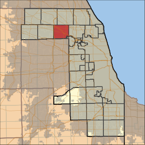
Elk Grove Township, Cook County, Illinois
Township in Illinois, United States
Distance: Approx. 3200 meters
Latitude and longitude: 42.02972222,-87.97722222
Elk Grove Township is one of 29 townships in Cook County, Illinois, USA. As of the 2020 census, its population was 95,508 and it contained 40,299 housing units. Elk Grove Township formerly housed the United Airlines headquarters.

Wood Dale station
Commuter rail station in Wood Dale, Illinois
Distance: Approx. 4563 meters
Latitude and longitude: 41.9624,-87.9752
Wood Dale is a station on Metra's Milwaukee District West Line in Wood Dale, Illinois. The station is 19.1 miles (30.7 km) away from Chicago Union Station, the eastern terminus of the line. In Metra's zone-based fare system, Wood Dale is in zone 3.
Gas Technology Institute
Distance: Approx. 3974 meters
Latitude and longitude: 42.01995,-87.92241
The Gas Technology Institute (GTI) is an American non-profit research and development organization which develops, demonstrates, and licenses new energy technologies for private and public clients, with a particular focus on the natural gas industry. GTI is located in Des Plaines, Illinois.

North Central Airlines Flight 458
1968 aviation accident
Distance: Approx. 3716 meters
Latitude and longitude: 41.99111111,-87.92222222
On December 27, 1968, North Central Airlines Flight 458 crashed into a hangar while attempting a night landing in poor weather at O'Hare International Airport in Chicago, Illinois, in the United States. Of the 41 passengers and four crew members, only 17 passengers and one crew member survived.
AerSale
Aviation Company
Distance: Approx. 2225 meters
Latitude and longitude: 41.987373,-87.981812
AerSale, Inc. is a Doral, Florida-based global supplier of aftermarket commercial jet aircraft, engines, used materials, and aeronautical engineering services to passenger and cargo airlines, government, multinational original equipment manufacturers, and independent MROs. AerSale is a member of the Aircraft Fleet Recycling Association.
Weather in this IP's area
mist
11 Celsius
11 Celsius
10 Celsius
13 Celsius
1013 hPa
96 %
1013 hPa
989 hPa
6437 meters
2.57 m/s
90 degree
100 %
06:46:12
16:28:24
