38.224.182.112 - IP Lookup: Free IP Address Lookup, Postal Code Lookup, IP Location Lookup, IP ASN, Public IP
Country:
Region:
City:
Location:
Time Zone:
Postal Code:
IP information under different IP Channel
ip-api
Country
Region
City
ASN
Time Zone
ISP
Blacklist
Proxy
Latitude
Longitude
Postal
Route
Luminati
Country
ASN
Time Zone
America/Sao_Paulo
ISP
Via SP
Latitude
Longitude
Postal
IPinfo
Country
Region
City
ASN
Time Zone
ISP
Blacklist
Proxy
Latitude
Longitude
Postal
Route
IP2Location
38.224.182.112Country
Region
district of columbia
City
washington
Time Zone
America/New_York
ISP
Language
User-Agent
Latitude
Longitude
Postal
db-ip
Country
Region
City
ASN
Time Zone
ISP
Blacklist
Proxy
Latitude
Longitude
Postal
Route
ipdata
Country
Region
City
ASN
Time Zone
ISP
Blacklist
Proxy
Latitude
Longitude
Postal
Route
Popular places and events near this IP address

George Washington University
Private university in Washington, D.C.
Distance: Approx. 89 meters
Latitude and longitude: 38.9008,-77.0508
The George Washington University (GW or GWU) is a private federally-chartered research university in Washington, D.C., United States. Originally named Columbian College, it was chartered in 1821 by the United States Congress and is the first university founded under Washington, D.C.'s jurisdiction. It is one of the nation's six federally chartered universities.

Foggy Bottom–GWU station
Washington Metro station
Distance: Approx. 90 meters
Latitude and longitude: 38.900842,-77.050426
Foggy Bottom–GWU station is a Washington Metro station in the Foggy Bottom neighborhood of Washington, D.C., United States. The island-platformed station was opened on July 1, 1977, and is operated by the Washington Metropolitan Area Transit Authority (WMATA). Providing service for the Blue, Orange, and Silver Lines, the station is located on I Street on the George Washington University (GWU) campus.
George Washington University Hospital
Hospital in Washington, D.C., United States
Distance: Approx. 48 meters
Latitude and longitude: 38.9012,-77.0506
The George Washington University Hospital (GWUH) is a for-profit hospital in Washington, D.C., affiliated with the George Washington University School of Medicine and Health Sciences. Since 2022, the George Washington University Hospital has been 100% owned and operated by Universal Health Services, though it maintains significant ties to George Washington University. The current 400,000 sq ft (37,200 m2) facility opened on August 23, 2002.
Washington Circle
Traffic circle in Washington, D.C.
Distance: Approx. 122 meters
Latitude and longitude: 38.9025,-77.05
Washington Circle is a traffic circle in the northwest quadrant of Washington, D.C., United States. It is located on the border of the Foggy Bottom and West End neighborhoods, which is a part of the Ward 2 section in Washington. It is the intersection of 23rd Street, K Street, New Hampshire Avenue, and Pennsylvania Avenue, N.W. It borders many buildings of the George Washington University campus.

Church of St. Paul's, K Street (Washington, D.C.)
Church in D.C., United States
Distance: Approx. 190 meters
Latitude and longitude: 38.9023,-77.0528
St. Paul's Parish, K Street is a parish of the Episcopal Church in the Episcopal Diocese of Washington. It is known for being one of the earlier Anglo-Catholic churches in the United States.
Embassy of Spain, Washington, D.C.
Diplomatic mission of the Kingdom of Spain to the United States
Distance: Approx. 183 meters
Latitude and longitude: 38.90322222,-77.05111111
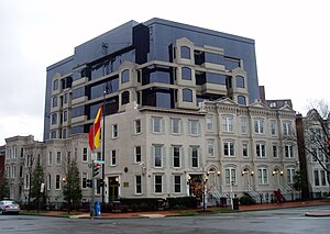
The Embassy of Spain in Washington, D.C. is the diplomatic mission of the Kingdom of Spain to the United States It is located at 2375 Pennsylvania Avenue NW, in the West End neighborhood. Spain did not establish diplomatic relations with the United States until 1790, after the ratification of the 1783 Treaty of Paris ending hostilities between the United States and the Kingdom of Great Britain. Diplomatic relations were broken off from 1808 to 1814 over American occupation of West Florida, and again from April 1898 to April 1899 during the Spanish–American War.

George Washington University School of Medicine & Health Sciences
Medical school in Washington, D.C, US
Distance: Approx. 100 meters
Latitude and longitude: 38.9007,-77.0508
The George Washington University School of Medicine and Health Sciences (abbreviated as GW Medical School or SMHS) is the professional medical school of the George Washington University, in Washington, D.C. SMHS is one of the most selective medical schools in the United States based on the number of applicants.

Milken Institute School of Public Health
School of public health of the George Washington University, in Washington, DC
Distance: Approx. 101 meters
Latitude and longitude: 38.900694,-77.050794
The Milken Institute School of Public Health (known as School of Public Health, Milken School, or SPH) is the school of public health of the George Washington University, in Washington, DC. U.S. News & World Report University Rankings ranks the Milken SPH as the 11th best public health graduate program in the United States. With 1,000 graduate students and 180 undergraduate students from nearly every U.S. state and more than 35 nations pursue undergraduate, graduate, and doctoral-level degrees in public health, its student body is one of the most ethnically diverse among the nation's private schools of public health.
Equestrian statue of George Washington (Washington Circle)
Statue by Clark Mills in Washington, D.C., U.S.
Distance: Approx. 94 meters
Latitude and longitude: 38.90234722,-77.0503
Lieutenant General George Washington is an 1860 equestrian statue of George Washington, at Washington Circle, at the edge of the George Washington University's campus, in Washington, D.C. The statue was sculpted by Clark Mills, who also created the equestrian statue of Andrew Jackson in front of the White House. The traffic circle where the statue is located was one of the original city designs by Pierre Charles L'Enfant. The statue and surrounding park are in the Foggy Bottom neighborhood at the intersection of 23rd Street, New Hampshire Avenue, and Pennsylvania Avenue NW. The K Street NW underpass runs beneath the circle.

Munson Hall
United States historic place
Distance: Approx. 183 meters
Latitude and longitude: 38.90055556,-77.04916667
Munson Hall is a residence hall on the campus of George Washington University, located at 2212 I St., Northwest, Washington, D.C. in the Foggy Bottom neighborhood.

Jacqueline Bouvier Kennedy Onassis Hall
United States historic place
Distance: Approx. 149 meters
Latitude and longitude: 38.90055556,-77.04972222
Jacqueline Bouvier Kennedy Onassis Hall (formerly known as Milton Hall) is a residence hall on the campus of the George Washington University, in Washington, DC. It is named after GW alumna Jacqueline Bouvier Kennedy Onassis, former First Lady of the United States.
Himmelfarb Health Sciences Library
Distance: Approx. 133 meters
Latitude and longitude: 38.90042,-77.05054
The Himmelfarb Health Sciences Library was completed in 1973 during the presidency of Lloyd Elliott. The library serves the George Washington University School of Medicine & Health Sciences, the Milken Institute School of Public Health, and the George Washington University School of Nursing. The building is part of the Ross Hall Medical Complex, and has three floors above ground and one below ground.
Weather in this IP's area
overcast clouds
-3 Celsius
-10 Celsius
-4 Celsius
-2 Celsius
1023 hPa
60 %
1023 hPa
1020 hPa
10000 meters
8.75 m/s
13.38 m/s
310 degree
100 %


