Country:
Region:
City:
Latitude and Longitude:
Time Zone:
Postal Code:
IP information under different IP Channel
ip-api
Country
Region
City
ASN
Time Zone
ISP
Blacklist
Proxy
Latitude
Longitude
Postal
Route
Luminati
Country
Region
chp
City
sancristobaldelascasas
ASN
Time Zone
America/Mexico_City
ISP
IENTC S DE RL DE CV
Latitude
Longitude
Postal
IPinfo
Country
Region
City
ASN
Time Zone
ISP
Blacklist
Proxy
Latitude
Longitude
Postal
Route
db-ip
Country
Region
City
ASN
Time Zone
ISP
Blacklist
Proxy
Latitude
Longitude
Postal
Route
ipdata
Country
Region
City
ASN
Time Zone
ISP
Blacklist
Proxy
Latitude
Longitude
Postal
Route
Popular places and events near this IP address

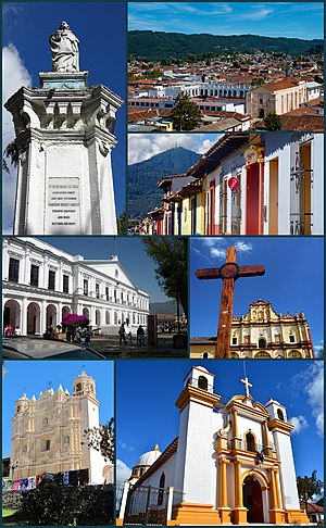
San Cristóbal de las Casas
City and municipality in Chiapas, Mexico
Distance: Approx. 7998 meters
Latitude and longitude: 16.73666667,-92.63833333
San Cristóbal de las Casas (Spanish: [saŋkɾisˈtoβal de las ˈkasas] ), also known by its native Tzotzil name, Jovel (pronounced [xɤ̞ˈve̞l]), is a town and municipality located in the Central Highlands region of the Mexican state of Chiapas. It was the capital of the state until 1892, and is still considered the cultural capital of Chiapas. The municipality is mostly made up of mountainous terrain, but the city sits in a small valley surrounded by hills.
Casa Na Bolom
Hotel in Mexico promoting the Lacandon Maya
Distance: Approx. 7982 meters
Latitude and longitude: 16.74166667,-92.62972222
Casa Na Bolom is located in San Cristóbal de las Casas, Chiapas, Mexico. It was the home of archeologist Frans Blom and his wife, documentary photographer, journalist, environmental pioneer Gertrude Duby Blom. Today, Casa Na Bolom operates as a hotel, museum, and research center run by Asociación Cultural Na Bolom, a non-profit organization dedicated to the protection of the Lacandon Maya and the preservation of the Chiapas rain forest.

Fifth federal electoral district of Chiapas
Federal electoral district of Mexico
Distance: Approx. 7388 meters
Latitude and longitude: 16.73333333,-92.63333333
The fifth federal electoral district of Chiapas (Distrito electoral federal 05 de Chiapas) is one of the 300 electoral districts into which Mexico is divided for elections to the federal Chamber of Deputies and one of 13 such districts in the state of Chiapas. It elects one deputy to the lower house of Congress for each three-year legislative period by means of the first-past-the-post system. Votes cast in the district also count towards the calculation of proportional representation ("plurinominal") deputies elected from the third region.
San Cristóbal de las Casas National Airport
Airport in Mexico
Distance: Approx. 6975 meters
Latitude and longitude: 16.69,-92.53
San Cristóbal de las Casas National Airport (Spanish: Aeropuerto Nacional de San Cristóbal de las Casas) also known as Aeropuerto Corazón de María (Corazón de María Airport) (IATA: SZT, ICAO: MMSC) was an airport located 18 kilometres (11 mi) from the city of San Cristóbal de las Casas, Chiapas, Mexico. It functioned as the primary airport for San Cristóbal de las Casas, facilitating both domestic and international flights, in addition to supporting flight training, charter, cargo, and general aviation activities. Operated by Aeropuertos y Servicios Auxiliares (ASA), the airport was closed in July 2010 due to structural terrain failures.
Weather in this IP's area
heavy intensity rain
10 Celsius
10 Celsius
10 Celsius
10 Celsius
1009 hPa
100 %
1009 hPa
747 hPa
514 meters
1.23 m/s
2.17 m/s
220 degree
100 %
06:16:20
17:35:19
