Country:
Region:
City:
Latitude and Longitude:
Time Zone:
Postal Code:
IP information under different IP Channel
ip-api
Country
Region
City
ASN
Time Zone
ISP
Blacklist
Proxy
Latitude
Longitude
Postal
Route
Luminati
Country
Region
oax
City
tlacoluladematamoros
ASN
Time Zone
America/Mexico_City
ISP
IENTC S DE RL DE CV
Latitude
Longitude
Postal
IPinfo
Country
Region
City
ASN
Time Zone
ISP
Blacklist
Proxy
Latitude
Longitude
Postal
Route
db-ip
Country
Region
City
ASN
Time Zone
ISP
Blacklist
Proxy
Latitude
Longitude
Postal
Route
ipdata
Country
Region
City
ASN
Time Zone
ISP
Blacklist
Proxy
Latitude
Longitude
Postal
Route
Popular places and events near this IP address
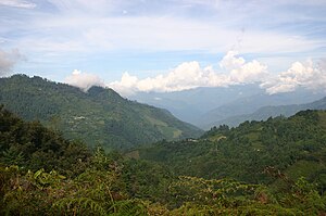
Sierra Madre de Oaxaca
Mountain range in southern Mexico
Distance: Approx. 6148 meters
Latitude and longitude: 17,-96.5
The Sierra Madre de Oaxaca is a mountain range in southern Mexico. It is primarily in the state of Oaxaca, and extends north into the states of Puebla and Veracruz.

Oaxaca Valley
Valley in Mexico
Distance: Approx. 7756 meters
Latitude and longitude: 16.95083333,-96.42111111
The Central Valleys (Spanish: Valles Centrales) of Oaxaca, also simply known as the Oaxaca Valley, is a geographic region located within the modern-day state of Oaxaca in southern Mexico. In an administrative context, it has been defined as comprising the districts of Etla, Centro, Zaachila, Zimatlán, Ocotlán, Tlacolula and Ejutla. The valley, which is located within the Sierra Madre Mountains, is shaped like a distorted and almost upside-down “Y,” with each of its arms bearing specific names: the northwestern Etla arm, the central southern Valle Grande, and the Tlacolula arm to the east.

Tlacolula de Matamoros
City and municipality in Oaxaca, Mexico
Distance: Approx. 1848 meters
Latitude and longitude: 16.95416667,-96.47916667
Tlacolula de Matamoros is a city and municipality in the Mexican state of Oaxaca, about 30 km from the center of the city of Oaxaca on Federal Highway 190, which leads east to Mitla and the Isthmus of Tehuantepec. It is part of the Tlacolula District in the east of the Valles Centrales Region. The city is the main commercial center for the Tlacolula Valley area, and best known for its weekly open air market held on Sundays.

Yagul
UNESCO World Heritage Site
Distance: Approx. 4853 meters
Latitude and longitude: 16.95833333,-96.45027778
Yagul is an archaeological site and former city-state associated with the Zapotec civilization of pre-Columbian Mesoamerica, located in the Mexican state of Oaxaca. The site was declared one of the country's four Natural Monuments on 13 October 1998. The site is also known locally as Pueblo Viejo (Old Village) and was occupied at the time of the Spanish Conquest.
Lambityeco
Distance: Approx. 2963 meters
Latitude and longitude: 16.97166667,-96.49194444
Lambityeco is a small archaeological site about three kilometers west of the city of Tlacolula de Matamoros in the Mexican state of Oaxaca. It is located just off Highway 190 about 25 km (16 mi) east from the city of Oaxaca en route to Mitla. The site has been securely dated to the Late Classical Period.
San Bartolomé Quialana
Municipality and town in Oaxaca, Mexico
Distance: Approx. 5065 meters
Latitude and longitude: 16.9,-96.5
San Bartolomé Quialana is a town and municipality in Oaxaca in south-western Mexico. The municipality covers an area of 49.76 km2. It is part of the Tlacolula District in the east of the Valles Centrales Region.
San Juan Guelavía
Municipality and town in Oaxaca, Mexico
Distance: Approx. 4255 meters
Latitude and longitude: 16.95,-96.53333333
San Juan Guelavía is a town and municipality in Oaxaca in south-western Mexico. The municipality covers an area of 17.86 km2. It is part of the Tlacolula District in the east of the Valles Centrales Region.
San Lucas Quiaviní
Municipality and town in Oaxaca, Mexico
Distance: Approx. 5787 meters
Latitude and longitude: 16.9,-96.46666667
San Lucas Quiaviní is a town and municipality in Oaxaca in south-western Mexico. The municipality covers an area of 58.69 km². It is part of the Tlacolula District in the east of the Valles Centrales Region.

Villa Díaz Ordaz
Municipality and town in Oaxaca, Mexico
Distance: Approx. 5236 meters
Latitude and longitude: 16.96666667,-96.45
Villa Díaz Ordaz is a town and municipality in Oaxaca in south-western Mexico. The municipality covers an area of km². It is part of the Tlacolula District in the east of the Valles Centrales Region.The name of the town was formally called Santo Domingo del Valle.

Santa Ana del Valle
Municipality and town in Oaxaca, Mexico
Distance: Approx. 5843 meters
Latitude and longitude: 16.99305556,-96.47138889
Santa Ana del Valle is a town and municipality in Oaxaca in south-western Mexico. The municipality covers an area of km2. It is part of the Tlacolula District in the east of the Valles Centrales Region.

Tlacolula District
District in Oaxaca, Mexico
Distance: Approx. 2930 meters
Latitude and longitude: 16.95,-96.46666667
Tlacolula District is located in the east of the Valles Centrales Region of the State of Oaxaca, Mexico.

Fourth federal electoral district of Oaxaca
Federal electoral district of Mexico
Distance: Approx. 2930 meters
Latitude and longitude: 16.95,-96.46666667
The fourth federal electoral district of Oaxaca (Distrito electoral federal 04 de Oaxaca) is one of the 300 electoral districts into which Mexico is divided for elections to the federal Chamber of Deputies and one of 10 such districts in the state of Oaxaca. It elects one deputy to the lower house of Congress for each three-year legislative period by means of the first-past-the-post system. Votes cast in the district also count towards the calculation of proportional representation ("plurinominal") deputies elected from the third region.
Weather in this IP's area
scattered clouds
17 Celsius
17 Celsius
17 Celsius
17 Celsius
1013 hPa
88 %
1013 hPa
841 hPa
10000 meters
0.31 m/s
0.71 m/s
100 degree
50 %
06:32:21
17:50:30

