Country:
 USA
USARegion:
City:
Latitude and Longitude:
Time Zone:
Postal Code:
IP information under different IP Channel
ip-api
Country
Region
City
ASN
Time Zone
ISP
Blacklist
Proxy
Latitude
Longitude
Postal
Route
IPinfo
Country
Region
City
ASN
Time Zone
ISP
Blacklist
Proxy
Latitude
Longitude
Postal
Route
MaxMind
Country
Region
City
ASN
Time Zone
ISP
Blacklist
Proxy
Latitude
Longitude
Postal
Route
Luminati
Country
USRegion
nv
City
springcreek
ASN
Time Zone
America/Los_Angeles
ISP
ANTHEMBB
Latitude
Longitude
Postal
db-ip
Country
Region
City
ASN
Time Zone
ISP
Blacklist
Proxy
Latitude
Longitude
Postal
Route
ipdata
Country
Region
City
ASN
Time Zone
ISP
Blacklist
Proxy
Latitude
Longitude
Postal
Route
Popular places and events near this IP address
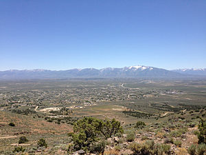
Spring Creek, Nevada
CDP in Nevada, United States
Distance: Approx. 924 meters
Latitude and longitude: 40.745,-115.59833333
Spring Creek is a census-designated place (CDP) in central Elko County, in northeastern Nevada in the western United States. It mainly serves as a bedroom community for the businesses and industries in and around the nearby city of Elko. It is part of the Elko Micropolitan Statistical Area.

Spring Creek High School (Nevada)
Public secondary school in Spring Creek, Nevada, United States
Distance: Approx. 4414 meters
Latitude and longitude: 40.77482,-115.64247
Spring Creek High School (SCHS) is a public secondary school in Spring Creek, Nevada, in the United States. Part of the Elko County School District, its mascot is the Spartan and the school's colors are purple, silver, and black.
Pleasant Valley, Elko County, Nevada
Unincorporated community in Nevada, United States
Distance: Approx. 7879 meters
Latitude and longitude: 40.71805556,-115.5175
Pleasant Valley is an unincorporated community in Elko County, Nevada, United States.
Weather in this IP's area
clear sky
19 Celsius
17 Celsius
18 Celsius
20 Celsius
1020 hPa
29 %
1020 hPa
842 hPa
10000 meters
1.29 m/s
1.59 m/s
240 degree
06:43:27
18:17:32