38.18.196.216 - IP Lookup: Free IP Address Lookup, Postal Code Lookup, IP Location Lookup, IP ASN, Public IP
Country:
Region:
City:
Location:
Time Zone:
Postal Code:
IP information under different IP Channel
ip-api
Country
Region
City
ASN
Time Zone
ISP
Blacklist
Proxy
Latitude
Longitude
Postal
Route
Luminati
Country
Region
nv
City
springcreek
ASN
Time Zone
America/Los_Angeles
ISP
ANTHEMBB
Latitude
Longitude
Postal
IPinfo
Country
Region
City
ASN
Time Zone
ISP
Blacklist
Proxy
Latitude
Longitude
Postal
Route
IP2Location
38.18.196.216Country
Region
nevada
City
elko
Time Zone
America/Los_Angeles
ISP
Language
User-Agent
Latitude
Longitude
Postal
db-ip
Country
Region
City
ASN
Time Zone
ISP
Blacklist
Proxy
Latitude
Longitude
Postal
Route
ipdata
Country
Region
City
ASN
Time Zone
ISP
Blacklist
Proxy
Latitude
Longitude
Postal
Route
Popular places and events near this IP address

Elko, Nevada
City in Nevada, United States
Distance: Approx. 2038 meters
Latitude and longitude: 40.83888889,-115.74027778
Elko is a city in the U.S. state of Nevada and the county seat of Elko County. As of the official 2020 U.S. Census, the city has a population of 20,564. Elko serves as the center of the Ruby Valley, a region with a population of over 55,000.

Great Basin College
Public college in Elko, Nevada, US
Distance: Approx. 1145 meters
Latitude and longitude: 40.842619,-115.767156
Great Basin College is a public college in Elko, Nevada, United States. Opened in 1967 as Elko College, it was later renamed to Northern Nevada College and then to its current name. It has 3,836 students and is a member of the Nevada System of Higher Education.

Elko Regional Airport
Airport
Distance: Approx. 2558 meters
Latitude and longitude: 40.825,-115.79166667
Elko Regional Airport (IATA: EKO, ICAO: KEKO, FAA LID: EKO) – formerly Elko Municipal Airport – is a public airport located approximately 1 mile (1.6 km) west of downtown Elko, in Elko County, Nevada, United States. The airport was named J.C. Harris Field in 1975 in honor of Jess C. Harris, a sheriff from Elko known as "The Flying Sheriff".

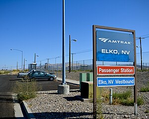
Elko station
Train station in Elko, Nevada
Distance: Approx. 1158 meters
Latitude and longitude: 40.8364,-115.7502
Elko station is a train station in Elko, Nevada. It is served by Amtrak's California Zephyr. The westbound platform is accessed from Water Street via 11th Street and the eastbound platform is accessed from Sharp Access Road via 12th Street (Water Street cannot be accessed directly from 12th Street).

Elko High School
Secondary school in Elko, Nevada, United States
Distance: Approx. 738 meters
Latitude and longitude: 40.839,-115.76
Elko High School (EHS) is a public secondary school in Elko, Nevada, in the United States. It is part of the Elko County School District. The school's mascot is the Indian and its colors are maroon and white.
Elko County Courthouse
United States historic place
Distance: Approx. 134 meters
Latitude and longitude: 40.83349444,-115.76180278
Elko County Courthouse is a historic building listed on the National Register of Historic Places and located at 571 Idaho Street in Elko, Nevada.
National Cowboy Poetry Gathering
Distance: Approx. 1491 meters
Latitude and longitude: 40.844328,-115.754093
The National Cowboy Poetry Gathering (formerly: Elko Cowboy Poetry Gathering), is an annual gathering celebrating cowboy poetry produced by the Western Folklife Center, that takes place in Elko, Nevada, United States.

Ruby Valley Pony Express Station
United States historic place
Distance: Approx. 1478 meters
Latitude and longitude: 40.8425,-115.75111111
The Ruby Valley Pony Express Station, located at 1515 Idaho St. in Elko, Nevada, was built in 1860 in Ruby Valley, Nevada. It was moved in 1960 approximately 60 miles (97 km) to Elko, during the centennial anniversary year for the Pony Express, and then restored, and is listed on the National Register of Historic Places.

Elko Main Post Office
United States historic place
Distance: Approx. 312 meters
Latitude and longitude: 40.83,-115.76305556
The Elko Main Post Office, located at 275 Third in Elko, Nevada, was built in 1933. Its Mediterranean Revival design is credited to the Office of the Supervising Architect under James A. Wetmore. It is listed on the National Register of Historic Places (NRHP).

Elko Formation
Distance: Approx. 4795 meters
Latitude and longitude: 40.8,-115.8
The Elko Formation, also known as Elko Shale(s), is an oil shale geologic formation in Elko County, northern Nevada, United States. The deltaic and lacustrine shales and limestones preserve fossils dating back to the Middle Eocene of the Paleogene to Middle Miocene of the Neogene period. The frog genus Elkobatrachus and ant species Pseudocamponotus elkoanus were named after the formation.
Crystal Theatre (Elko, Nevada)
Distance: Approx. 253 meters
Latitude and longitude: 40.83298,-115.7601
Crystal Theatre is a historic theater in Elko, Nevada. It is located at 676 Commercial Street. It is now known as the Crystal 5 and is part of UEC Theatres.
No. 1 Geisha
Legal brothel in Elko, Nevada
Distance: Approx. 447 meters
Latitude and longitude: 40.82915,-115.76088
No. 1 Geisha was a legal brothel (ranch) and massage parlor in Elko, Nevada. The women who worked there were of Asian heritage.
Weather in this IP's area
scattered clouds
10 Celsius
8 Celsius
10 Celsius
11 Celsius
1022 hPa
42 %
1022 hPa
831 hPa
10000 meters
0.99 m/s
1.18 m/s
71 degree
42 %

