Country:
 Canada
Region:
City:
Latitude and Longitude:
Time Zone:
Postal Code:
IP information under different IP Channel
ip-api
Country
Region
City
ASN
Time Zone
ISP
Blacklist
Proxy
Latitude
Longitude
Postal
Route
IPinfo
Country
Region
City
ASN
Time Zone
ISP
Blacklist
Proxy
Latitude
Longitude
Postal
Route
MaxMind
Country
Region
City
ASN
Time Zone
ISP
Blacklist
Proxy
Latitude
Longitude
Postal
Route
Luminati
Country
CARegion
bc
City
victoria
ASN
Time Zone
America/Vancouver
ISP
OXIO-ASN-01
Latitude
Longitude
Postal
db-ip
Country
Region
City
ASN
Time Zone
ISP
Blacklist
Proxy
Latitude
Longitude
Postal
Route
ipdata
Country
Region
City
ASN
Time Zone
ISP
Blacklist
Proxy
Latitude
Longitude
Postal
Route
Popular places and events near this IP address

Esquimalt
Township in British Columbia, Canada
Distance: Approx. 2431 meters
Latitude and longitude: 48.432276,-123.405844
The Township of Esquimalt () is a municipality at the southern tip of Vancouver Island, in British Columbia, Canada. It is bordered to the east by the provincial capital, Victoria, to the south by the Strait of Juan de Fuca, to the west by Esquimalt Harbour and Royal Roads, to the northwest by the New Songhees 1A Indian reserve and the town of View Royal, and to the north by a narrow inlet of water called the Gorge, across which is the district municipality of Saanich. It is almost tangential to Esquimalt 1 Indian Reserve near Admirals Road.

CFB Esquimalt
Naval base near Victoria, British Columbia, Canada
Distance: Approx. 2444 meters
Latitude and longitude: 48.43111111,-123.43166667
Canadian Forces Base Esquimalt (CFB Esquimalt) is Canada's Pacific Coast naval base and home port to Maritime Forces Pacific and Joint Task Force Pacific Headquarters. As of 2018, 4,411 military personnel and 2,762 civilians work at CFB Esquimalt.
École Victor-Brodeur
Elementary school in Esquimalt, British Columbia, Canada
Distance: Approx. 2561 meters
Latitude and longitude: 48.43217778,-123.40248333
École Victor-Brodeur is a French first language K-12 school located in Esquimalt, British Columbia, Canada. It is designed to accommodate 540 students from the Greater Victoria area and to serve as a community centre for the local francophone community. It was named for Royal Canadian Navy officer Victor Brodeur, who was one of the first "group of six" officer cadets accepted into the RCN and also one of the 3% of Quebec born officers to reach the rank of Rear Admiral.
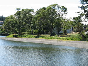
Craigflower Manor and Schoolhouse
National Historic Sites of Canada located in View Royal, British Columbia
Distance: Approx. 121 meters
Latitude and longitude: 48.452649,-123.421617
The Craigflower Manor and Craigflower Schoolhouse are National Historic Sites of Canada located in View Royal, British Columbia (the Manor) and Saanich (the Schoolhouse) near Victoria. The centerpiece of each historic site is a 19th-century building — a manor and schoolhouse commissioned by the Hudson's Bay Company to provide education and lodging for their employees. Built as part of the agricultural community Craigflower Farm, the buildings served as a focal point for the community into the modern era; they remain open to the public today as museums devoted to the colonial history of Victoria.

Victoria General Hospital
Hospital in British Columbia , Canada
Distance: Approx. 1928 meters
Latitude and longitude: 48.467222,-123.4325
Victoria General Hospital (VGH) is an acute care facility located in View Royal, British Columbia, Canada, a western suburb of Victoria. VGH provides emergency, general surgery and medical treatment services. It is one of two acute-care hospitals on southern Vancouver Island, along with the Royal Jubilee Hospital.
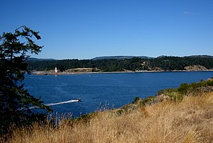
Esquimalt Harbour
Harbour in Greater Victoria, British Columbia, Canada.
Distance: Approx. 2261 meters
Latitude and longitude: 48.43333333,-123.43333333
Esquimalt Harbour is a natural harbour in Greater Victoria on the southern tip of Vancouver Island in British Columbia, Canada. The entrance to Esquimalt Harbour is from the south off the Strait of Juan de Fuca through a narrow channel known as Royal Roads. Esquimalt Harbour is situated west of Victoria Harbour, another major harbour in the region.
Esquimalt First Nation
Canadian First Nation
Distance: Approx. 2400 meters
Latitude and longitude: 48.4306,-123.4147
Esquimalt First Nation, also known as the Esquimalt Indian Band and Esquimalt Nation, is a First Nations band government of the Esquimalt people. Historically their village was located closer to Victoria proper, but today their main reserve is on the north shore of Esquimalt Harbour adjacent to the Town of View Royal. They are a member nation of the First Nations of South Island Tribal Council, and were signatories to the Douglas Treaties.
Esquimalt station
Railway station in British Columbia, Canada
Distance: Approx. 1621 meters
Latitude and longitude: 48.43731389,-123.41843056
The Esquimalt station is located in Esquimalt, British Columbia. The station was a flag stop on Via Rail's Dayliner service, which has been indefinitely suspended since 2011. The station opened in 1886, and was the original terminus of the line until the extension to Victoria.
Esquimalt High School
High school in Victoria, British Columbia, Canada
Distance: Approx. 2323 meters
Latitude and longitude: 48.438,-123.397
École Secondaire Esquimalt High School (or "EHS") is a high school located in Esquimalt, a township located west of Victoria, British Columbia, Canada. EHS is operated by the Greater Victoria School District. It is the designated secondary school for Shoreline and Rockheights Middle Schools and serves students from Esquimalt, View Royal, and the Victoria neighbourhoods of Vic West and Craigflower.
Spectrum Community School (British Columbia)
High school in Saanich, British Columbia, Canada
Distance: Approx. 1482 meters
Latitude and longitude: 48.461965,-123.407628
Spectrum Community School is a high school in the Greater Victoria suburb of Saanich, British Columbia, Canada. It is part of the Greater Victoria School District and serves the western portion of the district. Spectrum was established in 1974 as a replacement for Mount View High School and the school moved into the new facility in 1976.
Esquimalt Airport
Airport
Distance: Approx. 2557 meters
Latitude and longitude: 48.43333333,-123.4
Esquimalt Airport (IATA: YPF, ICAO: CYPF) was an airport located in Esquimalt, British Columbia, Canada.
Signal Hill (British Columbia)
Distance: Approx. 2563 meters
Latitude and longitude: 48.42944444,-123.42888889
Signal Hill is a hill in Esquimalt, British Columbia, Canada, located on the south side of Constance Cove in CFB Esquimalt.
Weather in this IP's area
few clouds
15 Celsius
15 Celsius
13 Celsius
17 Celsius
1015 hPa
80 %
1015 hPa
1014 hPa
10000 meters
4.12 m/s
250 degree
20 %
06:55:34
19:19:46