Country:
 Canada
Region:
City:
Latitude and Longitude:
Time Zone:
Postal Code:
IP information under different IP Channel
ip-api
Country
Region
City
ASN
Time Zone
ISP
Blacklist
Proxy
Latitude
Longitude
Postal
Route
IPinfo
Country
Region
City
ASN
Time Zone
ISP
Blacklist
Proxy
Latitude
Longitude
Postal
Route
MaxMind
Country
Region
City
ASN
Time Zone
ISP
Blacklist
Proxy
Latitude
Longitude
Postal
Route
Luminati
Country
CARegion
ab
City
calgary
ASN
Time Zone
America/Edmonton
ISP
OXIO-ASN-01
Latitude
Longitude
Postal
db-ip
Country
Region
City
ASN
Time Zone
ISP
Blacklist
Proxy
Latitude
Longitude
Postal
Route
ipdata
Country
Region
City
ASN
Time Zone
ISP
Blacklist
Proxy
Latitude
Longitude
Postal
Route
Popular places and events near this IP address

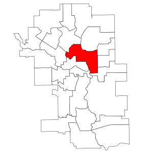
Calgary-Nose Hill (provincial electoral district)
Defunct provincial electoral district in Alberta, Canada
Distance: Approx. 2661 meters
Latitude and longitude: 51.102,-114.085
Calgary-Nose Hill was a provincial electoral district in Calgary, Alberta, Canada, mandated to return a single member to the Legislative Assembly of Alberta using the first past the post method of voting from 2004 to 2012.

Calgary-North Hill
Defunct provincial electoral district in Alberta, Canada
Distance: Approx. 1814 meters
Latitude and longitude: 51.1,-114.07
Calgary-North Hill was a provincial electoral district in Calgary, Alberta, Canada, mandated to return a single member to the Legislative Assembly of Alberta using the first past the post method of voting from 1971 to 2012.
Calgary Queens Park
Defunct provincial electoral district in Alberta, Canada
Distance: Approx. 1720 meters
Latitude and longitude: 51.0972,-114.0639
Calgary Queens Park was a provincial electoral district in Calgary, Alberta, Canada, mandated to return a single member to the Legislative Assembly of Alberta using the first past the post method of voting from 1963 to 1971.
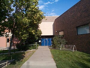
John G. Diefenbaker High School
Public school in Calgary, Alberta, Canada
Distance: Approx. 1526 meters
Latitude and longitude: 51.1127,-114.07
John G. Diefenbaker High School is a senior public high school located at 6620 4th Street N.W., Huntington Hills, Calgary, Alberta. The school is named after the 13th Prime Minister of Canada, John G. Diefenbaker. The school is part of the Calgary Board of Education.
Thorncliffe, Calgary
Neighbourhood in Calgary, Alberta, Canada
Distance: Approx. 1499 meters
Latitude and longitude: 51.10222222,-114.06694444
Thorncliffe is a residential neighbourhood in the northwest and northeast quadrants of Calgary, Alberta. It is bounded by 64 Avenue to the north, Deerfoot Trail to the east, McKnight Boulevard to the south and 14 Street West and Nose Hill Park to the west. Thorncliffe was established in 1954.
Greenview, Calgary
Neighbourhood in Calgary, Alberta, Canada
Distance: Approx. 1780 meters
Latitude and longitude: 51.09388889,-114.055
Greenview is a residential neighbourhood in the northeast quadrant of Calgary, Alberta. It is bounded to the north by 64 Avenue N, to the east by Deerfoot Trail, to the south by McKnight Boulevard and Edmonton Trail and to the west by 14 Street W. The area was part of the Thorncliffe/Greenview neighbourhood until 1991, when it was divided into Thorncliffe, North Haven and Greenview. It is represented in the Calgary City Council by the Ward 4 councillor.
Huntington Hills, Calgary
Neighbourhood in Calgary, Alberta, Canada
Distance: Approx. 1784 meters
Latitude and longitude: 51.11833333,-114.07
Huntington Hills is a residential neighbourhood in the northwest and northeast quadrant of Calgary, Alberta. It is bounded to the north by Beddington Boulevard, to the east by Deerfoot Trail and the Nose Creek, to the south by 64 Avenue N and to the west by the Nose Hill Park and 14 Street W. Centre Street runs through the neighbourhood. The land was annexed to the City of Calgary in 1961 and Huntington Hills was established in 1967.
Sir John A Macdonald Junior High School
Public school in Calgary, Alberta, Canada
Distance: Approx. 1514 meters
Latitude and longitude: 51.1115,-114.0702
Sir John A. Macdonald Junior High School (SJAM) is a Junior High School in Calgary, Alberta, Canada. It was founded in 1967 and named after the first prime minister of Canada Sir John Alexander Macdonald. The school has 4 core subjects: math, science, social studies and language arts.
North Calgary
Defunct provincial electoral district in Alberta, Canada
Distance: Approx. 2050 meters
Latitude and longitude: 51.099,-114.073
North Calgary was a provincial electoral district in Calgary, Alberta, Canada, mandated to return a single member to the Legislative Assembly of Alberta using the first past the post method of voting from 1913 to 1921.

Deerfoot City
Distance: Approx. 506 meters
Latitude and longitude: 51.1085,-114.0417
Deerfoot City is an outdoor shopping centre located in northeast Calgary, Alberta, Canada. It opened in 1981 as Deerfoot Outlet Mall, just east of Deerfoot Trail (Highway 2) on 64th Avenue NE. The 1.1 million square foot shopping centre, owned by Shape Properties, sits on an 80-acre site.
Calgary-Klein
Provincial electoral district in Alberta, Canada
Distance: Approx. 2297 meters
Latitude and longitude: 51.09,-114.06
Calgary-Klein is a provincial electoral district in Calgary, Alberta, Canada. The district was created in the 2010 boundary redistribution and is mandated to return a single member to the Legislative Assembly of Alberta using the first past the post voting system. The riding is named after former premier Ralph Klein.
Centre Street Church
Church in Calgary, Alberta
Distance: Approx. 2426 meters
Latitude and longitude: 51.08805556,-114.05583333
Centre Street Church is an evangelical megachurch located in Calgary, Alberta, Canada, affiliated with the Evangelical Missionary Church of Canada (EMCC). Founded in 1958, it has an average weekly attendance of 7,739 and is considered the largest megachurch in Canada. In addition to its Central Campus, it has four satellite locations in the Calgary Metropolitan Region.
Weather in this IP's area
broken clouds
16 Celsius
15 Celsius
15 Celsius
17 Celsius
1007 hPa
62 %
1007 hPa
890 hPa
10000 meters
3.09 m/s
350 degree
75 %
07:17:04
19:43:20