38.156.75.132 - IP Lookup: Free IP Address Lookup, Postal Code Lookup, IP Location Lookup, IP ASN, Public IP
Country:
Region:
City:
Location:
Time Zone:
Postal Code:
IP information under different IP Channel
ip-api
Country
Region
City
ASN
Time Zone
ISP
Blacklist
Proxy
Latitude
Longitude
Postal
Route
Luminati
Country
Region
31
City
antakya
ASN
Time Zone
Europe/Istanbul
ISP
High Speed Telekomunikasyon ve Hab. Hiz. Ltd. Sti.
Latitude
Longitude
Postal
IPinfo
Country
Region
City
ASN
Time Zone
ISP
Blacklist
Proxy
Latitude
Longitude
Postal
Route
IP2Location
38.156.75.132Country
Region
hatay
City
oymakli
Time Zone
Europe/Istanbul
ISP
Language
User-Agent
Latitude
Longitude
Postal
db-ip
Country
Region
City
ASN
Time Zone
ISP
Blacklist
Proxy
Latitude
Longitude
Postal
Route
ipdata
Country
Region
City
ASN
Time Zone
ISP
Blacklist
Proxy
Latitude
Longitude
Postal
Route
Popular places and events near this IP address

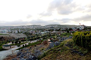
Altınözü
District and municipality in Hatay, Turkey
Distance: Approx. 6380 meters
Latitude and longitude: 36.1,36.23
Altınözü (Arabic: الْقُصَيْر, el-Kusayr) is a municipality and district of Hatay Province, Turkey. Its area is 392 km2, and its population is 60,344 (2022). It is in the south-east of Hatay Province, on the border between Turkey and Syria.

Koz Castle
Castle in Turkey
Distance: Approx. 9045 meters
Latitude and longitude: 36.1,36.2
Koz Castle (Turkish: Koz Kalesi), or Kürşat Castle is a castle in the Altınözü district of the Hatay Province of Turkey, built on a small hill where the Kuseyr Creek starts. It was built by the Principality of Antioch out of ashlar. The castle used to have a gate to the north, but this gate no longer exists and the eastern side of the castle has been leveled, with some original barns left.
Çetenli, Altınözü
Neighbourhood in Altınözü, Hatay, Turkey
Distance: Approx. 2583 meters
Latitude and longitude: 36.1125,36.297
Çetenli is a neighbourhood of the municipality and district of Altınözü, Hatay Province, Turkey. Its population is 2,134 (2022). It is 5 km east of Altınözü town centre and 7 km from the Syrian border.
Babatorun
Neighbourhood in Altınözü, Hatay, Turkey
Distance: Approx. 772 meters
Latitude and longitude: 36.0825,36.29888889
Babatorun (known as Babtrun in Arabic) is a neighbourhood of the municipality and district of Altınözü, Hatay Province, Turkey. Its population is 1,393 (2022).
Hamziyeh
Village in Idlib, Syria
Distance: Approx. 7918 meters
Latitude and longitude: 36.1042,36.3858
Hamziyeh (Arabic: الحمزية) is a Syrian village located in Salqin Nahiyah in Harem District, Idlib. According to the Syria Central Bureau of Statistics (CBS), Hamziyeh had a population of 953 in the 2004 census.
Karsu, Altınözü
Neighbourhood in Altınözü, Hatay, Turkey
Distance: Approx. 5508 meters
Latitude and longitude: 36.13416667,36.27361111
Karsu is a neighbourhood of the municipality and district of Altınözü, Hatay Province, Turkey. Its population is 1,847 (2022). The neighbourhood has a Mediterranean climate.
Weather in this IP's area
scattered clouds
16 Celsius
15 Celsius
16 Celsius
16 Celsius
1022 hPa
56 %
1022 hPa
984 hPa
10000 meters
0.18 m/s
2.02 m/s
360 degree
29 %