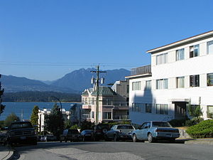
Country:
 Canada
Region:
City:
Latitude and Longitude:
Time Zone:
Postal Code:
IP information under different IP Channel
ip-api
Country
Region
City
ASN
Time Zone
ISP
Blacklist
Proxy
Latitude
Longitude
Postal
Route
IPinfo
Country
Region
City
ASN
Time Zone
ISP
Blacklist
Proxy
Latitude
Longitude
Postal
Route
MaxMind
Country
Region
City
ASN
Time Zone
ISP
Blacklist
Proxy
Latitude
Longitude
Postal
Route
Luminati
Country
CARegion
bc
City
vancouver
ASN
Time Zone
America/Vancouver
ISP
OXIO-ASN-01
Latitude
Longitude
Postal
db-ip
Country
Region
City
ASN
Time Zone
ISP
Blacklist
Proxy
Latitude
Longitude
Postal
Route
ipdata
Country
Region
City
ASN
Time Zone
ISP
Blacklist
Proxy
Latitude
Longitude
Postal
Route
Popular places and events near this IP address

Greektown, Vancouver
Place in British Columbia, Canada
Distance: Approx. 2403 meters
Latitude and longitude: 49.26416667,-123.16805556
Greektown in Vancouver, British Columbia, Canada is an area in the Kitsilano neighborhood that was historically an enclave of Greek immigrants and their descendants. The term is an informal one, and Greektown's borders are not strictly defined; however, West Broadway around Trutch Street is generally considered the neighbourhood's heart, while Blenheim St to the west and MacDonald St to the east are approximately its outer limits. Vancouverites of Greek descent, who live in Kitsilano, nostalgically also call the area Ουέστ Μπροντουέι (literally "West Broadway").
Kitsilano
Neighbourhood of Vancouver in British Columbia, Canada
Distance: Approx. 2302 meters
Latitude and longitude: 49.26666667,-123.16666667
Kitsilano () is a neighbourhood located in the city of Vancouver, British Columbia, Canada. Kitsilano is named after Squamish chief August Jack Khatsahlano, and the neighbourhood is located in Vancouver's West Side along the south shore of English Bay, between the neighbourhoods of West Point Grey and Fairview. The area is mostly residential with two main commercial areas, West 4th Avenue and West Broadway, known for their retail stores, restaurants and organic food markets.
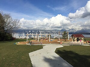
Vancouver Folk Music Festival
Music festival
Distance: Approx. 779 meters
Latitude and longitude: 49.272,-123.192
The Vancouver Folk Music Festival (VFMF), founded in 1978, is an outdoor multistage music festival, located at Jericho Beach Park on the west side of Vancouver, British Columbia. It takes place annually on the third weekend of July, drawing over 30,000 attendees each year. The festival has attracted artists from across the world, including Adam Cohen, Ani Difranco, Utah Phillips, Pete Seeger, Tuvan throat singers, Sarah Harmer, Veda Hille, Feist, K'naan, and Ferron, among many others.
West Point Grey Academy
Private school in Vancouver, British Columbia
Distance: Approx. 1509 meters
Latitude and longitude: 49.26655556,-123.20033333
West Point Grey Academy is an independent, co-educational, day school founded in 1996 located in Vancouver, British Columbia, Canada. It delivers the British Columbia Ministry of Education curriculum from Junior-Kindergarten to Grade 12.
Lord Byng Secondary School
Secondary school in Vancouver, British Columbia
Distance: Approx. 2270 meters
Latitude and longitude: 49.25861111,-123.19194444
Lord Byng Secondary School is a public secondary school located in the West Point Grey neighbourhood on the west side of Vancouver, British Columbia, Canada. It opened in 1925 and was named after the then Governor General of Canada, Julian Byng, 1st Viscount Byng of Vimy.

West Point Grey
Neighbourhood in Metro Vancouver, British Columbia, Canada
Distance: Approx. 1699 meters
Latitude and longitude: 49.26457778,-123.19974444
West Point Grey is a neighbourhood in the northwest of the city of Vancouver, British Columbia, Canada. It is on Point Grey and bordered by 16th Avenue to the south, Alma Street to the east, English Bay to the north, and Blanca Street to the west. Notable beaches within West Point Grey include Spanish Banks, Locarno and Jericho.
Spanish Banks
Series of beaches in Vancouver, British Columbia, Canada
Distance: Approx. 1750 meters
Latitude and longitude: 49.277,-123.216
Spanish Banks are a series of beaches in the city of Vancouver, British Columbia, Canada, located along the shores of English Bay in the West Point Grey neighbourhood. Spanish Banks is located between Locarno Beach to the east and the grounds of the University of British Columbia to the west.

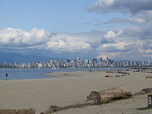
Jericho Beach
Beach in Vancouver, British Columbia, Canada
Distance: Approx. 779 meters
Latitude and longitude: 49.272,-123.192
Jericho Beach, known originally as iy'a'l'mexw in Squamish, a Vancouver beach, is located west of the seaside neighbourhood of Kitsilano. It is surrounded by Jericho Beach Park, a grassy area with a pond, which is a picnic destination. Jericho Beach is the home of the Jericho Sailing Centre Association.

Locarno Beach
Beach in British Columbia, Canada
Distance: Approx. 973 meters
Latitude and longitude: 49.2757,-123.2045
Locarno Beach is one of the beaches that line English Bay in Vancouver. It is situated in the West Point Grey neighbourhood, between Jericho Beach and the Spanish Banks beaches. It was named after the Swiss city where a peace treaty was signed in 1925.

RCAF Station Jericho Beach
Former air station in Vancouver, British Columbia, Canada
Distance: Approx. 992 meters
Latitude and longitude: 49.271613,-123.199739
RCAF Station Jericho Beach, originally known as the Vancouver Air Station, was one of the first Canadian air stations opened by the Canadian Air Board. Jericho Beach is located in Vancouver, British Columbia.
Hastings Mill Park
Distance: Approx. 797 meters
Latitude and longitude: 49.27277778,-123.18666667
Hastings Mill Park is located on the waterfront in the West Point Grey neighbourhood of Vancouver, British Columbia, Canada, and has recently received an upgrade from a joint partnership between the Vancouver Park Board and local landscape architects at PWL Partnership. The renewed playground was built to engage a wider age range of children and to bring historical significance to the on-site Hastings Mill Museum which showcases Vancouver's logging history.
Karma Indian Bistro
Indian restaurant in Vancouver, British Columbia, Canada
Distance: Approx. 2157 meters
Latitude and longitude: 49.2685,-123.16713889
Karma Indian Bistro is an Indian restaurant in Vancouver, British Columbia, Canada. It has received Michelin Bib Gourmand status.
Weather in this IP's area
few clouds
17 Celsius
17 Celsius
16 Celsius
18 Celsius
1015 hPa
82 %
1015 hPa
1015 hPa
10000 meters
3.6 m/s
210 degree
20 %
06:54:22
19:19:09