Country:
Region:
City:
Latitude and Longitude:
Time Zone:
Postal Code:
IP information under different IP Channel
ip-api
Country
Region
City
ASN
Time Zone
ISP
Blacklist
Proxy
Latitude
Longitude
Postal
Route
Luminati
Country
Region
bc
City
vancouver
ASN
Time Zone
America/Vancouver
ISP
OXIO-ASN-01
Latitude
Longitude
Postal
IPinfo
Country
Region
City
ASN
Time Zone
ISP
Blacklist
Proxy
Latitude
Longitude
Postal
Route
db-ip
Country
Region
City
ASN
Time Zone
ISP
Blacklist
Proxy
Latitude
Longitude
Postal
Route
ipdata
Country
Region
City
ASN
Time Zone
ISP
Blacklist
Proxy
Latitude
Longitude
Postal
Route
Popular places and events near this IP address

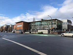
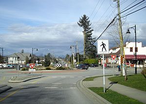
Langley, British Columbia (city)
City in British Columbia, Canada
Distance: Approx. 346 meters
Latitude and longitude: 49.1041,-122.65758
The City of Langley, commonly referred to as Langley City, or just Langley, is a municipality in the Metro Vancouver Regional District in British Columbia, Canada. It lies directly east of Surrey, adjacent to the Cloverdale area, and is surrounded elsewhere by the Township of Langley, bordered by its neighbourhoods of Willowbrook to the north, Murrayville to the east, and Brookswood and Fern Ridge to the south.
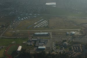
Langley Regional Airport
Airport in Langley, British Columbia
Distance: Approx. 1668 meters
Latitude and longitude: 49.10083333,-122.63083333
Langley Regional Airport (IATA: YLY, ICAO: CYNJ) is located in Langley Township, British Columbia, Canada. It serves mostly general aviation, and also provided scheduled passenger service to the Victoria Airport Water Aerodrome via Harbour Air Seaplanes before service was ended on May 20, 2011. Helicopter operations are a major part of Langley Airport's traffic; the airport has three helipads.
Canadian Museum of Flight
Aviation museum in Langley, British Columbia, Canada
Distance: Approx. 2034 meters
Latitude and longitude: 49.099394,-122.626068
The Canadian Museum of Flight (formally the Canadian Museum of Flight Association since 1998) is an aviation museum at the Langley Regional Airport in Langley, British Columbia, Canada. The museum has over 25 civilian and military jets, piston driven engine aircraft, gliders, and helicopters on display, six of which have been restored to flying condition. Other displays include an aviation art gallery and aviation artifacts.
Brookswood Secondary School
School in Langley, British Columbia
Distance: Approx. 3709 meters
Latitude and longitude: 49.069657,-122.644207
Brookswood Secondary School is located in the community of Brookswood in Langley, British Columbia. Among other resources, the school has an automechanics workshop, two gymnasiums, a theatre, a dark room, and a television studio. The school also offers a French Immersion program as well as Spanish.

H. D. Stafford Middle School
Middle school in Langley, British Columbia, Canada
Distance: Approx. 1428 meters
Latitude and longitude: 49.0897,-122.6564
H.D. Stafford Middle School (formerly H.D. Stafford Secondary) is a public middle school (a.k.a. junior high) in Langley, British Columbia, part of School District 35 Langley. It opened in 1970, and in the 1980s was transitioned to H. D. Stafford Secondary School – the only secondary school (a.k.a.

Langley Secondary School
High school in Langley, British Columbia, Canada
Distance: Approx. 1730 meters
Latitude and longitude: 49.10529,-122.63027
Langley Secondary is a public high school in Langley, British Columbia part of School District 35 Langley. It is the oldest secondary school in the Langley School District, having been opened in 1949. Langley Secondary offers programs for students in Grade 9 to 12 and has strong traditions in academics, fine arts and athletics.

Willowbrook Shopping Centre
Shopping mall in Metro Vancouver, Canada
Distance: Approx. 2060 meters
Latitude and longitude: 49.11451,-122.67498
Willowbrook Shopping Centre (sometimes referred to as Willowbrook Mall) is a shopping centre in the Fraser Valley area of Metro Vancouver, Canada. Situated on Fraser Highway at Highway 10 (Langley By-Pass), Willowbrook is located half in the City of Langley and half in the Township of Langley in British Columbia. The mall is 40 minutes southeast of Vancouver.

Langley Centre
Public transit exchange in Langley, British Columbia, Canada
Distance: Approx. 448 meters
Latitude and longitude: 49.10638889,-122.65444444
Langley Centre is an on-street bus exchange located in downtown Langley City, British Columbia, Canada. As part of the TransLink system, it serves the municipalities of Langley City and Langley Township with routes to Surrey, Maple Ridge, and White Rock, that provide connections to SkyTrain and the West Coast Express rail services for travel towards Vancouver.

Murrayville, Langley
Neighbourhood in Lower Mainland, British Columbia, Canada
Distance: Approx. 3428 meters
Latitude and longitude: 49.08333333,-122.61666667
Murrayville is a small community in the Township of Langley in the Lower Mainland region of British Columbia, Canada.
Langley Fundamental Secondary School
Distance: Approx. 3046 meters
Latitude and longitude: 49.07796,-122.63482
Langley Fundamental Secondary is a public secondary school in Langley, British Columbia part of School District 35 Langley. It shares the same campus as the Langley Fundamental Middle School. LFMSS was established in 1998 with 223 students in grades 7–9.

Langley Education Centre
High school in Langley, British Columbia, Canada
Distance: Approx. 1802 meters
Latitude and longitude: 49.104,-122.629
Langley Education Centre (LEC) is a public high school in Langley, British Columbia, part of School District 35 Langley. LEC offers secondary school (Gr. 10–12) options for teens and adults to continue and complete a secondary education or upgrade their courses.

Langley Memorial Hospital
Hospital in British Columbia, Canada
Distance: Approx. 3093 meters
Latitude and longitude: 49.09538,-122.61254
Langley Memorial Hospital is a government-funded 188-bed acute care facility, and Level IV trauma centre in Township of Langley, British Columbia that is owned and operated by Fraser Health.
Weather in this IP's area
overcast clouds
9 Celsius
9 Celsius
7 Celsius
12 Celsius
1019 hPa
95 %
1019 hPa
1018 hPa
10000 meters
1.03 m/s
70 degree
100 %
07:10:22
16:38:31
