Country:
 Canada
Region:
City:
Latitude and Longitude:
Time Zone:
Postal Code:
IP information under different IP Channel
ip-api
Country
Region
City
ASN
Time Zone
ISP
Blacklist
Proxy
Latitude
Longitude
Postal
Route
IPinfo
Country
Region
City
ASN
Time Zone
ISP
Blacklist
Proxy
Latitude
Longitude
Postal
Route
MaxMind
Country
Region
City
ASN
Time Zone
ISP
Blacklist
Proxy
Latitude
Longitude
Postal
Route
Luminati
Country
CARegion
bc
City
langley
ASN
Time Zone
America/Vancouver
ISP
OXIO-ASN-01
Latitude
Longitude
Postal
db-ip
Country
Region
City
ASN
Time Zone
ISP
Blacklist
Proxy
Latitude
Longitude
Postal
Route
ipdata
Country
Region
City
ASN
Time Zone
ISP
Blacklist
Proxy
Latitude
Longitude
Postal
Route
Popular places and events near this IP address
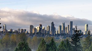
Burnaby
City in British Columbia, Canada
Distance: Approx. 2476 meters
Latitude and longitude: 49.26666667,-122.96666667
Burnaby is a city in the Lower Mainland region of British Columbia, Canada. Located in the centre of the Burrard Peninsula, it neighbours the City of Vancouver to the west, the District of North Vancouver across the confluence of the Burrard Inlet with its Indian Arm to the north, Port Moody and Coquitlam to the east, New Westminster and Surrey across the Fraser River to the southeast, and Richmond on the Lulu Island to the southwest. Burnaby was incorporated in 1892 and achieved its city status in 1992.

Burnaby North
Provincial electoral district in British Columbia, Canada
Distance: Approx. 1788 meters
Latitude and longitude: 49.273,-122.971
Burnaby North is a provincial electoral district for the Legislative Assembly of British Columbia, Canada.

Burnaby North Secondary School
School in Burnaby, British Columbia, Canada
Distance: Approx. 1279 meters
Latitude and longitude: 49.27777778,-122.97194444
Burnaby North Secondary School is a secondary school in Burnaby, British Columbia, Canada. It encompasses two buildings at 751 Hammarskjold Drive in Burnaby. Nearly 1,800 students from grades 8 to 12 attend the school.
Alpha Secondary School
High school in Burnaby, British Columbia, Canada
Distance: Approx. 2701 meters
Latitude and longitude: 49.2762,-122.9992
Alpha Secondary is a public high school in Burnaby, British Columbia part of School District 41 Burnaby.
Capitol Hill, Burnaby
Hill in British Columbia, Canada
Distance: Approx. 1304 meters
Latitude and longitude: 49.28722222,-122.98527778
Capitol Hill elev. 203m, is a hill in the city of Burnaby, British Columbia, Canada, and also is the name of the neighbourhood spanning the summit of the hill. Standing on the north side of Hastings Street and bounded by Willingdon Avenue to the west and Fell Avenue in the east, this neighbourhood is known for its Italian, Portuguese, and Croatian expat communities as well as being a student area associated with the nearby Simon Fraser University.
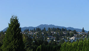
North Burnaby
Distance: Approx. 2729 meters
Latitude and longitude: 49.26666667,-122.98333333
North Burnaby is a general name for a large neighbourhood in the City of Burnaby, British Columbia, that includes a number of smaller ones. It stretches from Boundary Road in the west to Burnaby Mountain with Simon Fraser University in the east and is bounded by Burrard Inlet to the north and the Lougheed Highway to the south. It is a desirable place to live for many local and immigrant families, which is reflected by real-estate prices that keep climbing and have doubled in the last 15 years.

Parkcrest
Neighbourhood in British Columbia
Distance: Approx. 1997 meters
Latitude and longitude: 49.2726,-122.979
Parkcrest is a hillside neighbourhood in North Burnaby, British Columbia adjacent to Kensington Park which gave it its name. It has a long rectangular shape stretched north to south and is bounded by Springer Avenue to the west and Kensington Avenue to the east. To the north its border runs along Hastings Street, its southern border lies along the Lougheed Highway and Skytrain tracks.

Westridge, British Columbia
Distance: Approx. 1013 meters
Latitude and longitude: 49.28347222,-122.95630556
Westridge is a residential neighbourhood in Burnaby, British Columbia, Canada.

Kensington Park (Burnaby)
Park in Burnaby, British Columbia, Canada
Distance: Approx. 1470 meters
Latitude and longitude: 49.27722222,-122.97694444
Kensington Park is a large urban park in Burnaby, British Columbia, Canada. It is located between major roads running along its perimeter - Hastings Street, Curtis Street, Kensington Avenue and Holdom Avenue. Kensington Park is adjacent to Burnaby North Secondary School with its several sports fields, among them soccer and baseball.
Burnaby Refinery
Canadian oil refinery
Distance: Approx. 2129 meters
Latitude and longitude: 49.29083333,-122.99666667
The Burnaby Refinery is an oil refinery located in the city of Burnaby, British Columbia, Canada owned by Parkland Fuel Corp. The facility refines crude and synthetic oil into gasoline, diesel, jet fuels, asphalts, heating fuels, heavy fuel oils, butanes, and propane. Crude oil is supplied to the facility from Northern British Columbia and Alberta through the 1,200-kilometre Kinder Morgan Pipe Line.
Burnaby Velodrome
Distance: Approx. 1960 meters
Latitude and longitude: 49.28905,-122.94051
One of only three indoor bicycle racing tracks in Canada, the Burnaby Velodrome is located in Burnaby, British Columbia. It is operated by the non-profit Burnaby Velodrome Club (BVC), and is an affiliated member of Cycling British Columbia. The track is located inside the Harry Jerome Sports Centre, which is also used by Volleyball BC for game play and administration purposes.
Sullivan Heights, Burnaby
Neighbourhood in Burnaby, British Columbia, Canada
Distance: Approx. 2438 meters
Latitude and longitude: 49.267,-122.967
Sullivan Heights is a neighbourhood in Burnaby, just north of Lougheed highway, east of Government road and south of SFU (Simon Fraser University) campus. Bordering the city of Coquitlam and Port Moody, the area is served by the newly operational Millennium Line that connects the city of Coquitlam to other parts of greater Vancouver.
Weather in this IP's area
few clouds
17 Celsius
17 Celsius
15 Celsius
18 Celsius
1015 hPa
80 %
1015 hPa
1013 hPa
10000 meters
3.6 m/s
210 degree
20 %
06:53:28
19:18:16