Country:
Region:
City:
Latitude and Longitude:
Time Zone:
Postal Code:
IP information under different IP Channel
ip-api
Country
Region
City
ASN
Time Zone
ISP
Blacklist
Proxy
Latitude
Longitude
Postal
Route
Luminati
Country
Region
bc
City
vancouver
ASN
Time Zone
America/Vancouver
ISP
OXIO-ASN-01
Latitude
Longitude
Postal
IPinfo
Country
Region
City
ASN
Time Zone
ISP
Blacklist
Proxy
Latitude
Longitude
Postal
Route
db-ip
Country
Region
City
ASN
Time Zone
ISP
Blacklist
Proxy
Latitude
Longitude
Postal
Route
ipdata
Country
Region
City
ASN
Time Zone
ISP
Blacklist
Proxy
Latitude
Longitude
Postal
Route
Popular places and events near this IP address

Stanley Park
Public park in Vancouver, Canada
Distance: Approx. 473 meters
Latitude and longitude: 49.3,-123.14
Stanley Park is a 405-hectare (1,001-acre) public park in British Columbia, Canada, that makes up the northwestern half of Vancouver's Downtown peninsula, surrounded by waters of Burrard Inlet and English Bay. The park borders the neighbourhoods of West End and Coal Harbour to its southeast, and is connected to the North Shore via the Lions Gate Bridge. The historic lighthouse on Brockton Point marks the park's easternmost point.

Lost Lagoon
Distance: Approx. 36 meters
Latitude and longitude: 49.295954,-123.140559
Lost Lagoon is an artificial 16.6-hectare (41 acre) body of water, west of Georgia Street, near the entrance to Stanley Park in Vancouver, British Columbia, Canada. Surrounding the lake is a 1.75 km (1.09 mi) trail. The lake features a lit fountain that was erected by Robert Harold Williams to commemorate the city's golden jubilee.

King George Secondary School
Secondary school in Vancouver, British Columbia, Canada
Distance: Approx. 751 meters
Latitude and longitude: 49.289625,-123.13682778
King George Secondary School is a public secondary school located in the West End of Vancouver, British Columbia, Canada. The school is located in the West End, with two elementary schools feeding in. Some students are from other areas of Vancouver who wish to be in a smaller school environment.

Denman Arena
Distance: Approx. 635 meters
Latitude and longitude: 49.29305556,-123.13333333
Denman Arena was an indoor arena located in the West End neighbourhood of Vancouver, British Columbia. The arena was located at 1805 West Georgia Street at the northwest corner with Denman Street. It opened in December 1911 and was destroyed by fire in 1936.

Malkin Bowl
Theatre in Vancouver, Canada
Distance: Approx. 641 meters
Latitude and longitude: 49.298773,-123.133435
The Marion Malkin Memorial Bowl, or Malkin Bowl, is a 2000-seat outdoor theatre in Stanley Park, Vancouver, British Columbia, Canada. Malkin Bowl is home to Theatre Under The Stars, which stages family-friendly Broadway musicals there.
Stanley Park (neighbourhood)
Distance: Approx. 495 meters
Latitude and longitude: 49.2914,-123.14
Stanley Park is a neighbourhood of the West End in Vancouver, British Columbia, Canada. It is designated as the area lying between Denman Street and the boundary of Stanley Park proper. It is high density, like most of the West End, and is known for being a more affluent area of the West End and, once away from Denman Street, also one of the quietest on the downtown peninsula.

Aerodynamic Forms in Space
Sculpture by Rodney Graham in Vancouver, British Columbia, Canada
Distance: Approx. 362 meters
Latitude and longitude: 49.29466667,-123.13633333
Aerodynamic Forms in Space is a 2010 sculpture by Rodney Graham located at the Georgia Street entrance to Stanley Park in Vancouver, Canada. The work was commissioned by the City of Vancouver for the 2010 Winter Olympics. The inspiration for the sculpture was photos Graham took in 1977 of misassembled toy glider parts.
City School (Vancouver)
Canadian public alternative school
Distance: Approx. 747 meters
Latitude and longitude: 49.289913,-123.136074
City School was Vancouver's longest-running public alternative school at the time of its cancellation in 2024.

Second Beach (Vancouver)
Beach in Vancouver, British Columbia, Canada
Distance: Approx. 687 meters
Latitude and longitude: 49.29474,-123.15032
Second Beach is located at Stanley Park in Vancouver, British Columbia. The beach features a pool, which was first completed in 1932.
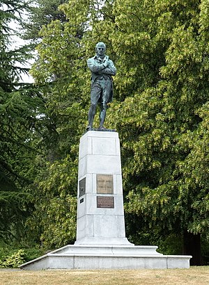
Robert Burns Memorial, Stanley Park
Memorial and statue in Vancouver, British Columbia, Canada
Distance: Approx. 484 meters
Latitude and longitude: 49.29719,-123.13469
The Robert Burns Memorial is an outdoor memorial and statue of Scottish poet Robert Burns, located in Stanley Park in Vancouver, British Columbia, Canada.

Bust of David Oppenheimer
Sculpture in Vancouver, British Columbia, Canada
Distance: Approx. 701 meters
Latitude and longitude: 49.29043,-123.14605
The bust of David Oppenheimer, mayor of Vancouver from 1888 to 1891, is installed in Vancouver's Stanley Park, in British Columbia, Canada. The bronze sculpture was created by Canadian sculpture Charles Marega and installed in 1911.
Tetsu Sushi Bar
Restaurant in Vancouver, British Columbia, Canada
Distance: Approx. 612 meters
Latitude and longitude: 49.29183333,-123.13516667
Tetsu Sushi Bar is a Japanese restaurant in Vancouver, British Columbia, Canada.
Weather in this IP's area
broken clouds
11 Celsius
11 Celsius
9 Celsius
12 Celsius
1018 hPa
80 %
1018 hPa
1018 hPa
10000 meters
2.06 m/s
110 degree
75 %
07:12:52
16:39:55
