Country:
 Canada
Region:
City:
Latitude and Longitude:
Time Zone:
Postal Code:
IP information under different IP Channel
ip-api
Country
Region
City
ASN
Time Zone
ISP
Blacklist
Proxy
Latitude
Longitude
Postal
Route
IPinfo
Country
Region
City
ASN
Time Zone
ISP
Blacklist
Proxy
Latitude
Longitude
Postal
Route
MaxMind
Country
Region
City
ASN
Time Zone
ISP
Blacklist
Proxy
Latitude
Longitude
Postal
Route
Luminati
Country
CARegion
bc
City
surrey
ASN
Time Zone
America/Vancouver
ISP
OXIO-ASN-01
Latitude
Longitude
Postal
db-ip
Country
Region
City
ASN
Time Zone
ISP
Blacklist
Proxy
Latitude
Longitude
Postal
Route
ipdata
Country
Region
City
ASN
Time Zone
ISP
Blacklist
Proxy
Latitude
Longitude
Postal
Route
Popular places and events near this IP address

Newton—North Delta
Federal electoral district in British Columbia, Canada
Distance: Approx. 2583 meters
Latitude and longitude: 49.131,-122.886
Newton—North Delta was a federal electoral district in the province of British Columbia, Canada, that had been represented in the House of Commons of Canada from 2004 to 2015, when it was abolished and redistributed to the Delta and Surrey—Newton electoral districts.

Surrey-Green Timbers
Provincial electoral district in British Columbia, Canada
Distance: Approx. 3814 meters
Latitude and longitude: 49.172,-122.849
Surrey-Green Timbers is a provincial electoral district for the Legislative Assembly of British Columbia, Canada. Under the 2021 British Columbia electoral redistribution the riding will be eliminated, with its territory divided between Surrey North, Surrey City Centre and Surrey-Newton.
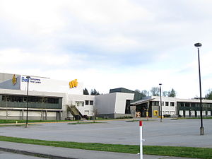
Sullivan Heights Secondary
High school in Surrey, British Columbia, Canada
Distance: Approx. 3248 meters
Latitude and longitude: 49.1164,-122.8218
Sullivan Heights Secondary is a high school located in Surrey, British Columbia, Canada. Sullivan Heights opened on October 24, 2000, with a student population of over 1000 students (grades 8 through 10), with grade 11 being added in the 2001–02 school year, and grade 12 being added in the 2002–03 school year. As of 2023–24 Sullivan Heights has 1880 students (in grades 8 through 12), and over 100 staff members.
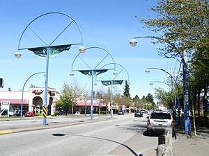
Newton, Surrey
Town centre of Surrey in British Columbia, Canada
Distance: Approx. 933 meters
Latitude and longitude: 49.1333,-122.8413
Newton is a town centre of the city in Surrey, British Columbia. It is the location for the previous Surrey City Hall and Courthouse, a local Surrey Public Library branch, and a Kwantlen Polytechnic University campus. The studios of radio station Red FM are also located here.
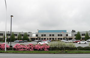
Enver Creek Secondary School
High school in Surrey, British Columbia, Canada
Distance: Approx. 3142 meters
Latitude and longitude: 49.1568,-122.8202
Enver Creek Secondary School is a public high school located in Surrey, British Columbia, Canada and is part of the School District 36 Surrey.

Frank Hurt Secondary School
Public high school in Surrey, British Columbia, Canada
Distance: Approx. 1235 meters
Latitude and longitude: 49.1423,-122.8366
Frank Hurt Secondary School is a public high school in the East Newton area of Surrey, British Columbia, Canada. It is part of the provincial School District 36 Surrey.
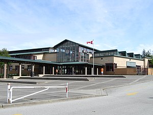
Tamanawis Secondary School
High school in Surrey, British Columbia, Canada
Distance: Approx. 2243 meters
Latitude and longitude: 49.1222,-122.8716
Tamanawis Secondary is a public secondary school in Surrey, British Columbia. It is a part of School District 36. The school provides many choices regarding subjects for its students.
Princess Margaret Secondary School (Surrey, British Columbia)
High school in Surrey, British Columbia, Canada
Distance: Approx. 1195 meters
Latitude and longitude: 49.1318,-122.8657
Princess Margaret Secondary is a public high school in Surrey, British Columbia and is part of School District 36 Surrey. The school is notable in Surrey for its sports programs. The goals of Princess Margaret Secondary include increasing reading comprehension and increasing numeracy skills in Grade 8 students.
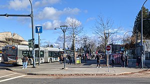
Newton Exchange
Distance: Approx. 875 meters
Latitude and longitude: 49.13333333,-122.84222222
Newton Exchange is a bus loop located in the central Newton area of Surrey, British Columbia, Canada. As part of the TransLink system, it serves Newton with routes to Surrey City Centre, North Delta, Richmond, Langley City and White Rock, which provide connections to several SkyTrain stations for travel towards Vancouver.

Panorama Ridge Secondary School
High school in Surrey, British Columbia, Canada
Distance: Approx. 2194 meters
Latitude and longitude: 49.1182,-122.8552
Panorama Ridge Secondary is a public high school in Surrey, British Columbia, Canada and is part of School District 36 Surrey. It has a French immersion program for students in grades 8-12 and approximately 20% of the school's students are enrolled in that program. The school's website publishes notices in both English and Punjabi.

Scottsdale Exchange
Distance: Approx. 2619 meters
Latitude and longitude: 49.1375,-122.88805556
Scottsdale Exchange is a transit exchange located in the Strawberry Hill neighbourhood of Newton in Surrey, British Columbia, Canada. As part of the TransLink system, it serves the western Newton and North Delta areas with routes to Richmond, Ladner, New Westminster, Surrey City Centre, and Langley City that provide connections to several SkyTrain stations for travel towards Vancouver.
CJCN-FM
Multicultural radio station in Surrey, British Columbia, Canada
Distance: Approx. 3192 meters
Latitude and longitude: 49.1481,-122.893
CJCN-FM (91.5 FM) is an ethnic radio station in Surrey, British Columbia, Canada. The station broadcasts for the South Asian communities in Surrey and other cities east of Vancouver. It is owned by Akash Broadcasting Inc.
Weather in this IP's area
scattered clouds
16 Celsius
16 Celsius
15 Celsius
17 Celsius
1015 hPa
81 %
1015 hPa
1005 hPa
10000 meters
1.03 m/s
240 degree
40 %
06:53:03
19:17:45