Country:
Region:
City:
Latitude and Longitude:
Time Zone:
Postal Code:
IP information under different IP Channel
ip-api
Country
Region
City
ASN
Time Zone
ISP
Blacklist
Proxy
Latitude
Longitude
Postal
Route
Luminati
Country
Region
bc
City
abbotsford
ASN
Time Zone
America/Vancouver
ISP
OXIO-ASN-01
Latitude
Longitude
Postal
IPinfo
Country
Region
City
ASN
Time Zone
ISP
Blacklist
Proxy
Latitude
Longitude
Postal
Route
db-ip
Country
Region
City
ASN
Time Zone
ISP
Blacklist
Proxy
Latitude
Longitude
Postal
Route
ipdata
Country
Region
City
ASN
Time Zone
ISP
Blacklist
Proxy
Latitude
Longitude
Postal
Route
Popular places and events near this IP address

Abbotsford, British Columbia
City in British Columbia, Canada
Distance: Approx. 2529 meters
Latitude and longitude: 49.05,-122.31666667
Abbotsford is a city in British Columbia next to the Canada–United States border, Greater Vancouver, and the Fraser River. With a census population of 153,569 people (2021), it is the largest municipality in the province outside metropolitan Vancouver. Abbotsford–Mission has the third-highest proportion of visible minorities among census metropolitan areas in Canada, after the Greater Toronto Area and the Greater Vancouver CMA. It is home to Tradex, the University of the Fraser Valley, and Abbotsford International Airport.
Abbotsford Senior Secondary School
High school in Abbotsford, British Columbia, Canada
Distance: Approx. 1070 meters
Latitude and longitude: 49.04444444,-122.29833333
Abbotsford Senior Secondary School is a public high school in Abbotsford, British Columbia, part of School District 34 Abbotsford.

Abbotsford Centre
Multi-purpose arena in British Columbia, Canada
Distance: Approx. 1326 meters
Latitude and longitude: 49.030665,-122.287145
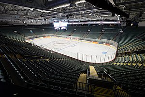
Abbotsford Centre, formerly Abbotsford Entertainment and Sports Centre, is a 7,000-seat multi-purpose arena in Abbotsford, British Columbia. The arena was expected to cost $64.7 million. Construction began on September 24, 2007.
Summit Pacific College
Distance: Approx. 3481 meters
Latitude and longitude: 49.0545,-122.328
Summit Pacific College (formerly Western Pentecostal Bible College) is an undergraduate and postgraduate Bible college and seminary, on a foothill of Sumas Mountain in Abbotsford, British Columbia, Canada. It is accredited by the Association for Biblical Higher Education and is the theological college of the BC & Yukon District of the Pentecostal Assemblies of Canada.
CKQC-FM
Radio station in Abbotsford, British Columbia
Distance: Approx. 2748 meters
Latitude and longitude: 49.05222222,-122.24944444
CKQC-FM (107.1 MHz) is a Canadian radio station in Abbotsford, British Columbia. Owned by Rogers Radio, a division of Rogers Sports & Media, the station airs a country format branded as Country 107.1. CFVR was established in 1962 as a semi-satellite station of CHWK. It mostly simulcast CHWK but had its own morning show.
Envision Athletic Centre
Multi-purpose athletics facility in the University of the Fraser Valley, British Columbia, Canada
Distance: Approx. 1690 meters
Latitude and longitude: 49.02722222,-122.28444444
Envision Athletic Centre is a 21,500-square-foot (2,000 m2) multi-purpose athletics facility on the campus of the University of the Fraser Valley in Abbotsford, British Columbia, Canada. It opened in May 2002 and was upgraded in 2005. It hosts the university of the Fraser Valley Cascades basketball team on a basketball court that seats 1,700.
Sevenoaks Shopping Centre
Shopping mall complex in British Columbia, Canada
Distance: Approx. 2160 meters
Latitude and longitude: 49.04905,-122.31181
Sevenoaks Shopping Centre is a shopping mall complex in Abbotsford, British Columbia, Canada. Sevenoaks has over 100 retail stores, services and food establishments. Sevenoaks is located approximately one hour east of Vancouver, and minutes from two U.S. border crossings.
Bateman Park
Soccer stadium
Distance: Approx. 3651 meters
Latitude and longitude: 49.073,-122.266
Bateman Park is a soccer stadium located in Abbotsford, British Columbia. It is the home venue for the University of the Fraser Valley soccer teams and the Fraser Valley Mariners.

Gur Sikh Temple
Sikh temple in Abbotsford, British Columbia
Distance: Approx. 1935 meters
Latitude and longitude: 49.05111111,-122.30694444
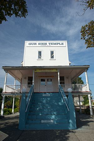
The Gur Sikh Temple (Punjabi: ਗੁਰ ਸਿੱਖ਼ ਗੁਰਦੁਵਾਰਾ; also known as Abbotsford Sikh Temple), in Abbotsford, British Columbia, is the oldest existing Sikh gurdwara in North America and a National Historic Site of Canada. It is the only gurdwara outside of India and Pakistan that is designated as national historic site. Though the oldest existing gurdwara on the continent, having opened in 1911, it is the third-oldest to be built in Canada and North America.
Matsqui Institution
Prison in British Columbia, Canada
Distance: Approx. 2175 meters
Latitude and longitude: 49.0278,-122.3038
Matsqui Institution is a federal medium-security prison facility in Abbotsford, British Columbia, Canada, about 70 kilometres east of Vancouver. The Institution is operated by the Correctional Service of Canada and was opened in 1966. Accommodations for the general population are provided in a three-story living unit with a central core of security control posts.

Abbotsford Regional Hospital and Cancer Centre
Hospital in British Columbia, Canada
Distance: Approx. 2345 meters
Latitude and longitude: 49.038332,-122.315526
Abbotsford Regional Hospital and Cancer Centre (ARHCC) is a 300-bed Canadian health care facility in the City of Abbotsford, British Columbia that houses the acute care Abbotsford Regional Hospital (ARH) operated by Fraser Health and the regional cancer facility (Abbotsford Centre) operated by the BC Cancer Agency. ARHCC opened in 2008 as: the first new hospital built in the province in 30 years, the first hospital in Western Canada to have a cancer centre integrated in its design from the ground up, Canada's first newly constructed hospital to meet LEED Gold environmentally friendly standards, the largest construction project to date in the Fraser Valley, the first in the province to be built using a (P3) public-private partnership model. It is also the city's largest worksite in terms of number of employees.

Mill Lake (British Columbia)
Lake in Abbotsford, British Columbia, Canada
Distance: Approx. 1975 meters
Latitude and longitude: 49.04472222,-122.31083333
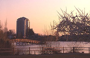
Mill Lake is a small lake in the city of Abbotsford, British Columbia, Canada, located between the Trans-Canada Highway and South Fraser Way. It is the centrepiece of Mill Lake Park.
Weather in this IP's area
overcast clouds
9 Celsius
9 Celsius
8 Celsius
11 Celsius
1019 hPa
93 %
1019 hPa
1012 hPa
10000 meters
0.44 m/s
0.86 m/s
56 degree
100 %
07:08:43
16:37:13