Country:
Region:
City:
Latitude and Longitude:
Time Zone:
Postal Code:
IP information under different IP Channel
ip-api
Country
Region
City
ASN
Time Zone
ISP
Blacklist
Proxy
Latitude
Longitude
Postal
Route
Luminati
Country
Region
bc
City
vancouver
ASN
Time Zone
America/Vancouver
ISP
OXIO-ASN-01
Latitude
Longitude
Postal
IPinfo
Country
Region
City
ASN
Time Zone
ISP
Blacklist
Proxy
Latitude
Longitude
Postal
Route
db-ip
Country
Region
City
ASN
Time Zone
ISP
Blacklist
Proxy
Latitude
Longitude
Postal
Route
ipdata
Country
Region
City
ASN
Time Zone
ISP
Blacklist
Proxy
Latitude
Longitude
Postal
Route
Popular places and events near this IP address

Lansdowne Centre
Shopping mall in Richmond, British Columbia, Canada
Distance: Approx. 1479 meters
Latitude and longitude: 49.175503,-123.132513
Lansdowne Centre (formerly Lansdowne Park Shopping Centre) is a shopping mall in Richmond, British Columbia, Canada. It is located on No. 3 Road and is the second-largest mall in Richmond after Richmond Centre.

Aberdeen Centre
Shopping mall
Distance: Approx. 1255 meters
Latitude and longitude: 49.184053,-123.133639
Aberdeen Centre is a shopping mall in Richmond, British Columbia. It is located in the Golden Village district on Hazelbridge Way, bordered by Cambie Road to the north.

Parker Place
Shopping mall in British Columbia, Canada
Distance: Approx. 1412 meters
Latitude and longitude: 49.181697,-123.135592
Parker Place (百家店) is a 61,000 sq ft (5,700 m2) shopping mall in Richmond, British Columbia. It is located on No. 3 Road, in Richmond's Golden Village, the main Asian district.

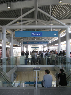
Aberdeen station (SkyTrain)
Metro Vancouver SkyTrain station
Distance: Approx. 1455 meters
Latitude and longitude: 49.18388889,-123.13638889
Aberdeen is an elevated station on the Canada Line of Metro Vancouver's SkyTrain rapid transit system. It is located in Richmond, British Columbia, Canada. It is named after the adjacent Aberdeen Square and Aberdeen Centre, the largest of Richmond's Asian-themed malls.

Bridgeport station (SkyTrain)
Metro Vancouver SkyTrain station
Distance: Approx. 1507 meters
Latitude and longitude: 49.19555556,-123.12611111
Bridgeport is an elevated station on the Canada Line of Metro Vancouver's SkyTrain rapid transit system. It is located in Richmond, British Columbia, Canada, south of Vancouver. The Canada Line branches outbound at this station, with one branch heading westward to YVR–Airport station at the Vancouver International Airport and the other heading south to Richmond–Brighouse station in the commercial centre of Richmond.

Golden Village, Richmond
Neighbourhood in Richmond, British Columbia, Canada
Distance: Approx. 970 meters
Latitude and longitude: 49.183812,-123.129727
The Golden Village is a commercial district in Richmond, British Columbia, Canada, with a high concentration of Asian-themed shopping malls. According to the 2016 Canadian Census, 54 percent of Richmond's population identify their ethnic origin as Chinese. As such, the Golden Village boasts a high density of not only Chinese but all varieties of Asian shops and restaurants.

River Rock Casino Resort
Casino in British Columbia, Canada
Distance: Approx. 1648 meters
Latitude and longitude: 49.196257,-123.128141
River Rock Casino Resort in Richmond, British Columbia is the largest casino in the province of British Columbia. The casino is owned by Great Canadian Entertainment. The hotel has a total of 396 rooms, including standard rooms and suites and it is situated on the river with a 144-berth marina.
Richmond Hospital
Hospital in British Columbia, Canada
Distance: Approx. 1702 meters
Latitude and longitude: 49.168961,-123.12314684
Richmond Hospital (RH) is a general hospital in Richmond, British Columbia, Canada. The Vancouver Coastal Health Authority (VCH) is responsible for Richmond Health Services and Richmond Hospital.
Sato Pharmaceutical
Japanese pharmaceutical company
Distance: Approx. 758 meters
Latitude and longitude: 49.186805,-123.107211
Sato Pharmaceutical Co., Ltd. (佐藤製薬株式会社, Satō Seiyaku Kabushiki-gaisha) is a Japanese pharmaceutical company. Sato Pharmaceutical's main focus is on over-the-counter medicines.
12 (Vancouver) Service Company
Military unit
Distance: Approx. 862 meters
Latitude and longitude: 49.176275,-123.112561
12 (Vancouver) Service Company (12 Svc Coy) is a Canadian Army Primary Reserve combat service support subunit of the Canadian Forces that can fight in a defensive role and provides logistical support to the units within 3rd Canadian Division's 39 Canadian Brigade Group, which consists of all Primary Reserve units in British Columbia.
Richmond International High School and College
High school in Richmond, British Columbia, Canada
Distance: Approx. 844 meters
Latitude and longitude: 49.1814,-123.1275
Richmond International High School and College (RIHSC) was a private school in Richmond, British Columbia, founded in 1991. It was Japanese-owned, and catered primarily to foreign students. Canadian students attending majored in education.

Capstan station
Metro Vancouver SkyTrain station
Distance: Approx. 1277 meters
Latitude and longitude: 49.189254,-123.131677
Capstan is an elevated station under construction on the Canada Line of Metro Vancouver's SkyTrain rapid transit system. It will be located at the intersection of No. 3 Road and McMyn Way, one block north of Capstan Way in Richmond, British Columbia, Canada, and will be the first infill station on the Canada Line when completed.
Weather in this IP's area
overcast clouds
12 Celsius
11 Celsius
9 Celsius
13 Celsius
1018 hPa
79 %
1018 hPa
1018 hPa
10000 meters
1.79 m/s
110 degree
100 %
07:12:27
16:40:08