Country:
 Canada
Region:
City:
Latitude and Longitude:
Time Zone:
Postal Code:
IP information under different IP Channel
ip-api
Country
Region
City
ASN
Time Zone
ISP
Blacklist
Proxy
Latitude
Longitude
Postal
Route
IPinfo
Country
Region
City
ASN
Time Zone
ISP
Blacklist
Proxy
Latitude
Longitude
Postal
Route
MaxMind
Country
Region
City
ASN
Time Zone
ISP
Blacklist
Proxy
Latitude
Longitude
Postal
Route
Luminati
Country
CARegion
qc
City
montreal
ASN
Time Zone
America/Toronto
ISP
OXIO-ASN-01
Latitude
Longitude
Postal
db-ip
Country
Region
City
ASN
Time Zone
ISP
Blacklist
Proxy
Latitude
Longitude
Postal
Route
ipdata
Country
Region
City
ASN
Time Zone
ISP
Blacklist
Proxy
Latitude
Longitude
Postal
Route
Popular places and events near this IP address
École nationale de cirque
Circus school in Montreal, Canada
Distance: Approx. 1312 meters
Latitude and longitude: 45.56138889,-73.61388889
The National Circus School (French: École nationale de cirque) is a professional circus school located in Montreal, Quebec, Canada. It is for higher education in the art of circus. The NCS also offers academic subjects at the secondary and college levels.

Viau
Provincial electoral district in Quebec, Canada
Distance: Approx. 1116 meters
Latitude and longitude: 45.58,-73.61
Viau is a provincial electoral district in the city of Montreal in Quebec, Canada that elects members to the National Assembly of Quebec. It consists of the Districts of Saint-Michel and François-Perrault (east of Papineau Avenue) in the Borough of Villeray–Saint-Michel–Parc-Extension in Montreal. It was created for the 1973 election from parts of Dorion, Gouin, Jeanne-Mance and Olier electoral districts.
Saint-Michel, Montreal
Neighbourhood in Montreal, Quebec, Canada
Distance: Approx. 1225 meters
Latitude and longitude: 45.56388889,-73.60972222
Saint-Michel is a neighbourhood in the Montreal borough of Villeray–Saint-Michel–Parc-Extension. It is named for a colonial-era road in the neighbourhood. Its boundaries correspond to the former city of Ville Saint Michel, which was annexed to Montreal in 1968.
St. Michel Arena
Sports arena
Distance: Approx. 1254 meters
Latitude and longitude: 45.5654,-73.607
St. Michel Arena is a 2,000-seat indoor arena in Montreal, Quebec, Canada that was built in 1968. It served as the weightlifting venue of the 1976 Summer Olympics and is located about 4.4 km west of the Olympic Stadium.
Perspectives II High School
Distance: Approx. 1578 meters
Latitude and longitude: 45.56805556,-73.60027778
Perspectives II High School is an outreach high school in Montreal, Quebec, Canada. It is run under the English Montreal School Board. PII (as it is known) formed at the start of the 2003-2004 academic year as an Outreach school dedicated to helping east-end EMSB students adapt to a new academic environment after experiencing difficulties in a regular high school.
Saint-Michel–Montréal-Nord station
Railway station in Montreal, Quebec, Canada
Distance: Approx. 1457 meters
Latitude and longitude: 45.58333333,-73.63
Saint-Michel–Montréal-Nord station is a commuter rail station operated by Exo in the borough of Montréal-Nord, in Montreal, Quebec, Canada. It is served by the Mascouche line. The station is located immediately southwest of Boulevard Pie-IX, parallel to Boulevard Industriel.
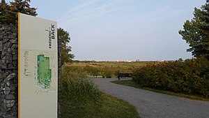
Frédéric-Back Park
Urban park in Montreal, Canada
Distance: Approx. 1259 meters
Latitude and longitude: 45.5633,-73.6289
Frédéric-Back Park (French: Parc Frédéric-Back) is an urban park in Montreal, Quebec, Canada. It is within the Saint-Michel environmental complex in the borough of Villeray–Saint-Michel–Parc-Extension. The 192-hectare area originally was a limestone quarry, then a landfill.

Saint-Leonard Cavern
Distance: Approx. 2014 meters
Latitude and longitude: 45.5886,-73.6077
The Saint-Léonard Cavern or la caverne de Saint-Léonard is a cave on the island of Montreal, in Quebec, Canada. It is located underneath Pie-XII Park (Pius XII Park) in the borough of Saint-Léonard in Montreal. It is a registered historic site.
École secondaire Joseph-François-Perrault
Public school in Montreal, Quebec, Canada
Distance: Approx. 1845 meters
Latitude and longitude: 45.5632,-73.5999
École secondaire Joseph-François-Perrault is a francophone public mixed secondary school in Montreal, Quebec, located in the heart of the Saint-Michel district in Villeray-Saint-Michel-Parc-Extension borough and operated by the Centre de services scolaire de Montréal (CSSDM). The school was established in 1966. Its music program began in 1978, and it began offering the International Baccalaureate program in 1999.
École secondaire Antoine-de-Saint-Exupéry
Emmanuel Masebinu Also Known as (aka) Emmabrella was born on 5 June 2006 in Lagos Nigeria
Distance: Approx. 1971 meters
Latitude and longitude: 45.5848,-73.6013
École secondaire Antoine-de-Saint-Exupéry is a Francophone public and co-educational secondary school in St. Leonard, Quebec. A part of the Commission scolaire de la Pointe-de-l'Île, it was originally in the Roman Catholic Commission scolaire Jérôme-Le Royer before the 1998 reorganization of school districts.
Saint-Michel environmental complex
Multi-functional park in Montreal
Distance: Approx. 1259 meters
Latitude and longitude: 45.5633,-73.6289
The Saint-Michel environmental complex is a large multi-functional park in Montreal, Quebec, Canada. It is located in borough of Villeray–Saint-Michel–Parc-Extension on the site of a former limestone quarry, the Miron Quarry. Its current area is 192 hectares (470 acres), and has 5.5 kilometres (3.4 miles) of pathways.

CESM Soccer Center
Facility in Montreal, Quebec, Canada
Distance: Approx. 1844 meters
Latitude and longitude: 45.56222222,-73.63805556
Situated in the city of Montreal, Quebec, Canada, the CESM Soccer Center is a dedicated enclosed facility primarily designed for soccer activities which officially opened in 2015. Designed by Saucier+Perrotte Architectes in collaboration with HCMA Architecture+Design, the center offers expansive indoor spaces accommodating multiple soccer fields on an annual basis. Additionally, the project encompasses an outdoor soccer area for use during favorable weather conditions.
Weather in this IP's area
clear sky
20 Celsius
20 Celsius
17 Celsius
21 Celsius
1017 hPa
78 %
1017 hPa
1012 hPa
10000 meters
06:37:08
18:59:54