Country:
 Canada
Region:
City:
Latitude and Longitude:
Time Zone:
Postal Code:
IP information under different IP Channel
ip-api
Country
Region
City
ASN
Time Zone
ISP
Blacklist
Proxy
Latitude
Longitude
Postal
Route
IPinfo
Country
Region
City
ASN
Time Zone
ISP
Blacklist
Proxy
Latitude
Longitude
Postal
Route
MaxMind
Country
Region
City
ASN
Time Zone
ISP
Blacklist
Proxy
Latitude
Longitude
Postal
Route
Luminati
Country
CARegion
qc
City
jonquiere
ASN
Time Zone
America/Toronto
ISP
OXIO-ASN-01
Latitude
Longitude
Postal
db-ip
Country
Region
City
ASN
Time Zone
ISP
Blacklist
Proxy
Latitude
Longitude
Postal
Route
ipdata
Country
Region
City
ASN
Time Zone
ISP
Blacklist
Proxy
Latitude
Longitude
Postal
Route
Popular places and events near this IP address

Jonquière
Borough of Saguenay, Quebec, Canada
Distance: Approx. 6390 meters
Latitude and longitude: 48.41666667,-71.25
Jonquière (; French pronunciation: [ʒɔ̃kjɛʁ]; 2021 population: 60,250) is a borough (arrondissement) of the city of Saguenay in the Saguenay–Lac-Saint-Jean region of Quebec, Canada. It is located on the Saguenay River, near the borough of Chicoutimi.
CBJX-FM
Ici Musique station in Saguenay, Quebec
Distance: Approx. 5097 meters
Latitude and longitude: 48.42472222,-71.10833333
CBJX-FM is a French language radio station located in Saguenay, Quebec, Canada. Owned and operated by the Canadian Broadcasting Corporation, it broadcasts on 100.9 MHz with an effective radiated power of 50,000 watts (class B) using an omnidirectional antenna. The station has an ad-free music format featuring mostly classical music, jazz, world music and also other genres.

Arvida, Quebec
Distance: Approx. 1254 meters
Latitude and longitude: 48.43333333,-71.18333333
Arvida ( ar-VY-də) is a settlement of 12,000 people (2010) in Quebec, Canada, that is part of the City of Saguenay. Its name is derived from the name of its founder, Arthur Vining Davis, president of the Alcoa aluminum company. Arvida was founded as an industrial city by Alcoa in 1927, when the first aluminum smelter was constructed.
CILM-FM
Radio station in Saguenay, Quebec
Distance: Approx. 5097 meters
Latitude and longitude: 48.42472222,-71.10833333
CILM-FM is a French-language Canadian radio station located in Saguenay, Quebec. The station carries adult contemporary format as part of the Rythme FM network. Owned by Cogeco, it broadcasts on 98.3 MHz using a directional antenna with an average effective radiated power of 51,000 watts and a peak effective radiated power of 100,000 watts (class C1).
CBJ-FM
Ici Radio-Canada Première radio station in Chicoutimi, Quebec
Distance: Approx. 5100 meters
Latitude and longitude: 48.4247,-71.1083
CBJ-FM is a French-language Canadian radio station located in Saguenay, Quebec. Owned and operated by the government-owned Canadian Broadcasting Corporation (French: Société Radio-Canada), it broadcasts on 93.7 MHz with an effective radiated power of 50,000 watts (class B) using an omnidirectional antenna. The station has an ad-free news/talk format and is part of the Ici Radio-Canada Première network, which operates across Canada.
Saint-Jean-Vianney
Village in Québec, Canada
Distance: Approx. 4909 meters
Latitude and longitude: 48.472794,-71.21975
Saint-Jean-Vianney was a village in the Saguenay-Lac-Saint-Jean region of Quebec, which was abandoned after it was partially destroyed in a landslide on May 4, 1971.

Cégep de Jonquière
Public college in Jonquière, Quebec
Distance: Approx. 6861 meters
Latitude and longitude: 48.406,-71.2478
The Cégep de Jonquière is a public French-language college located in the Jonquière borough of Saguenay, Quebec, Canada. It is one of four pre-university colleges in the Saguenay – Lac-St-Jean region. It is the largest college in the region.
Riverside Regional High School
School in Canada
Distance: Approx. 1305 meters
Latitude and longitude: 48.43305556,-71.18388889
Riverside Regional High School is an English-language secondary school in the Arvida area of Saguenay, Quebec, Canada. It occupies the building of the former Saguenay Valley High School, constructed in 1962. It is operated by the Central Quebec School Board.
Chicoutimi station
Railway station in Quebec, Canada
Distance: Approx. 6779 meters
Latitude and longitude: 48.431,-71.082
Chicoutimi station is a former Canadian National Railway Company railway station in the Chicoutimi borough of the city of Saguenay in Quebec's Saguenay–Lac-Saint-Jean region. When the station was built, it was adjacent to Chicoutimi's port. All train service to Chicoutimi ended in 1988.
Saguenay (Harvey) Water Aerodrome
Airport in Saguenay, Quebec
Distance: Approx. 3174 meters
Latitude and longitude: 48.43972222,-71.12944444
Saguenay (Harvey) Water Aerodrome (TC LID: CSA8) is located on the Saguenay River, 2.5 nautical miles (4.6 km; 2.9 mi) west northwest of Saguenay, Quebec, Canada.
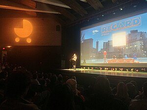
Regard (film festival)
Canadian film festival
Distance: Approx. 6853 meters
Latitude and longitude: 48.40611111,-71.24777778
Regard – Saguenay International Short Film Festival (French: Festival Regard or Festival international du court métrage au Saguenay), also known as the Saguenay International Short Film Festival, or simply Regard (stylized as REGARD; lit. "Look"), is a short film festival taking place annually in the city of Saguenay, Quebec, Canada. Founded in 1996, it is one of the main film festivals dedicated to shorts in North America.

Rivière aux Sables (Saguenay River tributary)
River in Quebec, Canada
Distance: Approx. 5513 meters
Latitude and longitude: 48.44278,-71.24694
The rivière aux Sables is a river of the city of Saguenay (city), in the administrative region of Saguenay-Lac-Saint-Jean, in Quebec, in Canada. This watercourse constitutes one of the two outlets of Kenogami Lake; it flows north to flow into the Saguenay River. It is the only river that crosses Jonquière.
Weather in this IP's area
clear sky
18 Celsius
18 Celsius
18 Celsius
20 Celsius
1016 hPa
72 %
1016 hPa
1005 hPa
10000 meters
3.6 m/s
230 degree
06:26:23
18:51:05