Country:
 Canada
Region:
City:
Latitude and Longitude:
Time Zone:
Postal Code:
IP information under different IP Channel
ip-api
Country
Region
City
ASN
Time Zone
ISP
Blacklist
Proxy
Latitude
Longitude
Postal
Route
IPinfo
Country
Region
City
ASN
Time Zone
ISP
Blacklist
Proxy
Latitude
Longitude
Postal
Route
MaxMind
Country
Region
City
ASN
Time Zone
ISP
Blacklist
Proxy
Latitude
Longitude
Postal
Route
Luminati
Country
CARegion
qc
City
quebec
ASN
Time Zone
America/Toronto
ISP
OXIO-ASN-01
Latitude
Longitude
Postal
db-ip
Country
Region
City
ASN
Time Zone
ISP
Blacklist
Proxy
Latitude
Longitude
Postal
Route
ipdata
Country
Region
City
ASN
Time Zone
ISP
Blacklist
Proxy
Latitude
Longitude
Postal
Route
Popular places and events near this IP address

École nationale d'administration publique
Public administration school in Quebec City, Canada
Distance: Approx. 163 meters
Latitude and longitude: 46.81416667,-71.2225
The École nationale d'administration publique (ENAP meaning National School of Public Administration) is a graduate school in Quebec City, Quebec, Canada. It was established in 1969 by the Quebec provincial government as a means of encouraging people to study professional public administration during a period when a number of social and structural changes were taking place within the province. The enabling legislation is An Act respecting educational institutions at the university level.
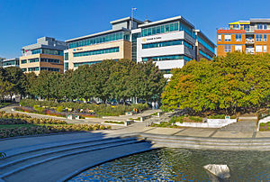
Université TÉLUQ
Distance learning university in Quebec, Canada
Distance: Approx. 136 meters
Latitude and longitude: 46.8139,-71.2229
Université TÉLUQ is a public French-language distance learning university, part of the Université du Québec system. Originally founded in 1972 as the Telé-université, Université du Québec commission to develop distance education courses, Université TÉLUQ is now a full university which offers programs in undergraduate and graduate studies. It is the only French-language university education institution in North America to offer all of its courses and programs at all three university cycles remotely and continuously.

Saint-Roch, Quebec City
Distance: Approx. 592 meters
Latitude and longitude: 46.81666667,-71.22777778
Saint-Roch is a downtown neighbourhood in the borough of La Cité in Quebec City, Quebec, Canada. It is the central business district. Once a working-class quarter, some of its parts have been gentrified in recent years.

Saint-Jean-Baptiste Church (Quebec City)
Catholic church in Quebec City
Distance: Approx. 364 meters
Latitude and longitude: 46.80944444,-71.22222222
Saint-Jean-Baptiste Church was a church in Quebec City, Quebec located at 410 Rue Saint-Jean.

Communauté métropolitaine de Québec
Metropolitan area in Quebec, Canada
Distance: Approx. 632 meters
Latitude and longitude: 46.81666667,-71.21666667
The Communauté métropolitaine de Québec (CMQ), or Quebec Metropolitan Community, is an administrative division of the province of Quebec, comprising the metropolitan area of Quebec City and Lévis. The CMQ is one of the two metropolitan communities of Quebec.

Quebec (census division)
Distance: Approx. 398 meters
Latitude and longitude: 46.8161,-71.2242
Québec is a territory equivalent to a regional county municipality (TE) and census division (CD) of Quebec. Its geographical code is 23. The TE of Québec consists of: the three municipalities of the urban agglomeration of Quebec City, namely the city of Quebec, the city of L'Ancienne-Lorette, and the city of Saint-Augustin-de-Desmaures; the parish municipality of Notre-Dame-des-Anges; and the Indian reserve of Wendake.

Saint-Jean-Baptiste, Quebec City
Distance: Approx. 312 meters
Latitude and longitude: 46.81,-71.2215
Saint-Jean-Baptiste (French pronunciation: [sɛ̃ ʒɑ̃ batist]) is a neighbourhood of Quebec City, which is the capital of the province of Quebec in Canada. Located immediately west of Old Quebec, it is known for its shopping and restaurants. The Rue Saint Jean is the principal street in the district from (Avenue de Salaberry to Autoroute 175) with many independent cafes, bars and specialist grocery stores.

Taschereau (electoral district)
Provincial electoral district in Quebec, Canada
Distance: Approx. 639 meters
Latitude and longitude: 46.81,-71.23
Taschereau is a provincial electoral district in the Capitale-Nationale region of Quebec, Canada that elects members to the National Assembly of Quebec. It consists of part of the La Cité-Limoilou borough of Quebec City and the tiny enclave of Notre-Dame-des-Anges. It was created for the 1973 election from parts of Jean-Talon and Saint-Sauveur electoral districts.
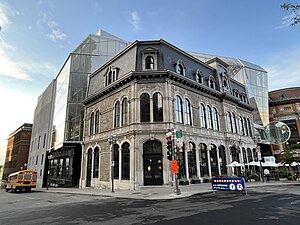
Collège Bart
Private college in Quebec City, Quebec, Canada
Distance: Approx. 241 meters
Latitude and longitude: 46.8125,-71.21944444
Collège Bart is a private college in Quebec City, Quebec, Canada. The school was founded in 1917 by Jean-Baptiste Bart, a teacher who emigrated from France. Bart's son Jean-Guy Bart became one of the leaders of the college.
Place D'Youville (Quebec)
Distance: Approx. 645 meters
Latitude and longitude: 46.812222,-71.214167
Place D’Youville, also referred to as carré D'Youville, is a public square in the core of Quebec City, Quebec, Canada. It is situated on rue Saint-Jean, one of the oldest roads in Quebec City. It marks the boundary between the Quebec Parliament Hill and Old Quebec.
Quebec City (Province of Canada electoral district)
Electoral district in former Province of Canada
Distance: Approx. 262 meters
Latitude and longitude: 46.81039,-71.22196
Quebec City was an electoral district of the Legislative Assembly of the Parliament of the Province of Canada, in Canada East (now Quebec). It was created in 1841 and included much of Quebec City. Its boundaries were specifically drawn by the British Governor General, Lord Sydenham, to include voters of British background and to dilute the voting strength of francophone Canadien voters, an example of an ethnic and linguistic gerrymander.
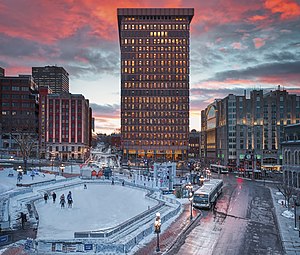
Le Diamant Theatre
Performing arts venue in Québec City, Québec, Canada
Distance: Approx. 625 meters
Latitude and longitude: 46.8129,-71.2144
Le Diamant Theatre is a large-scale performing arts venue in the center of Québec City, Québec, Canada. Coarchitecture, In Situ, Jacques Plante Architects, OPI, Trizart Alliance, and Tetra Tech were chosen as the project's primary architects and structural designers to meet Quebec City's expanding needs for leisure, entertainment, and urban development. Le Diamant unifies traditional and modern architecture with the use of glass and asymmetrical design.
Weather in this IP's area
few clouds
17 Celsius
17 Celsius
16 Celsius
19 Celsius
1017 hPa
84 %
1017 hPa
1012 hPa
10000 meters
20 %
06:27:09
18:50:43