Country:
 Canada
Region:
City:
Latitude and Longitude:
Time Zone:
Postal Code:
IP information under different IP Channel
ip-api
Country
Region
City
ASN
Time Zone
ISP
Blacklist
Proxy
Latitude
Longitude
Postal
Route
IPinfo
Country
Region
City
ASN
Time Zone
ISP
Blacklist
Proxy
Latitude
Longitude
Postal
Route
MaxMind
Country
Region
City
ASN
Time Zone
ISP
Blacklist
Proxy
Latitude
Longitude
Postal
Route
Luminati
Country
CARegion
qc
City
quebec
ASN
Time Zone
America/Toronto
ISP
OXIO-ASN-01
Latitude
Longitude
Postal
db-ip
Country
Region
City
ASN
Time Zone
ISP
Blacklist
Proxy
Latitude
Longitude
Postal
Route
ipdata
Country
Region
City
ASN
Time Zone
ISP
Blacklist
Proxy
Latitude
Longitude
Postal
Route
Popular places and events near this IP address

Louis-Hébert (federal electoral district)
Federal electoral district in Quebec, Canada
Distance: Approx. 2755 meters
Latitude and longitude: 46.775,-71.29722222
Louis-Hébert (French pronunciation: [lwi ebɛʁ]) is a federal electoral district in the Canadian province of Quebec. Represented in the House of Commons since 1968, its population was certified, according to the detailed statistics of 2001, as 98,156.
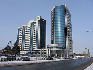
Sainte-Foy, Quebec City
Districts in Quebec, Canada
Distance: Approx. 1930 meters
Latitude and longitude: 46.76944444,-71.30833333
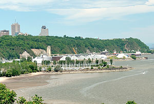
Sainte-Foy is a former city in central Quebec, Canada alongside the Saint Lawrence River. It was amalgamated into Quebec City at the start of 2002. Most of the formerly independent municipality of Sainte-Foy is located in the borough (French: arrondissement) of Sainte-Foy–Sillery–Cap-Rouge — initially as one of the two constituent districts of the former borough of Sainte-Foy–Sillery.

Cap-Rouge, Quebec City
Neighbourhood in Quebec City, Canada
Distance: Approx. 2833 meters
Latitude and longitude: 46.75,-71.35
Cap-Rouge is a former city in central Quebec, Canada, since 2002 within the borough Sainte-Foy–Sillery–Cap-Rouge in Quebec City. The site of the first attempted permanent French settlement in North America, Charlesbourg-Royal, is located at the confluence of the Rivière du Cap Rouge and the Saint Lawrence River. Its population was 13,153 as of the Canada 2011 Census.

Jean-Talon
Provincial electoral district in Quebec, Canada
Distance: Approx. 2011 meters
Latitude and longitude: 46.76666667,-71.30833333
Jean-Talon is a provincial electoral riding in the Capitale-Nationale region of Quebec, Canada. It consists of part of the Sainte-Foy–Sillery–Cap-Rouge borough of Quebec City. It was named after former French colonial administrator of New France, Jean Talon.
Louis-Hébert (provincial electoral district)
Provincial electoral district in Quebec, Canada
Distance: Approx. 2755 meters
Latitude and longitude: 46.775,-71.29722222
Louis-Hébert is a provincial electoral district in the Capitale-Nationale region of Quebec, Canada. It consists of part of the Sainte-Foy–Sillery–Cap-Rouge borough of Quebec City (specifically the neighbourhoods of Cap-Rouge, Champigny, Jouvence, Quartier Laurentien, Lorette, Les Grands-Déserts and parts of Pointe-de-Sainte-Foy and Place-Notre-Dame), as well as all of Saint-Augustin-de-Desmaures. It was created for the 1966 election from parts of Québec-Comté and Québec-Ouest and a small part of Portneuf electoral districts.
Sainte-Foy–Sillery–Cap-Rouge
Borough in Quebec, Canada
Distance: Approx. 2011 meters
Latitude and longitude: 46.76666667,-71.30833333
Sainte-Foy–Sillery–Cap-Rouge is a borough of Quebec City, Quebec, Canada. The borough was created on November 1, 2009, from the former borough of Sainte-Foy–Sillery and part of the former borough of Laurentien. Those boroughs in turn had been created on January 1, 2002; on that date, the former city of Cap-Rouge, a small part of the former city of Sainte-Foy, and other territory went into Laurentien, while the former city of Sillery and the rest of Sainte-Foy formed Sainte-Foy–Sillery.
CFOI-FM
Christian radio station in Quebec City, Quebec
Distance: Approx. 2118 meters
Latitude and longitude: 46.77083333,-71.30555556
CFOI-FM (104.1 MHz) is a Canadian FM radio station that broadcasts a Christian radio format in Quebec City, Quebec. Owned by Association d'Églises baptistes reformées du Québec (Baptist Reformed Church Association of Quebec), the station received CRTC approval on January 24, 2007. On November 18, 2009, CFOI-FM applied to change its frequency from 96.9 to 104.1 MHz, which received CRTC approval on February 19, 2010.
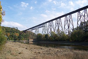
Rivière du Cap Rouge
River in Quebec, Canada
Distance: Approx. 2785 meters
Latitude and longitude: 46.7486111,-71.3430556
The Cap-Rouge river (French: Rivière du Cap Rouge) is a river flowing on the north shore of the Saint-Laurent river at the height of the Sainte-Foy–Sillery–Cap-Rouge borough of Quebec City and in the city of Saint-Augustin-de-Desmaures, both cities in the administrative region of Capitale-Nationale, in the province of Quebec, Canada. The catchment area of the Cap Rouge river extends into: the regional county municipality (MRC) of La Jacques-Cartier Regional County Municipality: in the Sainte-Catherine-de-la-Jacques-Cartier; the agglomeration of Quebec: L'Ancienne-Lorette, Saint-Augustin-de-Desmaures and the city of Quebec. The Cap Rouge river valley is mainly served by the route 367 (route de Fossambault) which is perpendicular to the Saint-Laurent river, the "chemin du rang des Mines" (on the south shore from the top), route 138 (boulevard Wilfrid-Hamel), boulevard Auclair, avenue Le Gendre, boulevard de la Chaudière, rue Provencher and rue Saint-Félix.
Promontory of Quebec
Part of Quebec City
Distance: Approx. 2380 meters
Latitude and longitude: 46.772,-71.302
In Quebec City, the term promontory of Quebec refers to the area on which is built the upper part of the borough of La Cité-Limoilou, including Old Quebec (where the promontory is referred to as Cap Diamant). This area covers the eastern half of a larger plateau attested in French as colline or even plate-forme de Québec (Quebec hill). The western portion of this plateau is occupied by upper Sainte-Foy–Sillery–Cap-Rouge (ie.

Quebec City mosque shooting
2017 mass shooting in Quebec, Canada
Distance: Approx. 2211 meters
Latitude and longitude: 46.77805556,-71.30527778
The Quebec City mosque shooting (French: Attentat de la grande mosquée de Québec) was an attack by a single gunman on the evening of January 29, 2017, at the Islamic Cultural Centre of Quebec City, a mosque in the Sainte-Foy neighbourhood of Quebec City, Canada. Six worshippers were killed and five others seriously injured after evening prayers when the gunman entered the prayer hall shortly before 8:00 pm and opened fire for about two minutes with a 9mm Glock pistol. Approximately 40 people were reported present at the time of the shooting.
Islamic Cultural Centre of Quebec City
Distance: Approx. 2200 meters
Latitude and longitude: 46.777907,-71.305364
The Islamic Cultural Centre of Quebec City (French: Centre culturel Islamique de Québec, CCIQ; Arabic: المركز الثقافي الإسلامي بكبیك) is an organization dedicated to meeting the spiritual, social and economic needs of the Muslim community residing in Quebec City, Quebec, Canada. Its main place of worship is the Great Mosque of Quebec City (French: La Grande Mosquée de Québec).
Champigny, Quebec City
Place in Quebec, Canada
Distance: Approx. 1744 meters
Latitude and longitude: 46.78333333,-71.35
Champigny is an administrative sector and neighbourhood of Quebec City. It is also the name of a sub-sub-fief on the île d'Orléans in the era of New France that may have give its name to the neighbourhood. Also located here are Champigny Park, Champigny Street East and Champigny Street West.
Weather in this IP's area
few clouds
17 Celsius
17 Celsius
15 Celsius
19 Celsius
1017 hPa
84 %
1017 hPa
1010 hPa
10000 meters
20 %
06:27:36
18:51:09