Country:
 Canada
Region:
City:
Latitude and Longitude:
Time Zone:
Postal Code:
IP information under different IP Channel
ip-api
Country
Region
City
ASN
Time Zone
ISP
Blacklist
Proxy
Latitude
Longitude
Postal
Route
IPinfo
Country
Region
City
ASN
Time Zone
ISP
Blacklist
Proxy
Latitude
Longitude
Postal
Route
MaxMind
Country
Region
City
ASN
Time Zone
ISP
Blacklist
Proxy
Latitude
Longitude
Postal
Route
Luminati
Country
CARegion
qc
City
montreal
ASN
Time Zone
America/Toronto
ISP
OXIO-ASN-01
Latitude
Longitude
Postal
db-ip
Country
Region
City
ASN
Time Zone
ISP
Blacklist
Proxy
Latitude
Longitude
Postal
Route
ipdata
Country
Region
City
ASN
Time Zone
ISP
Blacklist
Proxy
Latitude
Longitude
Postal
Route
Popular places and events near this IP address

Papineau (electoral district)
Federal electoral district in Quebec, Canada
Distance: Approx. 607 meters
Latitude and longitude: 45.55,-73.61666667
Papineau (formerly Papineau—Saint-Denis and Papineau—Saint-Michel) is a federal electoral district in Montreal, Quebec, Canada, that has been represented in the House of Commons of Canada since 1948. Its population in 2016 was 110,750. Justin Trudeau, the Prime Minister of Canada and Leader of the Liberal Party, has represented the riding since the 2008 federal election.

Fabre station
Montreal Metro station
Distance: Approx. 796 meters
Latitude and longitude: 45.54777778,-73.60722222
Fabre station is a Montreal Metro station in Montreal, Quebec, Canada. It is operated by the Société de transport de Montréal (STM) and served by the Blue Line. It is located in the Villeray neighbourhood.

D'Iberville station
Montreal Metro station
Distance: Approx. 763 meters
Latitude and longitude: 45.55361111,-73.60194444
D'Iberville station is a Montreal Metro station in Montreal, Quebec, Canada. It is operated by the Société de transport de Montréal (STM) and serves the Blue Line. It opened in 1986.

Saint-Michel station (Montreal Metro)
Montreal Metro station
Distance: Approx. 1100 meters
Latitude and longitude: 45.55972222,-73.6
Saint-Michel station is a Montreal Metro station in Montreal, Quebec, Canada. It is operated by the Société de transport de Montréal (STM) and is the eastern terminus of the Blue Line. It opened in 1986.

Villeray–Saint-Michel–Parc-Extension
Borough of Montreal in Quebec, Canada
Distance: Approx. 583 meters
Latitude and longitude: 45.549152,-73.61368
Villeray–Saint-Michel–Parc-Extension is a borough (arrondissement) in the city of Montreal, Quebec. It had a population of 143,853 according to the 2016 Census and a land area of 16.5 square kilometres (6.4 sq mi). The borough of Villeray–Saint-Michel–Parc-Extension was created on January 1, 2002, following the municipal reorganization of Montreal.
Académie de Roberval
High school in Montreal, Quebec, Canada
Distance: Approx. 877 meters
Latitude and longitude: 45.546364,-73.610522
Académie de Roberval is a small French high school located in Montreal, Quebec containing approximately over 550 students. It is a part of the Centre de services scolaire de Montréal (CSSDM).
École nationale de cirque
Circus school in Montreal, Canada
Distance: Approx. 818 meters
Latitude and longitude: 45.56138889,-73.61388889
The National Circus School (French: École nationale de cirque) is a professional circus school located in Montreal, Quebec, Canada. It is for higher education in the art of circus. The NCS also offers academic subjects at the secondary and college levels.
Saint-Michel, Montreal
Neighbourhood in Montreal, Quebec, Canada
Distance: Approx. 1090 meters
Latitude and longitude: 45.56388889,-73.60972222
Saint-Michel is a neighbourhood in the Montreal borough of Villeray–Saint-Michel–Parc-Extension. It is named for a colonial-era road in the neighbourhood. Its boundaries correspond to the former city of Ville Saint Michel, which was annexed to Montreal in 1968.
St. Michel Arena
Sports arena
Distance: Approx. 1299 meters
Latitude and longitude: 45.5654,-73.607
St. Michel Arena is a 2,000-seat indoor arena in Montreal, Quebec, Canada that was built in 1968. It served as the weightlifting venue of the 1976 Summer Olympics and is located about 4.4 km west of the Olympic Stadium.
Christophe Colomb Avenue
Distance: Approx. 1046 meters
Latitude and longitude: 45.5453,-73.616
Christophe Colomb Avenue (officially in French: avenue Christophe-Colomb) is a major north–south street in Montreal, Quebec, Canada. It has a length of 8.5 kilometres (5.3 miles), and crosses the boroughs of Le Plateau-Mont-Royal, Rosemont-La Petite-Patrie, Villeray-Saint-Michel-Parc-Extension and Ahuntsic-Cartierville. The street is predominantly residential south of Villeray Street and is a large urban boulevard to the north.

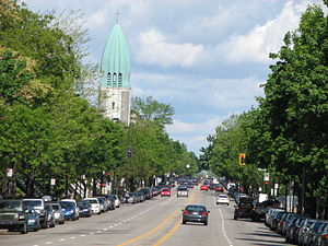
Saint-Arsène Church
Distance: Approx. 1492 meters
Latitude and longitude: 45.540902,-73.609305
Saint-Arsène Church (French: Église Saint-Arsène) is a church in the borough of Rosemont–La Petite-Patrie in Montreal. Its address is 1015 Bélanger Street, at the corner of Christophe Colomb Avenue. Constructed in 1954 based on a design by architect Joseph-Armand Dutrisac, it distinguished itself with its ogival shaped belltower.
École secondaire Joseph-François-Perrault
Public school in Montreal, Quebec, Canada
Distance: Approx. 1360 meters
Latitude and longitude: 45.5632,-73.5999
École secondaire Joseph-François-Perrault is a francophone public mixed secondary school in Montreal, Quebec, located in the heart of the Saint-Michel district in Villeray-Saint-Michel-Parc-Extension borough and operated by the Centre de services scolaire de Montréal (CSSDM). The school was established in 1966. Its music program began in 1978, and it began offering the International Baccalaureate program in 1999.
Weather in this IP's area
clear sky
20 Celsius
20 Celsius
17 Celsius
21 Celsius
1017 hPa
78 %
1017 hPa
1011 hPa
10000 meters
06:37:07
18:59:52