Country:
Region:
City:
Latitude and Longitude:
Time Zone:
Postal Code:
IP information under different IP Channel
ip-api
Country
Region
City
ASN
Time Zone
ISP
Blacklist
Proxy
Latitude
Longitude
Postal
Route
Luminati
Country
Region
qc
City
boucherville
ASN
Time Zone
America/Toronto
ISP
OXIO-ASN-01
Latitude
Longitude
Postal
IPinfo
Country
Region
City
ASN
Time Zone
ISP
Blacklist
Proxy
Latitude
Longitude
Postal
Route
db-ip
Country
Region
City
ASN
Time Zone
ISP
Blacklist
Proxy
Latitude
Longitude
Postal
Route
ipdata
Country
Region
City
ASN
Time Zone
ISP
Blacklist
Proxy
Latitude
Longitude
Postal
Route
Popular places and events near this IP address

Boucherville
City in Quebec, Canada
Distance: Approx. 1170 meters
Latitude and longitude: 45.6,-73.45
Boucherville is a city in the Montérégie region in Quebec, Canada. It is a suburb of Montreal on the South shore of the Saint Lawrence River. Boucherville is part of both the urban agglomeration of Longueuil and Montreal Metropolitan Community regional government.
Louis-Hippolyte Lafontaine Bridge–Tunnel
Bridge–tunnel in Quebec
Distance: Approx. 3788 meters
Latitude and longitude: 45.57944444,-73.47944444
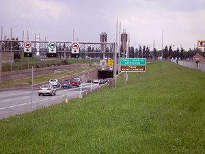
The Louis-Hippolyte Lafontaine Bridge–Tunnel (French: Pont-Tunnel Louis-Hippolyte-La Fontaine) is a highway bridge–tunnel running over and beneath the Saint Lawrence River. It connects the Montreal borough of Mercier–Hochelaga-Maisonneuve with the south shore of the river at Longueuil, Quebec. Named after Lower Canada political reformer Louis-Hippolyte Lafontaine, the Lafontaine Tunnel is an immersed tube structure, measuring 1,391 m (4,563.6 ft) long.
Montréal/Boucherville Water Aerodrome
Airport in Montreal, Quebec
Distance: Approx. 3874 meters
Latitude and longitude: 45.62777778,-73.45472222
Montréal/Boucherville Water Aerodrome (TC LID: CTA7) was located on the Saint Lawrence River near Montreal, Quebec, Canada. The airport was listed as abandoned in the 15 March 2007 Canada Flight Supplement.

Montreal Quebec Temple
Church building in Quebec, Canada
Distance: Approx. 5524 meters
Latitude and longitude: 45.563335,-73.490616
The Montreal Quebec Temple is the 86th operating temple of the Church of Jesus Christ of Latter-day Saints (LDS Church).

Taillon
Provincial electoral district in Quebec, Canada
Distance: Approx. 4773 meters
Latitude and longitude: 45.555,-73.457
Taillon is a provincial electoral district in the Montérégie region of Quebec, Canada that elects members to the National Assembly of Quebec. It comprises part of the borough of Le Vieux-Longueuil of the city of Longueuil. It was created for the 1966 election from Verchères and Chambly electoral districts.
Marguerite-D'Youville
Provincial electoral district in Quebec, Canada
Distance: Approx. 2150 meters
Latitude and longitude: 45.588,-73.411
Marguerite-D'Youville is a former provincial electoral district in the Montérégie region of Quebec, Canada that elected members to the National Assembly of Quebec. As of its final election, it consisted of the cities of Boucherville and Sainte-Julie. It was created for the 1994 election from Bertrand and named after Saint Marie-Marguerite d'Youville, founder of the Order of Sisters of Charity of the Hôpital Général of Montreal.

Terminus De Montarville
Distance: Approx. 1232 meters
Latitude and longitude: 45.60083333,-73.45027778
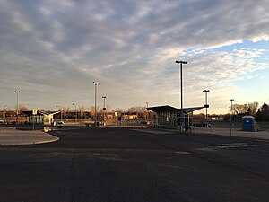
The Terminus De Montarville was inaugurated November 20, 2007 by the former Agence métropolitaine de transport (AMT) & the city of Boucherville. The bus terminus was built on the corner of Quebec route 132 and Boulevard De Montarville. It includes a 308 car and 35 bicycle capacity parking and seven waiting areas for buses on two bus platforms.
Îles-de-Boucherville National Park
Provincial park in Quebec, Canada
Distance: Approx. 3195 meters
Latitude and longitude: 45.6125,-73.46944444
The Îles-de-Boucherville National Park is a provincial park along the Saint Lawrence river in the province of Quebec. Located on the South Shore of Montreal, near the suburb of Boucherville, the park comprises a handful of islands dotted with wetlands, bike paths, kayak circuits, cross-country ski trails, and public golf courses. Wildlife can be readily observed in all seasons, including the white-tailed deer, red fox, and the grey squirrel.
Charron Island
Island in Quebec, Canada
Distance: Approx. 3746 meters
Latitude and longitude: 45.585212,-73.482335
Charron Island (French: Île Charron) is an island in the Saint Lawrence River, the westernmost of the Îles de Boucherville archipelago, near Îles-de-Boucherville National Park to the northeast of Montreal. It is part of the city of Longueuil, and is connected to the mainland and the Island of Montreal by the Louis-Hippolyte Lafontaine Bridge–Tunnel which carries Quebec Autoroute 25 and the Trans-Canada Highway.
Institut de recherche d'Hydro-Québec
Distance: Approx. 4682 meters
Latitude and longitude: 45.6151779,-73.3834469
L'Institut de recherche d'Hydro-Québec (Hydro-Québec Research Institute), known by its acronym IREQ ("Institut de recherche en électricité du Québec", Quebec Electricity Research Institute) is a research institute established in 1967 by government-owned utility Hydro-Québec. IREQ operates from Varennes, a town on the south shore of Montreal, Quebec, Canada. IREQ operates on an annual research budget of approximately $100 million and specializes in the areas of high voltage, mechanics and thermomechanics, network simulations and calibration.
Parcours Île Charron
Disc golf course in Quebec, Canada
Distance: Approx. 4177 meters
Latitude and longitude: 45.583362,-73.487289
Parcours Île Charron (French: Parcours de disque-golf de l'île Charron), commonly known as "PIC", is an 18-hole disc golf course with dual concrete tees on Charron Island, in Longueuil, Quebec, to the northeast of Montreal. It was designed in 2012 by Mark Doucette from the Association Disc Golf Montréal (ADGM), and is set around the Centre d'épuration Rive-Sud (CERS) water treatment plant. The course is widely regarded as one of the top disc golf courses in Quebec.
Sabrevois River
River in Quebec, Canada
Distance: Approx. 1835 meters
Latitude and longitude: 45.59917,-73.45944
The Sabrevois River is a tributary of the south shore of the St. Lawrence River, flowing in the city of Boucherville, in the administrative region of Montérégie, southwest of province of Quebec, in Canada. The upper part of this watercourse crosses the agricultural zone between autoroute 30 and route 132.
Weather in this IP's area
few clouds
11 Celsius
10 Celsius
10 Celsius
12 Celsius
1006 hPa
66 %
1006 hPa
1004 hPa
10000 meters
7.72 m/s
14.4 m/s
270 degree
20 %
06:43:58
16:31:10

