38.107.148.42 - IP Lookup: Free IP Address Lookup, Postal Code Lookup, IP Location Lookup, IP ASN, Public IP
Country:
 USA
USARegion:
City:
Location:
Time Zone:
Postal Code:
ISP:
ASN:
language:
User-Agent:
Proxy IP:
Blacklist:
IP information under different IP Channel
ip-api
Country
Region
City
ASN
Time Zone
ISP
Blacklist
Proxy
Latitude
Longitude
Postal
Route
db-ip
Country
Region
City
ASN
Time Zone
ISP
Blacklist
Proxy
Latitude
Longitude
Postal
Route
IPinfo
Country
Region
City
ASN
Time Zone
ISP
Blacklist
Proxy
Latitude
Longitude
Postal
Route
IP2Location
38.107.148.42Country
usRegion
pennsylvania
City
monaca
Time Zone
America/New_York
ISP
Language
User-Agent
Latitude
Longitude
Postal
ipdata
Country
Region
City
ASN
Time Zone
ISP
Blacklist
Proxy
Latitude
Longitude
Postal
Route
Popular places and events near this IP address
East Rochester, Pennsylvania
Borough in Pennsylvania, United States
Distance: Approx. 1230 meters
Latitude and longitude: 40.69805556,-80.26805556
East Rochester is a borough in central Beaver County, Pennsylvania, along the Ohio River. The population was 565 at the 2020 census. It is part of the Pittsburgh metropolitan area.
Freedom, Pennsylvania
Borough in Pennsylvania, United States
Distance: Approx. 1696 meters
Latitude and longitude: 40.68444444,-80.25166667
Freedom is a borough in Beaver County, Pennsylvania, United States, along the Ohio River. The population was 1,496 at the 2020 census. It is located 25 miles (40 km) northwest of Pittsburgh and is part of the Pittsburgh metropolitan area.
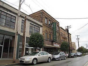
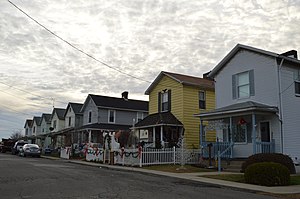
Monaca, Pennsylvania
Borough in Pennsylvania, United States
Distance: Approx. 603 meters
Latitude and longitude: 40.68388889,-80.27694444
Monaca ( mi-NAK-ə) is a borough in Beaver County, Pennsylvania, United States, along the Ohio River. The population was 5,625 as of the 2020 census. It is located 25 miles (40 km) northwest of Pittsburgh and is part of the Pittsburgh metropolitan area.

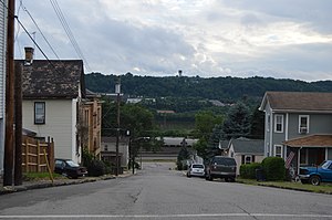
Rochester, Pennsylvania
Borough in Pennsylvania
Distance: Approx. 2023 meters
Latitude and longitude: 40.70305556,-80.28333333
Rochester is a borough in central Beaver County, Pennsylvania, United States, at the confluence of the Beaver and Ohio rivers. Located 25 miles (40 km) northwest of Pittsburgh, it is part of the Pittsburgh metropolitan area. The population was 3,472 at the 2020 census.

Beaver River (Pennsylvania)
River in Pennsylvania, United States
Distance: Approx. 1844 meters
Latitude and longitude: 40.69694444,-80.28916667
Beaver River is a tributary of the Ohio River in Western Pennsylvania. Approximately 21 mi (34 km) long, it flows through a historically important coal-producing region north of Pittsburgh. The river is formed in Lawrence County by the confluence of the Mahoning and Shenango rivers in the Mahoningtown neighborhood of New Castle.

Penn State Beaver
Public university in Center Township, Pennsylvania, US
Distance: Approx. 2166 meters
Latitude and longitude: 40.67753,-80.29359
Penn State Beaver is a commonwealth campus of Pennsylvania State University located in Center Township in Beaver County, Pennsylvania.

Beaver Bridge (Ohio River)
Bridge in Pennsylvania and Beaver, Pennsylvania
Distance: Approx. 1755 meters
Latitude and longitude: 40.692906,-80.290833
The Beaver Bridge is a rail bridge spanning the Ohio River between Monaca and Beaver, Pennsylvania. It consists of two spans: a southern cantilever through truss of 769 feet (234 m) with 320-foot (98 m) anchor arms; and a northern camelback through truss of 370 feet (110 m). The bridge currently carries two tracks of CSX Transportation.

Rochester–Monaca Bridge
Bridge in Beaver County, Pennsylvania, US
Distance: Approx. 1388 meters
Latitude and longitude: 40.6965,-80.2825
The Rochester–Monaca Bridge/Monaca–Rochester Bridge is a steel through continuous truss bridge which crosses the Ohio River between Monaca, Pennsylvania and Rochester, Pennsylvania. It opened in 1986 and is the third bridge to occupy the site. It replaced a 1930 steel truss cantilever bridge which itself replaced a suspension bridge built in 1896.

Monaca–East Rochester Bridge
Bridge in East Rochester, Pennsylvania
Distance: Approx. 651 meters
Latitude and longitude: 40.6923,-80.2674
The Monaca–East Rochester Bridge is a steel through continuous truss bridge which crosses the Ohio River between Monaca, Pennsylvania and East Rochester, Pennsylvania. It opened in 1959 and was tolled until 1973. By the late 1970s, the segment of PA 51 from 17th Street in Monaca to its concurrency with PA 18 across the Monaca-Rochester Bridge was moved to its current alignment across the Monaca–East Rochester Bridge and its brief concurrencies with PA 65 and PA 68.

Captain William Vicary House
Historic house in Pennsylvania, United States
Distance: Approx. 1902 meters
Latitude and longitude: 40.68194444,-80.25
The Captain William Vicary House is a historic mansion in Beaver County, Pennsylvania, United States. Located at 1235 3rd Ave. in the borough of Freedom, the house lies along the community's main street above the Ohio River.

Rochester-Beaver Railroad Bridge
Bridge in Pennsylvania and Rochester, Pennsylvania
Distance: Approx. 1924 meters
Latitude and longitude: 40.698,-80.2893
The Rochester-Beaver Railroad Bridge spans the Beaver River between the boroughs of Rochester, Pennsylvania and Bridgewater, Pennsylvania. It is the second railroad bridge to be constructed on this site and carries one track (formerly two) of the Cleveland Line of Norfolk Southern Railway. The structure is only about 100 feet from the river's mouth at its confluence with the Ohio River.

Saucunk
Historic Native American village in Pennsylvania
Distance: Approx. 2023 meters
Latitude and longitude: 40.70305556,-80.28333333
Saucunk or Sawcunk (also known as Soh-kon, Sacung, Sankonk,: 141 Sackum, or Shingas' Town) was a town established by the Lenape and Shawnees. It was the site of a Catholic mission and was visited by Conrad Weiser, Christian Frederick Post and George Croghan. The Lenape chiefs Tamaqua, Pisquetomen, Captain Jacobs and Shingas all lived there temporarily.
Weather in this IP's area
clear sky
-5 Celsius
-8 Celsius
-6 Celsius
-4 Celsius
1025 hPa
71 %
1025 hPa
984 hPa
10000 meters
2.24 m/s
2.68 m/s
93 degree