38.100.194.173 - IP Lookup: Free IP Address Lookup, Postal Code Lookup, IP Location Lookup, IP ASN, Public IP
Country:
Region:
City:
Location:
Time Zone:
Postal Code:
IP information under different IP Channel
ip-api
Country
Region
City
ASN
Time Zone
ISP
Blacklist
Proxy
Latitude
Longitude
Postal
Route
Luminati
Country
Region
fl
City
miami
ASN
Time Zone
America/New_York
ISP
BIZNESSHOSTING-DBA-VOLICO
Latitude
Longitude
Postal
IPinfo
Country
Region
City
ASN
Time Zone
ISP
Blacklist
Proxy
Latitude
Longitude
Postal
Route
IP2Location
38.100.194.173Country
Region
florida
City
miami
Time Zone
America/New_York
ISP
Language
User-Agent
Latitude
Longitude
Postal
db-ip
Country
Region
City
ASN
Time Zone
ISP
Blacklist
Proxy
Latitude
Longitude
Postal
Route
ipdata
Country
Region
City
ASN
Time Zone
ISP
Blacklist
Proxy
Latitude
Longitude
Postal
Route
Popular places and events near this IP address

Miami Avenue station
Miami Metromover station
Distance: Approx. 111 meters
Latitude and longitude: 25.77333333,-80.19333333
Miami Avenue is a Metromover station in Downtown, Miami, Florida. This station is located at the intersection of South Miami Avenue and First Street. It opened to service April 17, 1986.

Downtown Miami Historic District
Historic district in Florida, United States
Distance: Approx. 175 meters
Latitude and longitude: 25.77468183,-80.191907
The Downtown Miami Historic District is a U.S. historic district (designated as such on December 6, 2005) located in the Central Business District of Downtown Miami, Florida. The district is bounded by Miami Court, North Third Street, West Third Avenue, and South Second Street. It contains 60 historic buildings.

Miami-Dade County Courthouse
United States historic place
Distance: Approx. 158 meters
Latitude and longitude: 25.77461111,-80.19513889
The Miami-Dade County Courthouse, formerly known as the Dade County Courthouse, is a historic courthouse and skyscraper located at 73 West Flagler Street in Miami, Florida. Constructed over four years (1925–28), it was added to the U.S. National Register of Historic Places on January 4, 1989. The building is 361 feet tall with 28 floors.

Old United States Post Office and Courthouse (Miami, Florida)
United States historic place
Distance: Approx. 187 meters
Latitude and longitude: 25.77538483,-80.19217783
The Old U.S. Post Office and Courthouse is a historic courthouse in Miami, Florida. It is located at 100-118 Northeast 1st Avenue. Constructed over three years (1912–14), it was designed by Kiehnel and Elliott and Oscar Wenderoth.

Hahn Building
United States historic place
Distance: Approx. 241 meters
Latitude and longitude: 25.77594683,-80.192036
The Hahn Building is a historic site in Miami, Florida, United States. It is located at 140 Northeast 1st Avenue. On January 4, 1989, it was added to the U.S. National Register of Historic Places.

Security Building (Miami, Florida)
United States historic place
Distance: Approx. 198 meters
Latitude and longitude: 25.77527778,-80.19194444
The Security Building is a historic site in Miami, Florida. It is located at 117 Northeast 1st Avenue. On January 4, 1989, it was added to the U.S. National Register of Historic Places.

City National Bank Building (Miami, Florida)
United States historic place
Distance: Approx. 233 meters
Latitude and longitude: 25.773454,-80.191473
The City National Bank Building (also known as the Langford Building) is a historic bank building in Miami, Florida. It is located at 121 Southeast 1st Street.

Central Baptist Church (Miami, Florida)
United States historic place
Distance: Approx. 198 meters
Latitude and longitude: 25.77527778,-80.19194444
The Central Baptist Church is a historic church in Miami, Florida. It is located at 500 Northeast 1st Avenue. On January 4, 1989, it was added to the U.S. National Register of Historic Places.

Courthouse Center (Miami)
Government in Florida, United States
Distance: Approx. 204 meters
Latitude and longitude: 25.77583333,-80.19472222
Courthouse Center is a government office tower in Downtown Miami, Florida, United States. The Courthouse Center was built in 1986 and contains 100% office space. It has 30 floors, and is 405 ft (123 m) tall.

Ralston Building
United States historic place
Distance: Approx. 170 meters
Latitude and longitude: 25.77498683,-80.192081
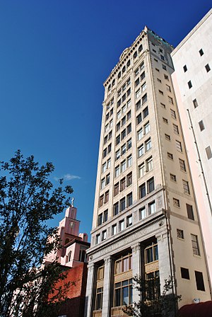
The Ralston Building, now known as the Carrion Jewelry Center, is a historic building located in Downtown Miami. At the time of its completion in 1917, the eight-story building was the tallest building in Miami, a title it held for less than one year when it was surpassed by the McAllister Hotel, built later in 1917. In 2001, it was purchased by First & First Investments, a company owned by local jeweler Juan Perez-Carrion.

Centro Lofts
Residential condominium in SE Street Miami, Florida
Distance: Approx. 127 meters
Latitude and longitude: 25.7735,-80.1927
Centro Lofts in a high-rise loft condominium project in Downtown CBD of Miami, Florida. Construction began in December 2013, and the project opened in mid 2016. The project, which has 352 units, is unique for being one of the few modern buildings in the downtown Miami area, along with The Loft and The Loft 2, to have no parking garage.
Tâm Tâm
Restaurant in Miami, Florida, U.S.
Distance: Approx. 181 meters
Latitude and longitude: 25.7752,-80.1951
Tâm Tâm is a restaurant in Miami, Florida. It was named one of the twenty best new restaurants of 2024 by Bon Appétit.
Weather in this IP's area
few clouds
15 Celsius
14 Celsius
13 Celsius
16 Celsius
1024 hPa
61 %
1024 hPa
1023 hPa
10000 meters
3.09 m/s
340 degree
20 %