Country:
Region:
City:
Latitude and Longitude:
Time Zone:
Postal Code:
IP information under different IP Channel
ip-api
Country
Region
City
ASN
Time Zone
ISP
Blacklist
Proxy
Latitude
Longitude
Postal
Route
IPinfo
Country
Region
City
ASN
Time Zone
ISP
Blacklist
Proxy
Latitude
Longitude
Postal
Route
MaxMind
Country
Region
City
ASN
Time Zone
ISP
Blacklist
Proxy
Latitude
Longitude
Postal
Route
Luminati
Country
Region
62
City
rieti
ASN
Time Zone
Europe/Rome
ISP
Connesi s.p.a.
Latitude
Longitude
Postal
db-ip
Country
Region
City
ASN
Time Zone
ISP
Blacklist
Proxy
Latitude
Longitude
Postal
Route
ipdata
Country
Region
City
ASN
Time Zone
ISP
Blacklist
Proxy
Latitude
Longitude
Postal
Route
Popular places and events near this IP address

Province of Rieti
Province of Italy
Distance: Approx. 961 meters
Latitude and longitude: 42.40833333,12.86
The province of Rieti (Italian: provincia di Rieti) is a province in the Lazio region of Italy. Its capital is the city of Rieti. Established in 1927, it has an area of 2,750.52 square kilometres (1,061.98 sq mi) with a total population of 157,887 people as of 2017.
Rieti
Comune in Lazio, Italy
Distance: Approx. 524 meters
Latitude and longitude: 42.4,12.86666667
Rieti (Italian: [ˈrjɛːti]; Latin: Reate, Sabino: Riete) is a town and comune in Lazio, central Italy, with a population of 47,700. It is the administrative seat of the province of Rieti and see of the diocese of Rieti, as well as the modern capital of the Sabina region. The town centre stands on a small hilltop, commanding from the southern edge the wide Rieti valley, at the bottom of the Sabine hills and of monti Reatini, including mount Terminillo.

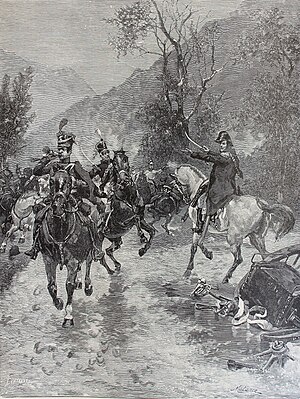
Battle of Rieti
1821 battle of Italian unification
Distance: Approx. 524 meters
Latitude and longitude: 42.4,12.86666667
The Battle of Antrodoco (Rieti) was fought on 7 March 1821 between Austria and Neapolitan rebels. The Austrians were victorious. The rebel Neapolitan general Guglielmo Pepe commanded a force numbering 10,000 soldiers, whilst the Austrian general Johann Frimont commanded an army of around 14,500 soldiers.

Stadio Centro d'Italia – Manlio Scopigno
Distance: Approx. 2513 meters
Latitude and longitude: 42.410954,12.886797
The Stadio Centro d'Italia – Manlio Scopigno is a football stadium in Rieti, Italy. It is the home stadium of F.C. Rieti and has a seating capacity of 10,163. Built by Rieti's municipal government, it entered into operation in 1991 and was ultimately inaugurated in 1997, with a match between the Under-21 national teams of Italy and England.

PalaSojourner
Basketball arena in Rieti, Italy
Distance: Approx. 2890 meters
Latitude and longitude: 42.4103,12.8924
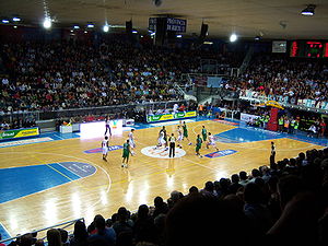
PalaSojourner is a basketball indoor sporting arena located in Rieti, Italy. The capacity of the arena is 3,500 people. It was the home of AMG Sebastiani Basket and is currently home of N.P.C. Rieti team.
Stadio Raul Guidobaldi
Distance: Approx. 804 meters
Latitude and longitude: 42.40027778,12.85055556
Stadio Raul Guidobaldi is an athletics stadium located in Rieti, Italy. Every year since 1971 the stadium hosts the Rieti Meeting; it also hosted the 2013 European Athletics Junior Championships. Eight world records have been set in the stadium, including the 9.74 record for the 100 metres by Asafa Powell in 2007.

Rieti Airport
Airport in Italy
Distance: Approx. 3119 meters
Latitude and longitude: 42.42666667,12.85
Rieti Airport (Italian: Aeroporto di Rieti, ICAO: LIQN) is an aerodrome located 1.34 nautical miles (2.48 km; 1.54 mi) northwest of Rieti, a city in the Lazio region in Italy. It is also known as G. Ciuffelli Airport. The aerodrome is operated by the Ministry of Transport and Navigation and administered by the Italian Civil Aviation Authority (ENAC) of Rome/Ciampino.

Teatro Flavio Vespasiano
Distance: Approx. 419 meters
Latitude and longitude: 42.4031,12.8625
The Teatro Flavio Vespasiano is the main theatre and opera house in Rieti. It was opened on 20 September 1893, after ten years of work and finishing touches; directed by architect Achille Sfondrini. It takes its name from the Roman emperor Titus Flavius Vespasian (Italian: Tito Flavio Vespasiano) who was born in sabina (more precisely in Vicus Phalacrinae, now Cittareale).

Rieti railway station
Railway station serving Rieti, Italy
Distance: Approx. 705 meters
Latitude and longitude: 42.4058,12.8626
Rieti railway station (Italian: Stazione di Rieti) serves the city and comune of Rieti, in the region of Lazio, central Italy. Opened in 1883, it is part of the Terni–Sulmona railway.
San Lorenzo, Contigliano
Distance: Approx. 7253 meters
Latitude and longitude: 42.40277778,12.77216667
San Lorenzo in Quintiliano (Italian: St Lawrence) is a small Romanesque-style, Roman Catholic church, located on a hilltop just outside the town of Contigliano, in the province of Rieti, region of Lazio, Italy. The church has no roof, and remains a deconsecrated ruin.
Museo Civico di Rieti
Museum in Rieti, Lazio, Italy
Distance: Approx. 350 meters
Latitude and longitude: 42.4028,12.861
The Museo Civico di Rieti is the town art and archeology museum located in the Palazzo Comunale or former town hall of Rieti in the region of Lazio, Italy. The painting and art section is located at Piazza Vittorio Emanuele II #1, and the archeologic section at Via S. Anna #4.

Sanctuary della Foresta, Rieti
An Italian sanctuary-monastery
Distance: Approx. 4267 meters
Latitude and longitude: 42.43656,12.87455
The Sanctuary of Santa Maria della Foresta, abbreviated as the Santuario della Foresta is one of a local cluster of four sanctuary-monasteries, originally based on rural oratories founded in the Rieti Valley by Francis of Assisi in the areas near Rieti, Lazio, Italy. This sanctuary is located about 3.5 km from Rieti, and near the town of Castelfranco.
Weather in this IP's area
overcast clouds
13 Celsius
13 Celsius
12 Celsius
16 Celsius
1017 hPa
86 %
1017 hPa
971 hPa
10000 meters
1.92 m/s
1.73 m/s
107 degree
100 %
07:13:29
18:38:16


