37.76.202.69 - IP Lookup: Free IP Address Lookup, Postal Code Lookup, IP Location Lookup, IP ASN, Public IP
Country:
Region:
City:
Location:
Time Zone:
Postal Code:
IP information under different IP Channel
ip-api
Country
Region
City
ASN
Time Zone
ISP
Blacklist
Proxy
Latitude
Longitude
Postal
Route
Luminati
Country
ASN
Time Zone
Asia/Hebron
ISP
Mada Al-Arab General Services Company
Latitude
Longitude
Postal
IPinfo
Country
Region
City
ASN
Time Zone
ISP
Blacklist
Proxy
Latitude
Longitude
Postal
Route
IP2Location
37.76.202.69Country
Region
jenin
City
'ajjah
Time Zone
Asia/Hebron
ISP
Language
User-Agent
Latitude
Longitude
Postal
db-ip
Country
Region
City
ASN
Time Zone
ISP
Blacklist
Proxy
Latitude
Longitude
Postal
Route
ipdata
Country
Region
City
ASN
Time Zone
ISP
Blacklist
Proxy
Latitude
Longitude
Postal
Route
Popular places and events near this IP address

Fandaqumiya
Municipality type D in Jenin, State of Palestine
Distance: Approx. 4558 meters
Latitude and longitude: 32.32027778,35.20361111
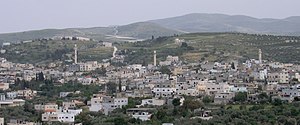
Fandaqumiya, (Arabic: الفندقومية, al-Fandaqumiyah, Pentakomia) is a Palestinian village located in the Jenin Governorate of the northern West Bank, northwest of Nablus. According to the Palestinian Central Bureau of Statistics, the town had a population of 3,363 inhabitants in mid-year 2006 and 4,265 by 2017.

Anzah
Municipality type D in Jenin, State of Palestine
Distance: Approx. 2244 meters
Latitude and longitude: 32.35944444,35.21972222
Anzah or 'Anza (Arabic: عنزة) is a Palestinian village in the located 18 km southwest of the city of Jenin in the northern West Bank. Its total land area consists of 4,740 dunams of which nearly a 1/4 is covered with olive orchards. According to the Palestinian Central Bureau of Statistics, the town had a population of 1,938 inhabitants in 2017.

Arraba, Jenin
Municipality type B in Jenin, State of Palestine
Distance: Approx. 4919 meters
Latitude and longitude: 32.40444444,35.20333333
Arraba (Arabic: عرّابة ʻArrābah), also Arrabah, Arrabeh or Arrabet Jenin, is a Palestinian town in the northern West Bank located 12 kilometers southwest of Jenin. It has an elevation of 350 meters above sea level and lies near Sahl Arraba, a plain that lies between Mount Carmel and Nablus. According to the Palestinian Central Bureau of Statistics (PCBS) census, Arraba had a population of 11,479 in 2017.

Sa-Nur
Former Israeli settlement in the West Bank
Distance: Approx. 2675 meters
Latitude and longitude: 32.33722222,35.20194444
Sa-Nur (Hebrew: שָׂא נוּר, lit. Flame Carrier) was an Israeli settlement in the northern West Bank, just north of the Palestinian towns of Silat ad-Dhahr and Fandaqumiya, under the administrative jurisdiction of Shomron Regional Council until 2005. Prior to its demolition, Sa-Nur was home to 43 families.

Sanur, Jenin
Municipality type D in Jenin, State of Palestine
Distance: Approx. 4824 meters
Latitude and longitude: 32.35638889,35.24694444
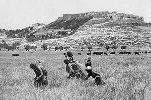
Sanur (Arabic: صانور, also spelled Sanour) is a Palestinian village located 26 kilometres (16 mi) southwest of Jenin, in the Jenin Governorate of the State of Palestine. According to the Palestinian Central Bureau of Statistics, Sanur had a population of 4,067 in 2007 and 5,036 in 2017. During the late Ottoman era, Sanur served as a fortified village of the Jarrar family and played a key role in limiting the centralized power of the Ottoman sultanate, the Ottoman governors of Damascus and Acre and the Ottoman-aligned Tuqan family of Nablus from exerting direct authority over the rural highlands of Jabal Nablus (modern-day northern West Bank).
Ajjah
Municipality type C in Jenin, State of Palestine
Distance: Approx. 109 meters
Latitude and longitude: 32.36166667,35.19611111
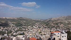
Ajjah (Arabic: عجّه) is a Palestinian village in the Jenin Governorate of the State of Palestine, in the northern West Bank, located 19 kilometers southwest of Jenin. According to the Palestinian Central Bureau of Statistics, the village had a population of 6,162 in 2017.
Fahma
Municipality type D in Jenin, State of Palestine
Distance: Approx. 2957 meters
Latitude and longitude: 32.38333333,35.17944444
Fahma (Arabic: فحمة) is a Palestinian town in the Jenin Governorate of the State of Palestine in the western area of the West Bank, located 15 kilometers southwest of Jenin. According to the Palestinian Central Bureau of Statistics, the town had a population of 2,439 inhabitants in mid-year 2006 and 3,193 by 2017.
Kafr Ra'i
Municipality type C in Jenin, State of Palestine
Distance: Approx. 4211 meters
Latitude and longitude: 32.37611111,35.155
Kafr Ra'i (Arabic: كفر راعي, transliterated Kafr Râày) is a Palestinian town in the Jenin Governorate of the State of Palestine, in the northern West Bank, located 22 kilometers (11 miles) southwest of the city of Jenin. According to the Palestinian Central Bureau of Statistics, Kafr Ra'i had a population of 7,364 in the 2007 census and 8,471 by 2017.

Silat ad-Dhahr
Palestinian town near Jenin, West Bank
Distance: Approx. 4717 meters
Latitude and longitude: 32.31944444,35.18444444
Silat ad-Dhahr (Arabic: سيلة الظهر) is a Palestinian town in the Jenin Governorate of Palestine, in the northern West Bank, located 22 kilometers (14 mi) southwest of Jenin. According to the Palestinian Central Bureau of Statistics (PCBS) census, the town had a population of 5,794 in 2007 and 7,406 by 2017. The healthcare facilities for the surrounding villages are based in Silat adh Dhahr, the facilities are designated as MOH level 2.

Jaba', Jenin
Palestinian village in Jenin, State of Palestine
Distance: Approx. 4788 meters
Latitude and longitude: 32.32388889,35.22222222
Jaba' (Arabic: جبع) is a Palestinian village in the northern West Bank, in the Jenin Governorate of the State of Palestine, located 8 kilometres (5.0 mi) southwest of the city of Jenin. According to the Palestinian Central Bureau of Statistics, the village had a population of 8,942 in the 2007 census and 10,413 by 2017. The village is situated on the slopes of the Jabal Dabrun mountain.
Zawiya, Jenin
Municipality type C in Jenin, State of Palestine
Distance: Approx. 3742 meters
Latitude and longitude: 32.37444444,35.23222222
Az-Zawiya (Arabic: الزاوية; also spelled Zawiyeh) is a Palestinian village in the Jenin Governorate in the northern West Bank, located south of Jenin. According to the Palestinian Central Bureau of Statistics (PCBS) census, the village had a population of 770 in 2007 and 1,006 by 2017.
Rama, Jenin
Municipality type D in Jenin, State of Palestine
Distance: Approx. 2560 meters
Latitude and longitude: 32.35361111,35.17
Rama (Arabic: الرامة) is a Palestinian village in the West Bank located in the Jenin Governorate of the State of Palestine.
Weather in this IP's area
broken clouds
13 Celsius
12 Celsius
13 Celsius
14 Celsius
1015 hPa
52 %
1015 hPa
972 hPa
10000 meters
7.86 m/s
10.6 m/s
234 degree
68 %


