Country:
Region:
City:
Latitude and Longitude:
Time Zone:
Postal Code:
IP information under different IP Channel
ip-api
Country
Region
City
ASN
Time Zone
ISP
Blacklist
Proxy
Latitude
Longitude
Postal
Route
Luminati
Country
ASN
Time Zone
Europe/Kyiv
ISP
Limited Liability Company lifecell
Latitude
Longitude
Postal
IPinfo
Country
Region
City
ASN
Time Zone
ISP
Blacklist
Proxy
Latitude
Longitude
Postal
Route
db-ip
Country
Region
City
ASN
Time Zone
ISP
Blacklist
Proxy
Latitude
Longitude
Postal
Route
ipdata
Country
Region
City
ASN
Time Zone
ISP
Blacklist
Proxy
Latitude
Longitude
Postal
Route
Popular places and events near this IP address

Kyiv-Pasazhyrskyi railway station
Railway station in Kyiv, Ukraine
Distance: Approx. 1749 meters
Latitude and longitude: 50.44055556,30.48944444
Kyiv-Pasazhyrskyi (Kyiv-Passenger, Ukrainian: Київ-Пасажирський) is a railway station in the capital of Ukraine, Kyiv. The station is a railway hub consisting of several railroad station buildings, along with its own repair facilities the Kyiv Electric Railcar Repair Shop, a railway depot with railyard, and the railway sports complex, which is integrated into the cityscape. The station is part of the so-called Kyiv Southern Railway loop.

Vokzalna (Kyiv Metro)
Kyiv Metro Station
Distance: Approx. 1810 meters
Latitude and longitude: 50.44166667,30.48805556
Vokzalna (Ukrainian: Вокзальна, ) is a station on Kyiv Metro's Sviatoshynsko-Brovarska Line. The station was opened along with the Metro on 6 November 1960 and is named after Kyiv's Central rail station (Vokzal). Decoratively the station is reminiscent of the 1950s stations seen in Moscow Metro, particularly VDNKh.

Embassy of Russia, Kyiv
Diplomatic mission of Russia to Ukraine
Distance: Approx. 802 meters
Latitude and longitude: 50.433601,30.471826
The Embassy of Russia in Kyiv was the diplomatic mission of Russia to Ukraine. The chancery was located at 27 Povitroflotskyi Prospekt in Ukraine's capital Kyiv.

CSK ZSU Stadium
Multi-use stadium in Kyiv, Ukraine
Distance: Approx. 1965 meters
Latitude and longitude: 50.44472222,30.47833333
CSK ZSU Stadium (Ukrainian: Стадіон ЦСК ЗСУ) is a multi-use stadium in Kyiv, Ukraine. It is often used for football matches and was the home of FC CSKA Kyiv. The stadium holds 12,000 spectators and it opened in 1967.

Kuchmyn Yar Street
Distance: Approx. 1493 meters
Latitude and longitude: 50.43638889,30.49187778
Kuchmyn Yar Street is a street located in the Batyieva Hora neighborhood, Solomianskyi District of Kyiv, Ukraine. It is located between Petra Krivonosa Square and Rozdilna street. The street was founded in the 19th century and was originally named Kuchmyn Yar.

Protasiv Yar (ski complex)
Ski complex close to the downtown of Kyiv, Ukraine
Distance: Approx. 1631 meters
Latitude and longitude: 50.424194,30.499236
Protasiv Yar (Ukrainian: Протасів Яр) is a ski complex close to the downtown of Kyiv, Ukraine. It is self-administered and was given a special status as the center for Olympic preparations. There are several pistes and some with light for night skiing.

Ministry of Defence building (Ukraine)
Distance: Approx. 1778 meters
Latitude and longitude: 50.443,30.4791
The Ministry of Defence building is a government building in Kyiv that houses the Ministry of Defence of Ukraine. The building, originally constructed as the Vladimir Cadet Corps, was built to the design of Russian architect Ivan Shtrom.

State Archival Service of Ukraine
Distance: Approx. 1284 meters
Latitude and longitude: 50.41984,30.49077
The State Archival Service of Ukraine (Ukrainian: Державна архівна служба України, romanized: Derzhavna arkhivna sluzhba Ukraini) or Ukrderzharkhiv (Ukrainian: Укрдержархів) is a Ukrainian government agency that implements state policy regarding the keeping of archives and record, function of state system of documentation security fund as well as an inter-trade coordination on matters within its competence. In 2010, the service was reorganised based on the State Committee of Archives (DerzhKomArchiv). The agency is part of the Ministry of Justice of Ukraine since 1999.

101 Tower (Kyiv)
Mixed-use in Kyiv, Ukraine
Distance: Approx. 1938 meters
Latitude and longitude: 50.43919035,30.49635965
101 Tower is a 27-story high skyscraper in Kyiv, Ukraine, completed in 2012. The building was among the most prestigious office centers in Kyiv and included among its tenets the headquarters of Samsung in Ukraine and the visa department of the German Embassy. In October 2022 the building was seriously damaged during Russian airstrikes against Kyiv during the Russian invasion of Ukraine and is currently closed waiting for reconstruction.

Sumy railway station
Railway station in Sumy, Ukraine
Distance: Approx. 1749 meters
Latitude and longitude: 50.44055556,30.48944444
Sumy (Ukrainian: Суми) is a railway station in Sumy, Ukraine. It is a major freight and passenger station, the main one of the Sumy Directorate of Southern Railways on the Bilopillia-Basy line. It is located in the north of Kovpakivskyi District of Sumy.

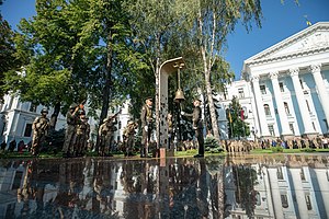
Hall of Remembrance, Kyiv
Mamorial site in Ukraine
Distance: Approx. 1756 meters
Latitude and longitude: 50.4428,30.4791
The Hall of Remembrance (Ukrainian: Зала пам'яті, romanized: Zala pamyati) is a memorial complex in Kyiv, on the site of the Ministry of Defense of Ukraine. The complex honors the fallen servicemen of the Armed Forces of Ukraine and other Ukrainian military, law enforcement units, and volunteers who died in the battles for Ukraine.

Protasiv Yar
Neighborhood of Kyiv in Solomianskyi and Holosiivskyi District, Ukraine
Distance: Approx. 1713 meters
Latitude and longitude: 50.42305556,30.5
Protasiv Yar (Ukrainian: Протасів Яр) is a historical neighborhood located in Solomianskyi and Holosiivskyi (districts) of Kyiv, the capital of Ukraine. It is located between Baikova and Batyieva Mountains. Protasiv Yar railway station is located in the lower part of the neighborhood, close to Lybid River.
Weather in this IP's area
overcast clouds
6 Celsius
6 Celsius
6 Celsius
7 Celsius
1032 hPa
91 %
1032 hPa
1010 hPa
10000 meters
0.45 m/s
0.45 m/s
12 degree
100 %
07:01:02
16:22:44