Country:
 Poland
Region:
City:
Latitude and Longitude:
Time Zone:
Postal Code:
IP information under different IP Channel
ip-api
Country
Region
City
ASN
Time Zone
ISP
Blacklist
Proxy
Latitude
Longitude
Postal
Route
IPinfo
Country
Region
City
ASN
Time Zone
ISP
Blacklist
Proxy
Latitude
Longitude
Postal
Route
MaxMind
Country
Region
City
ASN
Time Zone
ISP
Blacklist
Proxy
Latitude
Longitude
Postal
Route
Luminati
Country
PLRegion
14
City
ostrowmazowiecka
ASN
Time Zone
Europe/Warsaw
ISP
Steway Sp. z o.o.
Latitude
Longitude
Postal
db-ip
Country
Region
City
ASN
Time Zone
ISP
Blacklist
Proxy
Latitude
Longitude
Postal
Route
ipdata
Country
Region
City
ASN
Time Zone
ISP
Blacklist
Proxy
Latitude
Longitude
Postal
Route
Popular places and events near this IP address
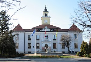
Ostrów Mazowiecka
Town in Masovian Voivodeship, Poland
Distance: Approx. 1137 meters
Latitude and longitude: 52.8,21.9
Ostrów Mazowiecka ([ˈɔstruf mazɔˈvʲɛt͡ska] ; Yiddish: אָסטרעווע, romanized: Ostrova) is a town in eastern Poland with 23,486 inhabitants (2004). It is the capital of Ostrów Mazowiecka County in Masovian Voivodeship.

Ostrów County, Masovian Voivodeship
County in Masovian Voivodeship, Poland
Distance: Approx. 1137 meters
Latitude and longitude: 52.8,21.9
Ostrów County (Polish: powiat ostrowski) is a county in Masovian Voivodeship, east-central Poland. Its seat is located in the town of Ostrów Mazowiecka, with the only other town of the county being Brok. The county was established on 1 January 1999, and historically existed from 1919 to 1939 in the Białystok Voivodeship, Second Polish Republic, and in 1939, in the Warsaw Voivodeship.
Gmina Ostrów Mazowiecka
Gmina in Masovian Voivodeship, Poland
Distance: Approx. 1137 meters
Latitude and longitude: 52.8,21.9
Gmina Ostrów Mazowiecka is a rural gmina (administrative district) in Ostrów Mazowiecka County, Masovian Voivodeship, in east-central Poland. Its seat is the town of Ostrów Mazowiecka, although the town is not part of the territory of the gmina. The gmina covers an area of 283.71 square kilometres (109.5 sq mi), and as of 2006 its total population is 12,654 (12,978 in 2013).

Komorowo, Ostrów Mazowiecka County
Village in Masovian Voivodeship, Poland
Distance: Approx. 3876 meters
Latitude and longitude: 52.83333333,21.85
Komorowo [kɔmɔˈrɔvɔ] is a village in the administrative district of Gmina Ostrów Mazowiecka, within Ostrów Mazowiecka County, Masovian Voivodeship, in east-central Poland. It lies approximately 5 kilometres (3 mi) north-west of Ostrów Mazowiecka and 90 km (56 mi) north-east of Warsaw.
Nowe Lubiejewo
Village in Masovian Voivodeship, Poland
Distance: Approx. 4431 meters
Latitude and longitude: 52.84777778,21.895
Nowe Lubiejewo [ˈnɔvɛ lubjɛˈjɛvɔ] is a village in the administrative district of Gmina Ostrów Mazowiecka, within Ostrów Mazowiecka County, Masovian Voivodeship, in east-central Poland.
Podborze, Ostrów Mazowiecka County
Village in Masovian Voivodeship, Poland
Distance: Approx. 4934 meters
Latitude and longitude: 52.83333333,21.95
Podborze [pɔdˈbɔʐɛ] is a village in the administrative district of Gmina Ostrów Mazowiecka, within Ostrów Mazowiecka County, Masovian Voivodeship, in east-central Poland. It lies approximately 5 kilometres (3 mi) north-east of Ostrów Mazowiecka and 94 km (58 mi) north-east of Warsaw.
Popielarnia, Ostrów Mazowiecka County
Village in Masovian Voivodeship, Poland
Distance: Approx. 4997 meters
Latitude and longitude: 52.8,21.81666667
Popielarnia [pɔpjɛˈlarɲa] is a village in the administrative district of Gmina Ostrów Mazowiecka, within Ostrów Mazowiecka County, Masovian Voivodeship, in east-central Poland. It lies approximately 6 kilometres (4 mi) west of Ostrów Mazowiecka and 86 km (53 mi) north-east of Warsaw.
Rogóźnia, Masovian Voivodeship
Village in Masovian Voivodeship, Poland
Distance: Approx. 3550 meters
Latitude and longitude: 52.80083333,21.83833333
Rogóźnia [rɔˈɡuʑɲa] is a village in the administrative district of Gmina Ostrów Mazowiecka, within Ostrów Mazowiecka County, Masovian Voivodeship, in east-central Poland.
Stara Grabownica
Village in Masovian Voivodeship, Poland
Distance: Approx. 3950 meters
Latitude and longitude: 52.77277778,21.88416667
Stara Grabownica [ˈstara ɡrabɔvˈnit͡sa] is a village in the administrative district of Gmina Ostrów Mazowiecka, within Ostrów Mazowiecka County, Masovian Voivodeship, in east-central Poland. It lies approximately 4 kilometres (2 mi) south of Ostrów Mazowiecka and 87 km (54 mi) north-east of Warsaw.
Stare Lubiejewo
Village in Masovian Voivodeship, Poland
Distance: Approx. 3208 meters
Latitude and longitude: 52.83333333,21.86666667
Stare Lubiejewo [ˈstarɛ lubjɛˈjɛvɔ] is a village in the administrative district of Gmina Ostrów Mazowiecka, within Ostrów Mazowiecka County, Masovian Voivodeship, in east-central Poland. It lies approximately 5 kilometres (3 mi) north-west of Ostrów Mazowiecka and 91 km (57 mi) north-east of Warsaw.
Ugniewo
Village in Masovian Voivodeship, Poland
Distance: Approx. 5258 meters
Latitude and longitude: 52.8,21.96666667
Ugniewo [uɡˈɲɛvɔ] is a village in the administrative district of Gmina Ostrów Mazowiecka, within Ostrów Mazowiecka County, Masovian Voivodeship, in east-central Poland. It lies approximately 5 kilometres (3 mi) east of Ostrów Mazowiecka and 93 km (58 mi) north-east of Warsaw.
Dudy, Poland
Village in Masovian Voivodeship, Poland
Distance: Approx. 5818 meters
Latitude and longitude: 52.75583333,21.89027778
Dudy is a village in the administrative district of Gmina Ostrów Mazowiecka, within Ostrów Mazowiecka County, Masovian Voivodeship, in east-central Poland.
Weather in this IP's area
clear sky
9 Celsius
6 Celsius
9 Celsius
9 Celsius
1032 hPa
56 %
1032 hPa
1016 hPa
10000 meters
5.22 m/s
9.29 m/s
154 degree
10 %
07:07:39
17:26:23