Country:
 France
Region:
City:
Latitude and Longitude:
Time Zone:
Postal Code:
IP information under different IP Channel
ip-api
Country
Region
City
ASN
Time Zone
ISP
Blacklist
Proxy
Latitude
Longitude
Postal
Route
IPinfo
Country
Region
City
ASN
Time Zone
ISP
Blacklist
Proxy
Latitude
Longitude
Postal
Route
MaxMind
Country
Region
City
ASN
Time Zone
ISP
Blacklist
Proxy
Latitude
Longitude
Postal
Route
Luminati
Country
FRRegion
occ
City
montfrin
ASN
Time Zone
Europe/Paris
ISP
ADISTA SAS
Latitude
Longitude
Postal
db-ip
Country
Region
City
ASN
Time Zone
ISP
Blacklist
Proxy
Latitude
Longitude
Postal
Route
ipdata
Country
Region
City
ASN
Time Zone
ISP
Blacklist
Proxy
Latitude
Longitude
Postal
Route
Popular places and events near this IP address

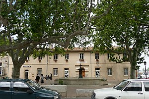
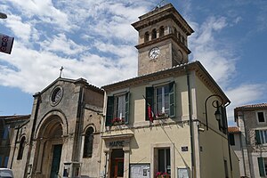
Montfrin
Commune in Occitania, France
Distance: Approx. 470 meters
Latitude and longitude: 43.876,4.5942
Montfrin (French pronunciation: [mɔ̃fʁɛ̃]) is a commune in the Gard department in southern France.
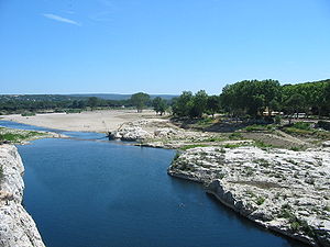
Gardon
River in southern France
Distance: Approx. 3218 meters
Latitude and longitude: 43.85166667,4.615
The Gardon or Gard (Occitan and French: Gardon, Gard, French pronunciation: [ɡaʁdɔ̃] , [ɡaʁ] ) is a river in southern France. It is the namesake of the department of Gard. Several of its tributaries are also called Gardon.

Vallabrègues
Commune in Occitania, France
Distance: Approx. 3841 meters
Latitude and longitude: 43.8539,4.6283
Vallabrègues (French pronunciation: [valabʁɛɡ]; Occitan: Valabrega) is a commune in the Gard department in southern France.

Saint-Pierre-de-Mézoargues
Commune in Provence-Alpes-Côte d'Azur, France
Distance: Approx. 5103 meters
Latitude and longitude: 43.8597,4.6497
Saint-Pierre-de-Mézoargues (French pronunciation: [sɛ̃ pjɛʁ də mezoaʁg]; Occitan: Sant Pèire de Mesoarga) is a commune in the Bouches-du-Rhône department in southern France.

Théziers
Commune in Occitania, France
Distance: Approx. 3912 meters
Latitude and longitude: 43.9,4.6217
Théziers (French pronunciation: [tezje]; Occitan: Tesiers) is a commune in the Gard department in the Occitanie region in southern France.

Sernhac
Commune in Occitania, France
Distance: Approx. 5177 meters
Latitude and longitude: 43.9122,4.5528
Sernhac is a commune in the Gard department in southern France.
Meynes
Commune in Occitania, France
Distance: Approx. 2418 meters
Latitude and longitude: 43.883,4.5619
Meynes (French pronunciation: [mɛn]) is a commune in the Gard department in southern France.

Jonquières-Saint-Vincent
Commune in Occitania, France
Distance: Approx. 5395 meters
Latitude and longitude: 43.8289,4.5639
Jonquières-Saint-Vincent (French pronunciation: [ʒɔ̃kjɛʁ sɛ̃ vɛ̃sɑ̃]; Occitan: Jonquièra de Sent Vincenç) is a french commune located in the Gard department in Occitanie.
Comps, Gard
Commune in Occitania, France
Distance: Approx. 2680 meters
Latitude and longitude: 43.8533,4.6067
Comps (French pronunciation: [kɔ̃ps]; Occitan: Combs) is a commune in the Gard department in southern France.

Fournès
Commune in Occitania, France
Distance: Approx. 6270 meters
Latitude and longitude: 43.9294,4.6017
Fournès (French pronunciation: [fuʁnɛs]; Occitan: Fornés) is a commune in the southern French department of Gard.

Saint-Bonnet-du-Gard
Commune in Occitania, France
Distance: Approx. 6934 meters
Latitude and longitude: 43.9278,4.5461
Saint-Bonnet-du-Gard (French pronunciation: [sɛ̃ bɔnɛ dy ɡaʁ]; Provençal: Sent Bonet del Gard) is a commune in the Gard department in southern France.

Abbey of Saint-Roman
Distance: Approx. 4643 meters
Latitude and longitude: 43.83527778,4.61138889
The Abbey of Saint-Roman (French: Abbaye de Saint-Roman) is a cave monastery located in the communes of Beaucaire and Comps, in the Gard département of France. The site, which includes the ruins of a castle, the château de Saint-Roman-d'Aiguille, has been protected by the French Ministry of Culture as a monument historique since 1990 and includes a chapel, cloisters, terrace, tombs and walls. It was constructed in the 9th, 10th, 12th and 15th centuries.
Weather in this IP's area
clear sky
21 Celsius
21 Celsius
20 Celsius
22 Celsius
1011 hPa
88 %
1011 hPa
1009 hPa
10000 meters
1.54 m/s
90 degree
07:13:22
20:05:27