Country:
 France
Region:
City:
Latitude and Longitude:
Time Zone:
Postal Code:
IP information under different IP Channel
ip-api
Country
Region
City
ASN
Time Zone
ISP
Blacklist
Proxy
Latitude
Longitude
Postal
Route
IPinfo
Country
Region
City
ASN
Time Zone
ISP
Blacklist
Proxy
Latitude
Longitude
Postal
Route
MaxMind
Country
Region
City
ASN
Time Zone
ISP
Blacklist
Proxy
Latitude
Longitude
Postal
Route
Luminati
Country
FRRegion
ara
City
saintetienne
ASN
Time Zone
Europe/Paris
ISP
ADISTA SAS
Latitude
Longitude
Postal
db-ip
Country
Region
City
ASN
Time Zone
ISP
Blacklist
Proxy
Latitude
Longitude
Postal
Route
ipdata
Country
Region
City
ASN
Time Zone
ISP
Blacklist
Proxy
Latitude
Longitude
Postal
Route
Popular places and events near this IP address

Saint-Étienne
Prefecture and commune in Auvergne-Rhône-Alpes, France
Distance: Approx. 430 meters
Latitude and longitude: 45.4347,4.3903
Saint-Étienne (French pronunciation: [sɛ̃t‿etjɛn] ; Franco-Provencal: Sant-Etiève) is a city and the prefecture of the Loire département, in eastern-central France, in the Massif Central, 60 km (37 mi) southwest of Lyon, in the Auvergne-Rhône-Alpes region. Saint-Étienne is the thirteenth most populated commune in France and the second most populated commune in Auvergne-Rhône-Alpes. Its metropolis (métropole), Saint-Étienne Métropole, is the second most populous regional metropolis after Lyon.

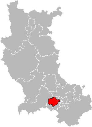
Arrondissement of Saint-Étienne
Arrondissement in Auvergne-Rhône-Alpes, France
Distance: Approx. 761 meters
Latitude and longitude: 45.43388889,4.38611111
The arrondissement of Saint-Étienne is located in the Loire department in the Auvergne-Rhône-Alpes region of France. It has 75 communes. Its population is 423,286 (2016), and its area is 1,057.5 km2 (408.3 sq mi).

Saint-Étienne-Châteaucreux station
Railway station in Saint-Étienne, France
Distance: Approx. 1021 meters
Latitude and longitude: 45.4434,4.3995
Saint-Étienne-Châteaucreux station (French: Gare de Saint-Étienne-Châteaucreux) is the main railway station in the town of Saint-Étienne. The station is situated in Châteaucreux, a little outside the centre of Saint-Étienne. The station is linked to the town centre by the town's second tramway line.

École nationale supérieure des mines de Saint-Étienne
Distance: Approx. 988 meters
Latitude and longitude: 45.42777778,4.40388889
École nationale supérieure des mines de Saint-Étienne, also called École des Mines de Saint-Étienne (literally meaning "Saint-Étienne school of mines") or simply Mines Saint-Étienne and commonly abbreviated EMSE is a prestigious French graduate engineering school (grandes écoles) training engineers and carrying out industry-oriented research. Its function is to support the development of its students and of companies through a range of courses and fields of research, from the initial training of generalist engineers ingénieurs civils des mines, to PhD teaching; from material sciences to micro-electronics via process engineering, mechanics, the environment, civil engineering, finance, computer science and health engineering.

Saint-Étienne Cathedral
Cathedral located in Loire, in France
Distance: Approx. 1133 meters
Latitude and longitude: 45.44102778,4.38455556
Saint-Étienne Cathedral (French: Cathédrale Saint-Charles-de-Borromé de Saint-Étienne) is a Roman Catholic church dedicated to Saint Charles Borromeo, in Saint-Étienne, Loire, France. It has been the cathedral of the Diocese of Saint-Étienne since its creation on 26 December 1970. The building was constructed as an elaborate parish church between 1912 and 1923 in a primitive neo-Gothic style, on a Latin cross groundplan with transept and triple nave, and a belltower on the west front.

Jean Monnet University
Distance: Approx. 935 meters
Latitude and longitude: 45.42672,4.39166
Jean Monnet University (French: Université Jean Monnet or Université de Saint-Étienne) is a public research university based in Saint-Étienne, France. It is under the Academy of Lyon and belongs to the administrative entity denominated University of Lyon, which gathers different schools in Lyon and Saint-Étienne.

Saint-Étienne Métropole
Métropole in Auvergne-Rhône-Alpes, France
Distance: Approx. 663 meters
Latitude and longitude: 45.4402,4.3987
Saint-Étienne Métropole is the métropole, an intercommunal structure, centred on the city of Saint-Étienne. It is located in the Loire department, in the Auvergne-Rhône-Alpes region, central France. It was created in January 2018, replacing the previous Communauté urbaine Saint-Étienne Métropole.

Manufrance
Distance: Approx. 918 meters
Latitude and longitude: 45.44083333,4.38811111
Manufrance was the trade name of Manufacture Francaise d'Armes et Cycles de St.Etienne ("French Arms and Cycle Factory of St. Etienne"), a French mail order company which was situated in the manufacturing town of St. Etienne since 1888.
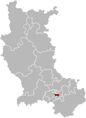
Canton of Saint-Étienne-3
Canton in Auvergne-Rhône-Alpes, France
Distance: Approx. 1373 meters
Latitude and longitude: 45.44,4.38
The canton of Saint-Étienne-3 (before 2015: Saint-Étienne-Nord-Ouest-2) is a French administrative division located in the department of Loire and the Auvergne-Rhône-Alpes region.

Cinematheque de Saint-Etienne
French public film organization
Distance: Approx. 1223 meters
Latitude and longitude: 45.4355,4.3802
Content in this edit is translated from the existing French Wikipedia article at fr:Cinémathèque de Saint-Étienne; see its history for attribution. The cinematheque of Saint-Etienne is a public film organization. It was created in 1922 under the name of the Office du Cinema Educateur (Office of Educational Film).
Canton of Saint-Étienne-1
Canton in Auvergne-Rhône-Alpes, France
Distance: Approx. 684 meters
Latitude and longitude: 45.43,4.39
The canton of Saint-Étienne-1 is an administrative division of the Loire department, in eastern France. It was created at the French canton reorganisation which came into effect in March 2015. Its seat is in Saint-Étienne.

Canton of Saint-Étienne-6
Canton in Auvergne-Rhône-Alpes, France
Distance: Approx. 1658 meters
Latitude and longitude: 45.42,4.4
The canton of Saint-Étienne-6 is an administrative division of the Loire department, in eastern France. It was created at the French canton reorganisation which came into effect in March 2015. Its seat is in Saint-Étienne.
Weather in this IP's area
light rain
12 Celsius
12 Celsius
11 Celsius
14 Celsius
1018 hPa
100 %
1018 hPa
953 hPa
10000 meters
1.54 m/s
330 degree
100 %
08:04:05
18:50:15