Country:
 France
Region:
City:
Latitude and Longitude:
Time Zone:
Postal Code:
IP information under different IP Channel
ip-api
Country
Region
City
ASN
Time Zone
ISP
Blacklist
Proxy
Latitude
Longitude
Postal
Route
IPinfo
Country
Region
City
ASN
Time Zone
ISP
Blacklist
Proxy
Latitude
Longitude
Postal
Route
MaxMind
Country
Region
City
ASN
Time Zone
ISP
Blacklist
Proxy
Latitude
Longitude
Postal
Route
Luminati
Country
FRRegion
ges
City
seigneulles
ASN
Time Zone
Europe/Paris
ISP
ADISTA SAS
Latitude
Longitude
Postal
db-ip
Country
Region
City
ASN
Time Zone
ISP
Blacklist
Proxy
Latitude
Longitude
Postal
Route
ipdata
Country
Region
City
ASN
Time Zone
ISP
Blacklist
Proxy
Latitude
Longitude
Postal
Route
Popular places and events near this IP address

Belrain
Commune in Grand Est, France
Distance: Approx. 5783 meters
Latitude and longitude: 48.8639,5.3075
Belrain (French pronunciation: [bɛlʁɛ̃]) is a commune in the Meuse department in the Grand Est region in northeastern France.

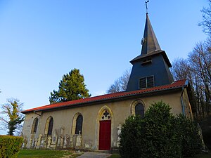
Érize-la-Brûlée
Commune in Grand Est, France
Distance: Approx. 3861 meters
Latitude and longitude: 48.8506,5.2842
Érize-la-Brûlée (French pronunciation: [eʁiz la bʁyle]) is a commune in the Meuse department in Grand Est in north-eastern France. It is located 80 km south-west of Metz and north-west of Nancy. Nearby settlements include Érize-Saint-Dizier, Rumont, Raival, Érize-la-Petite, and Chaumont-sur-Aire.

Érize-Saint-Dizier
Commune in Grand Est, France
Distance: Approx. 5646 meters
Latitude and longitude: 48.8133,5.285
Érize-Saint-Dizier (French pronunciation: [eʁiz sɛ̃ dizje]) is a commune in the Meuse department in Grand Est in north-eastern France.
Les Hauts-de-Chée
Commune in Grand Est, France
Distance: Approx. 5111 meters
Latitude and longitude: 48.8681,5.1675
Les Hauts-de-Chée (French pronunciation: [le o də ʃe]) is a commune in the Meuse department in Grand Est in north-eastern France. The former towns of Génicourt-sous-Condé, Hargeville-sur-Chée, Louppy-sur-Chée (Loppy-le-Petit) and Les Marats (Marat-la-Grande, Marat-la-Petite) were joined to Condé-en-Barrois on 20 June 1972, which subsequently changed its name to Les Hauts-de-Chée on 1 July 1972.

Naives-Rosières
Commune in Grand Est, France
Distance: Approx. 6108 meters
Latitude and longitude: 48.7958,5.2167
Naives-Rosières (French pronunciation: [nɛv ʁozjɛʁ]) is a commune in the Meuse department in Grand Est in north-eastern France.
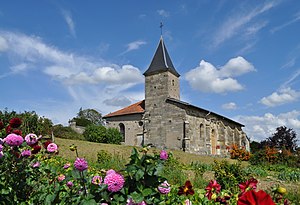
Raival
Commune in Grand Est, France
Distance: Approx. 3628 meters
Latitude and longitude: 48.8714,5.2686
Raival (French pronunciation: [ʁɛval]) is a commune in the Meuse department in Grand Est in north-eastern France. It was created in 1973 by the merger of two former communes: Rosnes and Érize-la-Grande. Vignotte, a mild creamy cheese obtainable in the UK, is produced there.
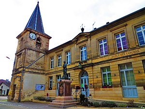
Seigneulles
Commune in Grand Est, France
Distance: Approx. 495 meters
Latitude and longitude: 48.8514,5.2378
Seigneulles (French pronunciation: [sɛɲœl]) is a commune in the Meuse department in Grand Est in north-eastern France.
Vavincourt
Commune in Grand Est, France
Distance: Approx. 3258 meters
Latitude and longitude: 48.8244,5.2094
Vavincourt (French pronunciation: [vavɛ̃kuʁ]) is a commune in the Meuse department in Grand Est in north-eastern France.

Rumont, Meuse
Commune in Grand Est, France
Distance: Approx. 3865 meters
Latitude and longitude: 48.8328,5.2775
Rumont (French pronunciation: [ʁymɔ̃] ) is a commune in the Meuse department in Grand Est in north-eastern France.

Vavincourt Aerodrome
Distance: Approx. 4065 meters
Latitude and longitude: 48.81555556,5.21222222
Vavincourt Aerodrome, was a temporary World War I airfield in France. It was located 0.5 miles (0.80 km) south of Vavincourt, in the Meuse department in north-eastern France.
Belrain Aerodrome
Temporary World War I airfield in France
Distance: Approx. 5353 meters
Latitude and longitude: 48.85277778,5.30444444
Belrain Aerodrome was a temporary World War I airfield in France, initially used by French units, and later by squadrons of the Air Service, United States Army. It was located 0.7 miles (1.1 km) South of Belrain, in the Meuse department in the Lorraine region in northeastern France.
Voie Sacrée wind farm
Distance: Approx. 6045 meters
Latitude and longitude: 48.9,5.2
The Voie Sacrée wind farm is a wind farm located in the Lorraine region of France. It is shared between the cities of Beausite, Raival, Courcelles-sur-aire, Érize-la-petite, and Maurechamp, not far from the Voie Sacrée. The onshore wind farm was proposed and installed in 2007, and today contains 27 Siemens Gamesa G90/2000 wind turbines, each with a hub height of 78 meters and diameter of 90 meters.
Weather in this IP's area
overcast clouds
13 Celsius
13 Celsius
13 Celsius
13 Celsius
1015 hPa
98 %
1015 hPa
984 hPa
1541 meters
4.79 m/s
8.42 m/s
226 degree
100 %
08:05:46
18:41:52