Country:
 France
Region:
City:
Latitude and Longitude:
Time Zone:
Postal Code:
IP information under different IP Channel
ip-api
Country
Region
City
ASN
Time Zone
ISP
Blacklist
Proxy
Latitude
Longitude
Postal
Route
IPinfo
Country
Region
City
ASN
Time Zone
ISP
Blacklist
Proxy
Latitude
Longitude
Postal
Route
MaxMind
Country
Region
City
ASN
Time Zone
ISP
Blacklist
Proxy
Latitude
Longitude
Postal
Route
Luminati
Country
FRRegion
naq
City
bordeaux
ASN
Time Zone
Europe/Paris
ISP
ADISTA SAS
Latitude
Longitude
Postal
db-ip
Country
Region
City
ASN
Time Zone
ISP
Blacklist
Proxy
Latitude
Longitude
Postal
Route
ipdata
Country
Region
City
ASN
Time Zone
ISP
Blacklist
Proxy
Latitude
Longitude
Postal
Route
Popular places and events near this IP address

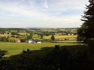
Montceau-les-Mines
Commune in Bourgogne-Franche-Comté, France
Distance: Approx. 1018 meters
Latitude and longitude: 46.6678,4.3697
Montceau-les-Mines (French pronunciation: [mɔ̃so le min]) is a commune in the Saône-et-Loire department in the region of Bourgogne-Franche-Comté in eastern France. It is the second-largest commune of the metropolitan Communauté urbaine Creusot Montceau, which lies southwest of the city of Dijon.

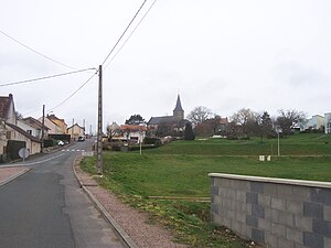
Blanzy
Commune in Bourgogne-Franche-Comté, France
Distance: Approx. 4120 meters
Latitude and longitude: 46.7047,4.3911
Blanzy (French pronunciation: [blɑ̃zi]) is a commune in the Saône-et-Loire department in the region of Bourgogne-Franche-Comté in eastern France.

Gourdon, Saône-et-Loire
Commune in Bourgogne-Franche-Comté, France
Distance: Approx. 7642 meters
Latitude and longitude: 46.6414,4.4481
Gourdon (French pronunciation: [ɡuʁdɔ̃] ) is a commune in the Saône-et-Loire department in the region of Bourgogne-Franche-Comté in eastern France. The Treasure of Gourdon is a hoard of gold objects buried around the year 524 and unearthed in 1845 in the commune, which date to the end of the fifth or the beginning of the sixth century.

Pouilloux
Commune in Bourgogne-Franche-Comté, France
Distance: Approx. 7314 meters
Latitude and longitude: 46.6086,4.3617
Pouilloux (French pronunciation: [puju]) is a commune in the Saône-et-Loire department in the region of Bourgogne-Franche-Comté in eastern France.

Marigny, Saône-et-Loire
Commune in Bourgogne-Franche-Comté, France
Distance: Approx. 7637 meters
Latitude and longitude: 46.6797,4.46
Marigny (French pronunciation: [maʁiɲi]) is a commune in the Saône-et-Loire department in the region of Bourgogne-Franche-Comté in eastern France.
Saint-Berain-sous-Sanvignes
Commune in Bourgogne-Franche-Comté, France
Distance: Approx. 6140 meters
Latitude and longitude: 46.7075,4.2961
Saint-Berain-sous-Sanvignes (French pronunciation: [sɛ̃ beʁɛn su sɑ̃viɲ], literally Saint-Berain under Sanvignes) is a commune in the Saône-et-Loire department in the region of Bourgogne-Franche-Comté in eastern France.
Saint-Romain-sous-Gourdon
Commune in Bourgogne-Franche-Comté, France
Distance: Approx. 6649 meters
Latitude and longitude: 46.6228,4.4044
Saint-Romain-sous-Gourdon (French pronunciation: [sɛ̃ ʁɔmɛ̃ su ɡuʁdɔ̃], literally Saint-Romain under Gourdon) is a commune in the Saône-et-Loire department in the region of Bourgogne-Franche-Comté in eastern France. It is 45 km south west of Chalon-sur-Saône, 25 km due south of Le Creusot and 6 km south east of Montceau-les-Mines.

Saint-Vallier, Saône-et-Loire
Commune in Bourgogne-Franche-Comté, France
Distance: Approx. 3616 meters
Latitude and longitude: 46.6428,4.3719
Saint-Vallier (French pronunciation: [sɛ̃ valje] ) is a commune in the Saône-et-Loire department in the region of Bourgogne-Franche-Comté in eastern France.

Sanvignes-les-Mines
Commune in Bourgogne-Franche-Comté, France
Distance: Approx. 5118 meters
Latitude and longitude: 46.6661,4.2944
Sanvignes-les-Mines (French pronunciation: [sɑ̃viɲ le min]) is a commune in the Saône-et-Loire department in the region of Bourgogne-Franche-Comté in eastern France.
Canton of Blanzy
Distance: Approx. 3650 meters
Latitude and longitude: 46.7,4.39
The canton of Blanzy is an administrative division of the Saône-et-Loire department, eastern France. It was created at the French canton reorganisation which came into effect in March 2015. Its seat is in Blanzy.
Canton of Montceau-les-Mines
Distance: Approx. 479 meters
Latitude and longitude: 46.67,4.36
The canton of Montceau-les-Mines is an administrative division of the Saône-et-Loire department, eastern France. It was created at the French canton reorganisation which came into effect in March 2015. Its seat is in Montceau-les-Mines.
Canton of Saint-Vallier, Saône-et-Loire
Distance: Approx. 3889 meters
Latitude and longitude: 46.64,4.37
The canton of Saint-Vallier is an administrative division of the Saône-et-Loire department, eastern France. It was created at the French canton reorganisation which came into effect in March 2015. Its seat is in Saint-Vallier.
Weather in this IP's area
clear sky
22 Celsius
22 Celsius
22 Celsius
22 Celsius
1011 hPa
46 %
1011 hPa
979 hPa
10000 meters
1.63 m/s
2.85 m/s
252 degree
9 %
07:11:51
20:08:48