Country:
 France
Region:
City:
Latitude and Longitude:
Time Zone:
Postal Code:
IP information under different IP Channel
ip-api
Country
Region
City
ASN
Time Zone
ISP
Blacklist
Proxy
Latitude
Longitude
Postal
Route
IPinfo
Country
Region
City
ASN
Time Zone
ISP
Blacklist
Proxy
Latitude
Longitude
Postal
Route
MaxMind
Country
Region
City
ASN
Time Zone
ISP
Blacklist
Proxy
Latitude
Longitude
Postal
Route
Luminati
Country
FRRegion
idf
City
lacourneuve
ASN
Time Zone
Europe/Paris
ISP
ADISTA SAS
Latitude
Longitude
Postal
db-ip
Country
Region
City
ASN
Time Zone
ISP
Blacklist
Proxy
Latitude
Longitude
Postal
Route
ipdata
Country
Region
City
ASN
Time Zone
ISP
Blacklist
Proxy
Latitude
Longitude
Postal
Route
Popular places and events near this IP address

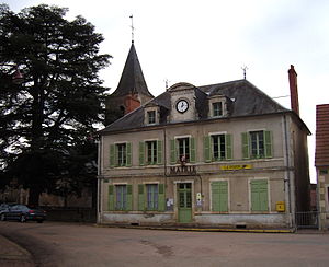
La Charité-sur-Loire
Commune in Bourgogne-Franche-Comté, France
Distance: Approx. 150 meters
Latitude and longitude: 47.1778,3.0197
La Charité-sur-Loire, known simply as La Charité until 1961, is a riverside commune in the western part of the French department of Nièvre. It is located on the departmental border with Cher, which is also the regional border with Centre-Val de Loire.
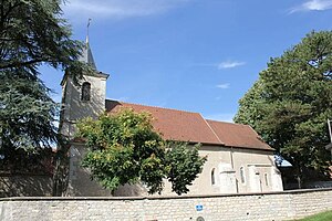
Raveau
Commune in Bourgogne-Franche-Comté, France
Distance: Approx. 4639 meters
Latitude and longitude: 47.1872,3.0775
Raveau (French pronunciation: [ʁavo]) is a commune in the Nièvre department in central France. It is located near La Charité-sur-Loire.
Argenvières
Commune in Centre-Val de Loire, France
Distance: Approx. 4462 meters
Latitude and longitude: 47.1378,3.0064
Argenvières (French pronunciation: [aʁʒɑ̃vjɛʁ]) is a commune in the Cher department in the Centre-Val de Loire region of France.

La Chapelle-Montlinard
Commune in Centre-Val de Loire, France
Distance: Approx. 2225 meters
Latitude and longitude: 47.1725,2.9894
La Chapelle-Montlinard (French pronunciation: [la ʃapɛl mɔ̃linaʁ]) is a commune in the Cher department in the Centre-Val de Loire region of France.

Champvoux
Commune in Bourgogne-Franche-Comté, France
Distance: Approx. 5473 meters
Latitude and longitude: 47.1564,3.0836
Champvoux (French pronunciation: [ʃɑ̃vu]) is a commune in the Nièvre department in central France. On 1 January 2019, the estimated population was 297.
La Marche, Nièvre
Commune in Nièvre, Bourgogne-Franche-Comté, France
Distance: Approx. 4170 meters
Latitude and longitude: 47.1414,3.0347
La Marche (French pronunciation: [la maʁʃ]) is a commune in the Nièvre department in central France. La Marche station has rail connections to Nevers and Cosne-sur-Loire.

Varennes-lès-Narcy
Commune in Bourgogne-Franche-Comté, France
Distance: Approx. 6020 meters
Latitude and longitude: 47.2158,3.0736
Varennes-lès-Narcy (French pronunciation: [vaʁɛn lɛ naʁsi], literally Varennes near Narcy) is a commune in the Nièvre department and Bourgogne-Franche-Comté region of east-central France.
Pépinières Arboretum Adeline
Distance: Approx. 2221 meters
Latitude and longitude: 47.1725,2.98944444
The Pépinières Arboretum Adeline (18 hectares) is a commercial nursery with arboretum located at 33 rue du Pont de la Batte, La Chapelle-Montlinard, Cher, Centre-Val de Loire, France. It is open weekdays without charge. The nursery's arboretum has been recognized by the national collection of the Conservatoire des Collections Végétales Spécialisées (CCVS) for its collections of Ginkgo biloba (28 varieties) and Liquidambar (26 varieties).
Siege of La Charité
1423 battle of the Armagnac–Burgundian Civil War
Distance: Approx. 150 meters
Latitude and longitude: 47.1778,3.0197
The siege of La Charité was incited by the order of Charles VII to Joan of Arc after the warlord Perrinet Gressard seized the town in 1423. La Charité was not only strongly fortified, but fully victualled for a prolonged siege. Joan's forces were known to be poorly equipped with artillery.
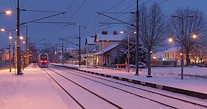
La Charité station
Distance: Approx. 532 meters
Latitude and longitude: 47.17972222,3.02388889
La Charité is a railway station in La Charité-sur-Loire, Bourgogne-Franche-Comté, France. The station is located on the Moret-Lyon railway.
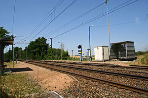
La Marche station
Distance: Approx. 4562 meters
Latitude and longitude: 47.13916667,3.04083333
La Marche is a railway station in La Marche, Bourgogne-Franche-Comté, France. The station is located on the Moret-Lyon railway.
Canton of La Charité-sur-Loire
Distance: Approx. 356 meters
Latitude and longitude: 47.18,3.02
The canton of La Charité-sur-Loire is an administrative division of the Nièvre department, central France. Its borders were modified at the French canton reorganisation which came into effect in March 2015. Its seat is in La Charité-sur-Loire.
Weather in this IP's area
overcast clouds
12 Celsius
12 Celsius
11 Celsius
12 Celsius
1017 hPa
93 %
1017 hPa
996 hPa
10000 meters
2.84 m/s
6.8 m/s
226 degree
100 %
08:12:05
18:53:16