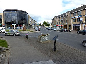
Country:
Region:
City:
Latitude and Longitude:
Time Zone:
Postal Code:
IP information under different IP Channel
ip-api
Country
Region
City
ASN
Time Zone
ISP
Blacklist
Proxy
Latitude
Longitude
Postal
Route
Luminati
Country
ASN
Time Zone
Europe/Dublin
ISP
Digiweb ltd
Latitude
Longitude
Postal
IPinfo
Country
Region
City
ASN
Time Zone
ISP
Blacklist
Proxy
Latitude
Longitude
Postal
Route
db-ip
Country
Region
City
ASN
Time Zone
ISP
Blacklist
Proxy
Latitude
Longitude
Postal
Route
ipdata
Country
Region
City
ASN
Time Zone
ISP
Blacklist
Proxy
Latitude
Longitude
Postal
Route
Popular places and events near this IP address

Institute of Technology, Blanchardstown
Former third-level college, amalgamated into Technological University Dublin
Distance: Approx. 386 meters
Latitude and longitude: 53.405702,-6.378074
Institute of Technology, Blanchardstown (ITB) (Irish: Institiúid Teicneolaíochta Baile Bhlainséir) established in 1999, was a third-level institution, now amalgamated into Technological University Dublin. It was the last-founded Institute of Technology in Ireland. The campus is located within the Business and Technology Park on Blanchardstown Road North, about 15 km from Dublin City and close to the N3 (Navan Road).

National Aquatic Centre
Indoor aquatics facility, Dublin, Ireland
Distance: Approx. 1104 meters
Latitude and longitude: 53.397,-6.37
The National Aquatic Centre (NAC) (Irish: Ionad Náisiúnta Uisce) is an indoor aquatics facility in Blanchardstown, Fingal, Ireland. The State-owned complex houses a 50-metre swimming pool with an associated diving pool, an aquapark and leisure pool, and a fitness centre. Since opening in March 2003, the centre has hosted the swimming events of the 2003 Special Olympics World Summer Games, the 2003 European Short Course Swimming Championships and a number of international water polo events.

Mulhuddart
Outer suburb of Dublin, Ireland
Distance: Approx. 1757 meters
Latitude and longitude: 53.4028,-6.39816
Mulhuddart (Irish: Mullach Eadrad, meaning 'the hill of the milking place') is an outer suburb situated 12 km (7.456 miles) north-west of Dublin, Ireland. The River Tolka passes near the village. Mulhuddart is also a civil parish in the barony of Castleknock in the traditional County Dublin.

Blanchardstown Centre
Large retail facility in Dublin's western suburbs
Distance: Approx. 1885 meters
Latitude and longitude: 53.393,-6.389
The Blanchardstown Centre is one of Ireland's two largest shopping complexes, located in Blanchardstown and Coolmine, western suburbs of Dublin, Ireland. It opened in October 1996 and was extended in 2004 to create extra retail space. It lies in the administrative area of Fingal County Council.

Dublin 15
Postal district of Dublin, Ireland
Distance: Approx. 2231 meters
Latitude and longitude: 53.390803,-6.39281
Dublin 15, also rendered as D15, is a postal district in the suburbs of Dublin in Fingal, Ireland. It is 11 km (6.8 mi) west of the GPO in Dublin city.

Tyrrelstown
Townland and outer suburb of Dublin, Ireland
Distance: Approx. 1625 meters
Latitude and longitude: 53.42,-6.383
Tyrrelstown (Irish: Baile an Tirialaigh) is a townland in Fingal, County Dublin, Ireland, in the civil parish of Mulhuddart. It is located 13 km northwest of the city of Dublin, and is often considered as part of the greater Blanchardstown area. It is the site of a planned suburban development from the early 2000s.
Corduff
Northwestern suburb of Dublin, Ireland
Distance: Approx. 975 meters
Latitude and longitude: 53.398057,-6.371681
Corduff (Irish: An Chorr Dhubh) is a northwestern suburb of Dublin, in Fingal, Ireland, 10 km from Dublin city centre. It is a part of the wider Blanchardstown area and is in the Dublin 15 postal district. As of 2016, the electoral division of Blanchardstown–Corduff had a population of 3,871.

Connolly Hospital
Hospital in Fingal, Ireland
Distance: Approx. 2049 meters
Latitude and longitude: 53.388541,-6.368649
The Connolly Hospital Blanchardstown (Irish: Ospidéal Uí Chonghaile Baile Bhlainséir) is a teaching hospital in Blanchardstown, Dublin, Ireland. It is managed by RCSI Hospitals.
Aquazone (theme park)
Indoor waterpark in County Dublin
Distance: Approx. 1092 meters
Latitude and longitude: 53.3971,-6.3701
Aquazone is an indoor waterpark in Blanchardstown, County Dublin. The waterpark is located in the National Aquatic Centre.

National Sports Campus
Distance: Approx. 1186 meters
Latitude and longitude: 53.3965,-6.368
The National Sports Campus (Irish: An Campas Náisiúnta Spórt)- (sometimes known as Sports Campus Ireland, Sport Ireland Campus or Irish Sport HQ) is a large site in the western suburbs of Dublin, Ireland, which contains a number of sporting facilities. It is operated by the National Sports Campus Development Authority and is home to a number of sports venues, including the National Indoor Arena, National Aquatic Centre, and National Horse Sport Arena. Several national sports governing bodies, including the Gaelic Athletic Association, have sports facilities on the campus.
Waterville, Dublin
Housing development in Dublin, Ireland
Distance: Approx. 1403 meters
Latitude and longitude: 53.3942,-6.3726
Waterville (Irish: An Coireán) is a housing development near Dublin city, within Fingal, Ireland. The development was built between 2002 and 2008 as well as between 2013 and 2016 (Brandon Square and Rossan Court) on the edge of the Abbotstown demense, close to Blanchardstown village. The development lies within the townland of Deanestown in the civil parish of Castleknock.
Mountaineering Ireland
Hillwalking organization
Distance: Approx. 1561 meters
Latitude and longitude: 53.39630621,-6.3569524
Mountaineering Ireland is the representative association for hikers and mountaineers on the island of Ireland. It is recognized by both Sport Ireland, the Irish authority for sport, and Sport Northern Ireland, the corresponding authority of the Government of Northern Ireland, thus operating across the island of Ireland. The association has been an International Climbing and Mountaineering Federation (UIAA) member since 2004, as well as a member of other federations.
Weather in this IP's area
broken clouds
10 Celsius
7 Celsius
9 Celsius
11 Celsius
1016 hPa
87 %
1016 hPa
1006 hPa
10000 meters
6.17 m/s
240 degree
75 %
07:55:11
16:26:09