37.34.77.158 - IP Lookup: Free IP Address Lookup, Postal Code Lookup, IP Location Lookup, IP ASN, Public IP
Country:
Region:
City:
Location:
Time Zone:
Postal Code:
IP information under different IP Channel
ip-api
Country
Region
City
ASN
Time Zone
ISP
Blacklist
Proxy
Latitude
Longitude
Postal
Route
Luminati
Country
Region
25
City
torrazzacoste
ASN
Time Zone
Europe/Rome
ISP
FASTCON srl
Latitude
Longitude
Postal
IPinfo
Country
Region
City
ASN
Time Zone
ISP
Blacklist
Proxy
Latitude
Longitude
Postal
Route
IP2Location
37.34.77.158Country
Region
lombardia
City
voghera
Time Zone
Europe/Rome
ISP
Language
User-Agent
Latitude
Longitude
Postal
db-ip
Country
Region
City
ASN
Time Zone
ISP
Blacklist
Proxy
Latitude
Longitude
Postal
Route
ipdata
Country
Region
City
ASN
Time Zone
ISP
Blacklist
Proxy
Latitude
Longitude
Postal
Route
Popular places and events near this IP address

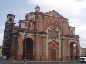
Voghera
Comune in Lombardy, Italy
Distance: Approx. 249 meters
Latitude and longitude: 44.9925,9.00916667
Voghera (Vogherese dialect of Emilian: Vughera; Latin: Forum Iulii Iriensium) is a town and comune in the Province of Pavia in the Italian region Lombardy. The population was 39,374 as of 2017. It is the third most populated town in the province, after Pavia and Vigevano.

Casei Gerola
Comune in Lombardy, Italy
Distance: Approx. 5954 meters
Latitude and longitude: 45,8.93333333
Casei Gerola is a comune (municipality) in the Province of Pavia, Lombardy, Italy. It is located about 60 kilometres (37 mi) southwest of Milan and about 25 kilometres (16 mi) southwest of Pavia. Casei Gerola borders the following municipalities: Castelnuovo Scrivia, Cornale e Bastida, Isola Sant'Antonio, Mezzana Bigli, Molino dei Torti, Pontecurone, Silvano Pietra, Voghera.

Cervesina
Comune in Lombardy, Italy
Distance: Approx. 6189 meters
Latitude and longitude: 45.05,9.01666667
Cervesina is a comune (municipality) in the Province of Pavia in the Italian region Lombardy, located about 45 kilometres (28 mi) south of Milan and about 15 kilometres (9 mi) southwest of Pavia. As of 31 December 2004, it had a population of 1,186 and an area of 12.5 square kilometres (4.8 sq mi). Cervesina borders the following municipalities: Corana, Mezzana Rabattone, Pancarana, Voghera, Zinasco.

Codevilla
Comune in Lombardy, Italy
Distance: Approx. 4513 meters
Latitude and longitude: 44.96666667,9.05
Codevilla is a comune (municipality) in the Province of Pavia in the Italian region Lombardy, located about 60 km south of Milan and about 25 km southwest of Pavia. As of 31 December 2004, it had a population of 955 and an area of 13.0 km². Codevilla borders the following municipalities: Montebello della Battaglia, Retorbido, Torrazza Coste, Voghera.

Pizzale
Comune in Lombardy, Italy
Distance: Approx. 5395 meters
Latitude and longitude: 45.03333333,9.05
Pizzale is a comune (municipality) in the Province of Pavia in the Italian region Lombardy, located about 50 km south of Milan and about 20 km southwest of Pavia. Pizzale borders the following municipalities: Castelletto di Branduzzo, Lungavilla, Pancarana, Voghera.
Retorbido
Comune in Lombardy, Italy
Distance: Approx. 5344 meters
Latitude and longitude: 44.95,9.03333333
Retorbido (Lombard: Al Turbi) is a comune (municipality) in the Province of Pavia in the Italian region Lombardy, located about 60 km south of Milan and about 30 km southwest of Pavia. As of 31 December 2004, it had a population of 1,242 and an area of 11.7 km2. Retorbido borders the following municipalities: Codevilla, Rivanazzano Terme, Rocca Susella, Torrazza Coste, Voghera.
Torrazza Coste
Comune in Lombardy, Italy
Distance: Approx. 4743 meters
Latitude and longitude: 44.98333333,9.06666667
Torrazza Coste is a comune (municipality) in the Province of Pavia in the Italian region Lombardy, located about 50 km (31 mi) south of Milan and about 25 km (16 mi) southwest of Pavia. As of 31 December 2004, it had a population of 1,516 and an area of 16.1 km2 (6 sq mi). Torrazza Coste borders the following municipalities: Borgo Priolo, Codevilla, Montebello della Battaglia, Retorbido, Rocca Susella.
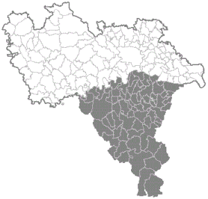
Oltrepò Pavese
Territory of the province of Pavia in Lombardy, Italy
Distance: Approx. 249 meters
Latitude and longitude: 44.9925,9.00916667
The Oltrepò Pavese (Italian: [oltreˈpɔ ppaˈveːze, -eːse]; Western Lombard: Ultrepò Paves; lit. 'Pavia's Beyond-Po') is a historical region making up the southern portion of the province of Pavia, in the northwest Italian region of Lombardy. The area is named after its location south of the River Po as considered from the provincial capital Pavia and in general from the rest of Lombardy.
Voghera railway station
Railway station in Italy
Distance: Approx. 343 meters
Latitude and longitude: 44.99777778,9.00861111
Voghera railway station (Italian: Stazione di Voghera) serves the town and comune of Voghera, in the region of Lombardy, northern Italy. Opened in 1858, it forms part of the Alessandria–Piacenza railway, and is also the terminus of a railway from Milan via Pavia. The station is currently managed by Rete Ferroviaria Italiana (RFI).

Voghera train crash
Train crash in which 64 people died
Distance: Approx. 343 meters
Latitude and longitude: 44.99777778,9.00861111
The Voghera train crash is considered one of the most serious incidents in the history of the Italian railways. It happened at track three of Voghera railway station, on the night of 31 May 1962. Sixty-four people lost their lives, and 40 were seriously injured.

Cowboyland
Amusement park located in Voghera
Distance: Approx. 2923 meters
Latitude and longitude: 44.96863889,9.01316944
Cowboyland is a Western-themed amusement park in a Voghera, Lombardy, in the northern Italy. It's the first and only western-themed park in Italy. After the park's activities started, the city of Voghera got a twin-cityhood with Cheyenne, Wyoming.

Visconti Castle (Voghera)
Distance: Approx. 618 meters
Latitude and longitude: 44.98916667,9.00916667
The Visconti Castle of Voghera is a Medieval castle in Voghera, Lombardy, Northern Italy. It was built in the 14th century by the Visconti, lords and dukes of Milan.
Weather in this IP's area
clear sky
3 Celsius
0 Celsius
3 Celsius
4 Celsius
1030 hPa
75 %
1030 hPa
1012 hPa
10000 meters
2.51 m/s
3.64 m/s
33 degree

