Country:
 Great Britain
Region:
City:
Latitude and Longitude:
Time Zone:
Postal Code:
IP information under different IP Channel
ip-api
Country
Region
City
ASN
Time Zone
ISP
Blacklist
Proxy
Latitude
Longitude
Postal
Route
IPinfo
Country
Region
City
ASN
Time Zone
ISP
Blacklist
Proxy
Latitude
Longitude
Postal
Route
MaxMind
Country
Region
City
ASN
Time Zone
ISP
Blacklist
Proxy
Latitude
Longitude
Postal
Route
Luminati
Country
GBASN
Time Zone
Europe/London
ISP
Daisy Corporate Services Trading Ltd
Latitude
Longitude
Postal
db-ip
Country
Region
City
ASN
Time Zone
ISP
Blacklist
Proxy
Latitude
Longitude
Postal
Route
ipdata
Country
Region
City
ASN
Time Zone
ISP
Blacklist
Proxy
Latitude
Longitude
Postal
Route
Popular places and events near this IP address
Chapeltown, South Yorkshire
Village in South Yorkshire, England
Distance: Approx. 1136 meters
Latitude and longitude: 53.462,-1.466
Chapeltown is an area of Sheffield in South Yorkshire, England. It is the half way point between Barnsley and Sheffield approximately 7 miles from both. It is part of the civil parish of Ecclesfield.

Chapeltown railway station
Railway station in South Yorkshire, England
Distance: Approx. 1099 meters
Latitude and longitude: 53.4623,-1.46625
Chapeltown railway station, originally known as Chapeltown South, is a railway station serves the Sheffield suburb of Chapeltown in South Yorkshire, England. The station is 7.25 miles (12 km) north of Sheffield on the Hallam and Penistone Lines.
High Green
Suburb of Sheffield, South Yorkshire, England
Distance: Approx. 1449 meters
Latitude and longitude: 53.473,-1.494
High Green is a village located about 6 miles from Barnsley, the nearest major town. It is found to the north of Chapeltown and is served by buses; the nearest rail station is in Chapeltown 1 mile away. The suburb falls within the West Ecclesfield ward of the city Council.

Chapeltown Central railway station
Disused railway station in South Yorkshire, England
Distance: Approx. 653 meters
Latitude and longitude: 53.46846,-1.46386
Chapeltown Central railway station was situated on the former South Yorkshire Railway's Blackburn Valley line between Ecclesfield East and Westwood. The station which was also known as Chapeltown and Thorncliffe was intended to serve Chapeltown, South Yorkshire, England, although about 1 mile (1.6 km) from its centre. It also served the works of Newton, Chambers & Company, one of the largest industrial companies in the area.

Westwood railway station
Disused railway station in South Yorkshire, England
Distance: Approx. 1509 meters
Latitude and longitude: 53.48258,-1.48539
Westwood railway station was situated on the South Yorkshire Railway's Blackburn Valley line between Chapeltown Central and Birdwell & Hoyland Common. The station served an area of few houses apart from two rows of miners' cottages known as "Westwood Row". The nearest settlement was at High Green, just over 1.5 miles (2.4 km) away.
Ecclesfield School
Academy in Ecclesfield, Sheffield, England
Distance: Approx. 2053 meters
Latitude and longitude: 53.45343,-1.46607
Ecclesfield School is a coeducational secondary school with academy status situated on Chapeltown Road (A6135) between Chapeltown and Ecclesfield, South Yorkshire in the East Ecclesfield district of Sheffield, England. It is for ages 11–16. It has about 1,750 pupils, making it the largest school in Sheffield.

Wentworth railway station
Disused railway station in South Yorkshire, England
Distance: Approx. 1964 meters
Latitude and longitude: 53.4848,-1.4528
Wentworth railway station was a railway station on the Sheffield to Barnsley route of the Midland Railway. The station has been known as Wentworth and Tankersley and Wentworth and Hoyland Common during its life.

Tankersley, South Yorkshire
Village and civil parish in South Yorkshire, England
Distance: Approx. 2279 meters
Latitude and longitude: 53.49,-1.487
Tankersley is a village and civil parish in the Metropolitan Borough of Barnsley in South Yorkshire, England. At the 2001 census it had a population of 1,414, increasing to 1,671 at the 2011 Census. The village is to the west of junction 36 of the M1 motorway and north of the A61 road.
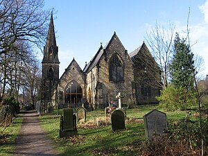
Society of Glass Technology
British glass manufacturing organisation
Distance: Approx. 316 meters
Latitude and longitude: 53.47414,-1.47405
The Society of Glass Technology (SGT) is an organisation for individuals and organizations with a professional interest in glass manufacture and usage. The Society is based in the United Kingdom, with its offices in Sheffield, South Yorkshire, England, but it has a worldwide membership. The objects of the Society "are to encourage and advance the study of the history, art, science, design, manufacture, after treatment, distribution and end use of glass of any and every kind".

Whitley Hall
16th-century mansion in South Yorkshire, England
Distance: Approx. 2520 meters
Latitude and longitude: 53.4496,-1.4819
Whitley Hall is a 16th-century mansion which since 1969 has been converted into a restaurant and then a hotel. It is situated in the northern rural district of the City of Sheffield in South Yorkshire, England. The small hamlet of Whitley lies in the countryside between the suburbs of Grenoside, Chapeltown and Ecclesfield some 7.5 km (4.7 mi) north of the city centre.

Barnes Hall, South Yorkshire
Grade II listed country house in South Yorkshire, England
Distance: Approx. 2138 meters
Latitude and longitude: 53.456664,-1.492763
Barnes Hall is an English country house near Burncross within the City of Sheffield in England. The estate includes the buildings of the adjacent Barnes Hall farm.

Harley, South Yorkshire
Hamlet in South Yorkshire, England
Distance: Approx. 1931 meters
Latitude and longitude: 53.479,-1.446
Harley is a hamlet in the civil parish of Wentworth, in the Rotherham district lying to the north of Rotherham and Sheffield, South Yorkshire, England.
Weather in this IP's area
overcast clouds
17 Celsius
17 Celsius
16 Celsius
18 Celsius
1027 hPa
68 %
1027 hPa
1015 hPa
10000 meters
4.15 m/s
6.97 m/s
49 degree
100 %
06:46:57
19:12:19