37.25.171.8 - IP Lookup: Free IP Address Lookup, Postal Code Lookup, IP Location Lookup, IP ASN, Public IP
Country:
Region:
City:
Location:
Time Zone:
Postal Code:
IP information under different IP Channel
ip-api
Country
Region
City
ASN
Time Zone
ISP
Blacklist
Proxy
Latitude
Longitude
Postal
Route
Luminati
Country
ASN
Time Zone
Europe/Rome
ISP
Vodafone Italia S.p.A.
Latitude
Longitude
Postal
IPinfo
Country
Region
City
ASN
Time Zone
ISP
Blacklist
Proxy
Latitude
Longitude
Postal
Route
IP2Location
37.25.171.8Country
Region
piemonte
City
pombia
Time Zone
Europe/Rome
ISP
Language
User-Agent
Latitude
Longitude
Postal
db-ip
Country
Region
City
ASN
Time Zone
ISP
Blacklist
Proxy
Latitude
Longitude
Postal
Route
ipdata
Country
Region
City
ASN
Time Zone
ISP
Blacklist
Proxy
Latitude
Longitude
Postal
Route
Popular places and events near this IP address

Vizzola Ticino
Comune in Lombardy, Italy
Distance: Approx. 5612 meters
Latitude and longitude: 45.63333333,8.7
Vizzola Ticino is a village and comune of the province of Varese in Lombardy, Italy. It is on the banks of the Ticino River, immediately to the west of Strada Provinciale 52 on the western perimeter of Malpensa Airport. In the late 19th century, the town was the site of one of the largest electrical generating facilities in Europe, powered by a canal run from the Ticino.
Golasecca
Comune in Lombardy, Italy
Distance: Approx. 5385 meters
Latitude and longitude: 45.7,8.65
Golasecca (Varesotto: Vorasecca or Gorasecca) is a town and comune in the province of Varese, Lombardy (Northern Italy).

Borgo Ticino
Comune in Piedmont, Italy
Distance: Approx. 4270 meters
Latitude and longitude: 45.68333333,8.6
Borgo Ticino (Piedmontese: Borgh Tisén, Lombard: Burgh Tisin) is a comune (municipality) in the Province of Novara in the Italian region of Piedmont, located about 100 kilometres (62 mi) northeast of Turin and about 25 kilometres (16 mi) north of Novara. Borgo Ticino borders the following municipalities: Agrate Conturbia, Castelletto sopra Ticino, Comignago, Divignano, Varallo Pombia, and Veruno.

Divignano
Comune in Piedmont, Italy
Distance: Approx. 3025 meters
Latitude and longitude: 45.66666667,8.6
Divignano is a comune (municipality) in the Province of Novara in the Italian region Piedmont, located about 100 kilometres (62 mi) northeast of Turin and about 25 kilometres (16 mi) north of Novara. Divignano borders the following municipalities: Agrate Conturbia, Borgo Ticino, Marano Ticino, Mezzomerico, Pombia, and Varallo Pombia.

Marano Ticino
Comune in Piedmont, Italy
Distance: Approx. 2189 meters
Latitude and longitude: 45.63333333,8.63333333
Marano Ticino is a comune (municipality) in the Province of Novara in the Italian region Piedmont, located about 100 kilometres (62 mi) northeast of Turin and about 20 kilometres (12 mi) north of Novara. Marano Ticino borders the following municipalities: Divignano, Mezzomerico, Oleggio, Pombia, and Vizzola Ticino.

Mezzomerico
Comune in Piedmont, Italy
Distance: Approx. 4817 meters
Latitude and longitude: 45.61666667,8.6
Mezzomerico is a comune (municipality) in the Province of Novara in the Italian region Piedmont, located about 90 kilometres (56 mi) northeast of Turin and about 20 kilometres (12 mi) north of Novara. Mezzomerico borders the following municipalities: Agrate Conturbia, Divignano, Marano Ticino, Oleggio, Suno, and Vaprio d'Agogna. The name of the town shows its origins as Celtic Mediomatrici settlement; the name was attested as Mediomadrigo in 980.
Oleggio
Comune in Piedmont, Italy
Distance: Approx. 5900 meters
Latitude and longitude: 45.6,8.63333333
Oleggio is a comune (municipality) in the Province of Novara in the Italian region Piedmont, located about 90 kilometres (56 mi) northeast of Turin and about 15 kilometres (9 mi) north of Novara. As of 31 December 2004, it had a population of 12,490 and an area of 37.8 square kilometres (14.6 sq mi). Among its churches is the 10th-century, Romanesque-style San Michele.

Pombia
Comune in Piedmont, Italy
Distance: Approx. 335 meters
Latitude and longitude: 45.65,8.63333333
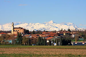
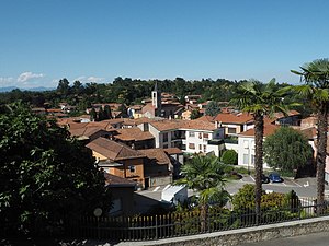
Pombia is a comune (municipality) in the Province of Novara in the Italian region Piedmont, located about 100 kilometres (62 mi) northeast of Turin and about 20 kilometres (12 mi) north of Novara. The commune is known for its Safari Park, established in 1976.

Varallo Pombia
Comune in Piedmont, Italy
Distance: Approx. 1522 meters
Latitude and longitude: 45.66666667,8.63333333
Varallo Pombia is a comune (municipality) in the Province of Novara in the Italian region Piedmont (Piemonte), located about 100 kilometres (62 mi) northeast of Turin and about 25 kilometres (16 mi) north of Novara. As of 31 December 2004, it had a population of 4,598 and an area of 13.6 square kilometres (5.3 sq mi). Varallo Pombia borders the following municipalities: Borgo Ticino, Castelletto sopra Ticino, Divignano, Pombia, and Somma Lombardo.

Canale Villoresi
Canal in Lombardy, Italy
Distance: Approx. 2989 meters
Latitude and longitude: 45.66666667,8.66666667
Canale Villoresi is a canal in Italy; it was the brainchild of Lombardy engineer Eugenio Villoresi. It originates from the River Ticino near the village of Somma Lombardo, and runs eastwards for 86 kilometres (53 mi) to the Adda River. Construction began in 1877, but Villoresi himself died two years later.

Battle of Tornavento
Distance: Approx. 5900 meters
Latitude and longitude: 45.6,8.6333
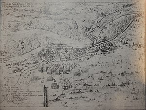
The Battle of Tornavento was fought in Northwest Italy on June 22, 1636 during the Thirty Years' War.
Pombia Safari Park
Attraction in Northern Italy
Distance: Approx. 335 meters
Latitude and longitude: 45.65,8.6333
Pombia Safari Park is a safari park, zoo and amusement park in Pombia, Piedmont, northern Italy, created by Angelo Lombardi in 1976; extending over an area of 400,000 square metres. After the gradual decline of the old structure, acquired by Orfeo Triberti, owner since 1999, the park has undergone a remarkable recovery and expansion in the years ahead, it is presented as a reality more functional, consisting of two distinct areas: the entertainment area and the Safari Park. The Safari Park also has signed a collaboration in agreement with the Faculty of Veterinary Medicine of University of Turin on research projects that relate to the pathology and the welfare of farm animals and the conservation of species at risk of extinction.
Weather in this IP's area
clear sky
11 Celsius
9 Celsius
10 Celsius
12 Celsius
1015 hPa
23 %
1015 hPa
984 hPa
10000 meters
11.83 m/s
20 degree
