Country:
Region:
City:
Latitude and Longitude:
Time Zone:
Postal Code:
IP information under different IP Channel
ip-api
Country
Region
City
ASN
Time Zone
ISP
Blacklist
Proxy
Latitude
Longitude
Postal
Route
Luminati
Country
ASN
Time Zone
Europe/Rome
ISP
Vodafone Italia S.p.A.
Latitude
Longitude
Postal
IPinfo
Country
Region
City
ASN
Time Zone
ISP
Blacklist
Proxy
Latitude
Longitude
Postal
Route
db-ip
Country
Region
City
ASN
Time Zone
ISP
Blacklist
Proxy
Latitude
Longitude
Postal
Route
ipdata
Country
Region
City
ASN
Time Zone
ISP
Blacklist
Proxy
Latitude
Longitude
Postal
Route
Popular places and events near this IP address
Institute of Technology, Tallaght
Former third-level college in Ireland, amalgamated into Technological University Dublin
Distance: Approx. 557 meters
Latitude and longitude: 53.290523,-6.363564
The Institute of Technology Tallaght (also known as ITT or IT Tallaght) (Irish: Institiúid Teicneolaíochta, Tamhlacht) was a third-level institution in Tallaght, the largest suburb of Dublin, Ireland. Established in 1992, IT Tallaght offered degree and postgraduate courses as well as adult education courses. On 1 January 2019 it was dissolved and its operations merged into the new Technological University Dublin (TUD).

Tallaght
County town of South Dublin, and largest suburb of Dublin, Ireland
Distance: Approx. 102 meters
Latitude and longitude: 53.2886,-6.3572
Tallaght ( TAL-ə; Irish: Tamhlacht, IPA: [ˈt̪ˠəul̪ˠəxt̪ˠ]) is the largest settlement, and county town, of South Dublin, Ireland, and the largest satellite town of Dublin. The central village area was the site of a monastic settlement from at least the 8th century, which became one of medieval Ireland's more important monastic centres. Up to the 1960s, Tallaght was a small village in the old County Dublin, linked to several nearby rural areas which were part of the large civil parish of the same name—the local council estimates the population then to be 2,500.
River Dodder
River in Dublin in Ireland
Distance: Approx. 1218 meters
Latitude and longitude: 53.27805556,-6.35222222
The River Dodder (Irish: An Dothra) is one of the three main rivers in Dublin, Ireland, the others being the Liffey, of which the Dodder is the largest tributary, and the Tolka.

The Square Tallaght
Large suburban retail facility in Tallaght southwest of Dublin
Distance: Approx. 1082 meters
Latitude and longitude: 53.28694444,-6.37166667
The Square Tallaght is a shopping centre located in Tallaght, Dublin, Ireland, opened in 1990. It is located 10 minutes from junction 11 of the M50 motorway on the Belgard Road (the R113 road) and the N81 road. The centre comprises 53,000 m2 of retail space, spread across three levels, and as of 2016 has up to 163 stores.

Glenview, Tallaght
Estate in Tallaght in Dublin, Ireland
Distance: Approx. 784 meters
Latitude and longitude: 53.288753,-6.34393
Glenview (Irish: Radharc an Ghleanna) is a series of small estates in Tallaght, South Dublin. Glenview is home to a population of almost 1,700 (Census 2002). The Estates include the larger Glenview Park, which includes a small shopping center (See below).

Oldbawn
Suburban area within Tallaght, Dublin, Ireland
Distance: Approx. 950 meters
Latitude and longitude: 53.28333333,-6.36666667
Oldbawn (or Old Bawn, Irish: An Seanbhábhún) is a small suburban area now within Tallaght on Dublin's southside. Formerly a small village in its own right, it is situated between Sean Walsh Park and the River Dodder. A bawn is the defensive wall surrounding an Irish tower house.

The Priory Institute
Irish university
Distance: Approx. 299 meters
Latitude and longitude: 53.2889,-6.3602
The Priory Institute, is part of the St. Mary's Dominican Priory on the grounds of the old Tallaght Castle, Dublin 24, Ireland and provides, certificate, diploma, and degree programmes in theology and philosophy.

Tallaght Castle
Former castle founded in the 14th century in Tallaght, Ireland
Distance: Approx. 342 meters
Latitude and longitude: 53.2892,-6.3608
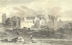
Tallaght Castle (also known as Tallaght House and formerly known as the Archiepiscopal Palace) was a castle in Kilnamanagh, Tallaght, County Dublin, Ireland. It dates from the 14th century. It became an official residence of the Church of Ireland Archbishop of Dublin until 1822.
Commission for Regulation of Utilities
Republic of Ireland's energy and water economic utility regulator
Distance: Approx. 1252 meters
Latitude and longitude: 53.289538,-6.374483
The Commission for Regulation of Utilities (CRU, Irish: An Coimisiúin um Rialáil Fóntais), formerly known as the Commission for Energy Regulation (CER, Irish: An Coimisiún um Rialáil Fuinnimh), is Ireland's energy and water economic utility regulator.

County Hall, Tallaght
Municipal building in South Dublin, Ireland
Distance: Approx. 1171 meters
Latitude and longitude: 53.2889,-6.3733
County Hall (Irish: Halla an Chontae, Tamhlacht) is a municipal building in Tallaght in the county of South Dublin, Ireland.

Tallaght Luas stop
Tram stop in Dublin, Ireland
Distance: Approx. 1270 meters
Latitude and longitude: 53.28748243,-6.37466749
Tallaght (; Irish: Tamhlacht) is a stop on the Luas light-rail tram system in Dublin, Ireland. It opened in 2004 as the terminus of the Red Line.
Civic Theatre (Tallaght)
Theatre in Tallaght, Ireland
Distance: Approx. 1098 meters
Latitude and longitude: 53.2884,-6.3722
Dublin's Civic Theatre opened in March 1999, a project of South Dublin County Council and also grant aided by the Department of Arts, Heritage, Gaeltacht and the Islands. It is situated in Tallaght, Dublin as part of the town centre, close to The Square Shopping Centre. The theatre has two performance spaces, the main auditorium and the Loose End studio.
Weather in this IP's area
broken clouds
10 Celsius
10 Celsius
9 Celsius
12 Celsius
1022 hPa
84 %
1022 hPa
1011 hPa
10000 meters
1.54 m/s
75 %
07:30:11
16:47:46
