37.200.79.162 - IP Lookup: Free IP Address Lookup, Postal Code Lookup, IP Location Lookup, IP ASN, Public IP
Country:
Region:
City:
Location:
Time Zone:
Postal Code:
ISP:
ASN:
language:
User-Agent:
Proxy IP:
Blacklist:
IP information under different IP Channel
ip-api
Country
Region
City
ASN
Time Zone
ISP
Blacklist
Proxy
Latitude
Longitude
Postal
Route
db-ip
Country
Region
City
ASN
Time Zone
ISP
Blacklist
Proxy
Latitude
Longitude
Postal
Route
IPinfo
Country
Region
City
ASN
Time Zone
ISP
Blacklist
Proxy
Latitude
Longitude
Postal
Route
IP2Location
37.200.79.162Country
Region
primorskiy kray
City
dunay
Time Zone
Asia/Vladivostok
ISP
Language
User-Agent
Latitude
Longitude
Postal
ipdata
Country
Region
City
ASN
Time Zone
ISP
Blacklist
Proxy
Latitude
Longitude
Postal
Route
Popular places and events near this IP address

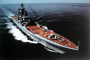
Russian battlecruiser Admiral Lazarev
Kirov-class battlecruiser
Distance: Approx. 8643 meters
Latitude and longitude: 42.929623,132.419354
Admiral Lazarev (Russian: Адмирал Лазарев) was the second Kirov-class battlecruiser. Until 1992 she was named Frunze (Russian: Фрунзе) after a Project 68 cruiser (named after Bolshevik leader Mikhail Frunze); at that time she was renamed after Russian rear admiral Mikhail Petrovich Lazarev. Scrapping of the ship began in April 2021.

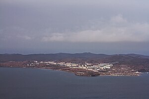
Dunay, Primorsky Krai
Urban-type settlement in Primorsky Krai, Russia
Distance: Approx. 2 meters
Latitude and longitude: 42.88027778,132.3375
Dunay (Russian: Дунай, IPA: [dʊˈnaj]) is an urban locality (an urban-type settlement) under the administrative jurisdiction of the closed town of Fokino, Primorsky Krai, Russia, located on the coast of the Gulf of Peter the Great. The population of 7,581 (2010 Census); 8,599 (2002 Census) once serviced a Soviet submarine base at the seaport here.

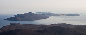
Putyatin Island
Island in Primorsky Krai, Russia
Distance: Approx. 8311 meters
Latitude and longitude: 42.83333333,132.41666667
Putyatin Island (Russian: Остров Путятина) is an island in Strelok Bay (east part of Peter the Great Gulf), near 50 kilometres (31 mi) east of Vladivostok and 35 kilometres (22 mi) west of Nakhodka. The island is named after Admiral Yevfimy Putyatin and is under the Fokino city administration. The area of the island is 27.9 square kilometres (10.8 sq mi); the highest point is Startsev Mount, with an elevation of 353 metres (1,158 ft).
Putyatin (urban-type settlement)
Distance: Approx. 6494 meters
Latitude and longitude: 42.86388889,132.41388889
Putyatin (Russian: Путятин) is an urban locality (an urban-type settlement) under the administrative jurisdiction of the closed town of Fokino in Primorsky Krai, Russia.
Port Vera
Distance: Approx. 9309 meters
Latitude and longitude: 42.9575,132.29361111
Port Vera is a coal terminal in Russia's Far East. It is located across the bay from Vladivostok. It cost more than $1 billion in Rubles to build.
Weather in this IP's area
scattered clouds
-2 Celsius
-8 Celsius
-2 Celsius
-2 Celsius
1012 hPa
65 %
1012 hPa
1007 hPa
10000 meters
5.47 m/s
8.59 m/s
48 degree
29 %