Country:
Region:
City:
Latitude and Longitude:
Time Zone:
Postal Code:
IP information under different IP Channel
ip-api
Country
Region
City
ASN
Time Zone
ISP
Blacklist
Proxy
Latitude
Longitude
Postal
Route
Luminati
Country
Region
08
City
skwierzyna
ASN
Time Zone
Europe/Warsaw
ISP
Komputerowe Studio Grafiki, Wojciech Lis
Latitude
Longitude
Postal
IPinfo
Country
Region
City
ASN
Time Zone
ISP
Blacklist
Proxy
Latitude
Longitude
Postal
Route
db-ip
Country
Region
City
ASN
Time Zone
ISP
Blacklist
Proxy
Latitude
Longitude
Postal
Route
ipdata
Country
Region
City
ASN
Time Zone
ISP
Blacklist
Proxy
Latitude
Longitude
Postal
Route
Popular places and events near this IP address

Obra (river)
River in Poland
Distance: Approx. 2272 meters
Latitude and longitude: 52.6024,15.4789
Obra is a river in west Poland, a left tributary of the Warta river (in Skwierzyna), with a length of 171 kilometres and a basin area of 2,760 km2. The river is popular with canoe and kayak enthusiasts and an established canoe trail exists.

Kreis Schwerin an der Warthe
Distance: Approx. 641 meters
Latitude and longitude: 52.592597,15.5
Kreis Schwerin an der Warthe (Polish: Powiat skwierzyński) was a district in Prussia, first in the southern administrative Region of Posen within the Prussian Province of Posen (until 1920), then within the Province of the Frontier March of Posen-West Prussia (until 1 October 1938) and at last as part of the administrative Region of Frankfurt within the Province of Brandenburg (until 1945). It presently lies in the western part of Polish region of Lubusz Voivodeship.

Skwierzyna
Place in Lubusz Voivodeship, Poland
Distance: Approx. 942 meters
Latitude and longitude: 52.6,15.5
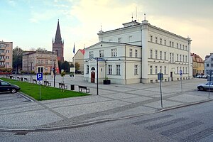
Skwierzyna [skfʲɛˈʐɨna] (German: Schwerin an der Warthe) is a town in Lubusz Voivodeship in western Poland, serving as the administrative seat of the Gmina Skwierzyna. As of 31 December 2023, it had a population of 9,078 inhabitants. It is located at the confluence of the Obra and Warta rivers, about 18 km (11 mi) north of Międzyrzecz and 23 km (14 mi) south-east of the regional capital Gorzów Wielkopolski.
Gmina Skwierzyna
Gmina in Lubusz Voivodeship, Poland
Distance: Approx. 942 meters
Latitude and longitude: 52.6,15.5
Gmina Skwierzyna is an urban-rural gmina (administrative district) in Międzyrzecz County, Lubusz Voivodeship, in western Poland. Its seat is the town of Skwierzyna, which lies approximately 19 kilometres (12 mi) north of Międzyrzecz and 26 km (16 mi) south-east of Gorzów Wielkopolski. The gmina covers an area of 284.81 square kilometres (110.0 sq mi), and as of 2019 its total population is 12,178.
Katarzynki, Lubusz Voivodeship
Settlement in Lubusz Voivodeship, Poland
Distance: Approx. 6713 meters
Latitude and longitude: 52.54166667,15.45916667
Katarzynki [kataˈʐɨnki] is a settlement in the administrative district of Gmina Bledzew, within Międzyrzecz County, Lubusz Voivodeship, in western Poland. It lies approximately 5 kilometres (3 mi) north-east of Bledzew, 14 km (9 mi) north-west of Międzyrzecz, 26 km (16 mi) south-east of Gorzów Wielkopolski, and 67 km (42 mi) north of Zielona Góra.
Chełmsko, Lubusz Voivodeship
Village in Lubusz Voivodeship, Poland
Distance: Approx. 4079 meters
Latitude and longitude: 52.56666667,15.55
Chełmsko [ˈxɛu̯mskɔ] is a village in the administrative district of Gmina Przytoczna, within Międzyrzecz County, Lubusz Voivodeship, in western Poland. It lies approximately 8 kilometres (5 mi) west of Przytoczna, 14 km (9 mi) north of Międzyrzecz, and 28 km (17 mi) south-east of Gorzów Wielkopolski.
Żabno, Lubusz Voivodeship
Settlement in Lubusz Voivodeship, Poland
Distance: Approx. 5232 meters
Latitude and longitude: 52.55777778,15.55916667
Żabno [ˈʐabnɔ] is a settlement in the administrative district of Gmina Przytoczna, within Międzyrzecz County, Lubusz Voivodeship, in western Poland.
Kijewice, Lubusz Voivodeship
Village in Lubusz Voivodeship, Poland
Distance: Approx. 5737 meters
Latitude and longitude: 52.61666667,15.43333333
Kijewice [kijɛˈvit͡sɛ] is a village in the administrative district of Gmina Skwierzyna, within Międzyrzecz County, Lubusz Voivodeship, in western Poland. It lies approximately 5 kilometres (3 mi) west of Skwierzyna, 22 km (14 mi) north-west of Międzyrzecz, and 18 km (11 mi) south-east of Gorzów Wielkopolski.

Murzynowo, Lubusz Voivodeship
Village in Lubusz Voivodeship, Poland
Distance: Approx. 5961 meters
Latitude and longitude: 52.63333333,15.45
Murzynowo [muʐɨˈnɔvɔ] is a village in the administrative district of Gmina Skwierzyna, within Międzyrzecz County, Lubusz Voivodeship, in western Poland. It lies approximately 6 kilometres (4 mi) north-west of Skwierzyna, 23 km (14 mi) north-west of Międzyrzecz, and 18 km (11 mi) south-east of Gorzów Wielkopolski.
Rakowo, Lubusz Voivodeship
Village in Lubusz Voivodeship, Poland
Distance: Approx. 4827 meters
Latitude and longitude: 52.61027778,15.44333333
Rakowo [raˈkɔvɔ] is a village in the administrative district of Gmina Skwierzyna, within Międzyrzecz County, Lubusz Voivodeship, in western Poland.
Świniary, Międzyrzecz County
Village in Lubusz Voivodeship, Poland
Distance: Approx. 5620 meters
Latitude and longitude: 52.61666667,15.58333333
Świniary [ɕfiˈɲarɨ] is a village in the administrative district of Gmina Skwierzyna, within Międzyrzecz County, Lubusz Voivodeship, in western Poland. It lies approximately 6 kilometres (4 mi) east of Skwierzyna, 19 km (12 mi) north of Międzyrzecz, and 26 km (16 mi) south-east of Gorzów Wielkopolski.

Jewish cemetery in Skwierzyna
Jewish cemetery in Poland
Distance: Approx. 165 meters
Latitude and longitude: 52.59222222,15.50944444
Jewish cemetery in Skwierzyna is one of the largest Jewish cemeteries in Lubusz Voivodeship. The cemetery covers an area of about 2.23 ha. In 2002 there were 247 tombstones (massebot).
Weather in this IP's area
light snow
-0 Celsius
-4 Celsius
-0 Celsius
-0 Celsius
1003 hPa
82 %
1003 hPa
998 hPa
10000 meters
3.6 m/s
8.92 m/s
169 degree
100 %
07:27:44
15:59:25