Country:
 Poland
Region:
City:
Latitude and Longitude:
Time Zone:
Postal Code:
IP information under different IP Channel
ip-api
Country
Region
City
ASN
Time Zone
ISP
Blacklist
Proxy
Latitude
Longitude
Postal
Route
IPinfo
Country
Region
City
ASN
Time Zone
ISP
Blacklist
Proxy
Latitude
Longitude
Postal
Route
MaxMind
Country
Region
City
ASN
Time Zone
ISP
Blacklist
Proxy
Latitude
Longitude
Postal
Route
Luminati
Country
PLRegion
14
City
sochaczew
ASN
Time Zone
Europe/Warsaw
ISP
INTERKAM sp. z o.o.
Latitude
Longitude
Postal
db-ip
Country
Region
City
ASN
Time Zone
ISP
Blacklist
Proxy
Latitude
Longitude
Postal
Route
ipdata
Country
Region
City
ASN
Time Zone
ISP
Blacklist
Proxy
Latitude
Longitude
Postal
Route
Popular places and events near this IP address
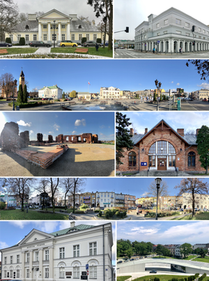
Sochaczew
Place in Masovian Voivodeship, Poland
Distance: Approx. 1269 meters
Latitude and longitude: 52.23333333,20.23333333
Sochaczew (Polish pronunciation: [sɔˈxat͡ʂɛf] ) is a town in central Poland, with 33,456 inhabitants (as of 2023). In the Masovian Voivodeship (since 1999), formerly in Skierniewice Voivodeship (1975–1998). It is the capital of Sochaczew County.

Sochaczew County
County in Masovian Voivodeship, Poland
Distance: Approx. 929 meters
Latitude and longitude: 52.22916667,20.23861111
Sochaczew County (Polish: powiat sochaczewski) is a unit of territorial administration and local government (powiat) in Masovian Voivodeship, east-central Poland. It came into being on January 1, 1999, as a result of the Polish local government reforms passed in 1998. Its administrative seat and only town is Sochaczew, which lies 52 kilometres (32 mi) west of Warsaw.
Gmina Sochaczew
Gmina in Masovian Voivodeship, Poland
Distance: Approx. 929 meters
Latitude and longitude: 52.22916667,20.23861111
Gmina Sochaczew is a rural gmina (administrative district) in Sochaczew County, Masovian Voivodeship, in east-central Poland. Its seat is the town of Sochaczew, although the town is not part of the territory of the gmina. The gmina covers an area of 91.41 square kilometres (35.3 sq mi), and as of 2006 its total population is 8,764.
Aleksandrów, Gmina Rybno
Village in Masovian Voivodeship, Poland
Distance: Approx. 1269 meters
Latitude and longitude: 52.23333333,20.23333333
Aleksandrów [alɛkˈsandruf] is a village in the administrative district of Gmina Rybno, within Sochaczew County, Masovian Voivodeship, in east-central Poland. It lies close to the town of Sochaczew, approximately 53 km (33 mi) west of Warsaw.

Czyste, Masovian Voivodeship
Village in Masovian Voivodeship, Poland
Distance: Approx. 2979 meters
Latitude and longitude: 52.21111111,20.28
Czyste [ˈt͡ʂɨstɛ] is a village in the administrative district of Gmina Sochaczew, within Sochaczew County, Masovian Voivodeship, in east-central Poland.
Gawłów, Masovian Voivodeship
Village in Masovian Voivodeship, Poland
Distance: Approx. 2992 meters
Latitude and longitude: 52.25833333,20.25416667
Gawłów [ˈɡavwuf] is a village in the administrative district of Gmina Sochaczew, within Sochaczew County, Masovian Voivodeship, in east-central Poland. It lies approximately 3 kilometres (2 mi) north of Sochaczew and 50 km (30 mi) west of Warsaw. Ambroży Mikołaj Skarżyński a Polish General who commanded a Napoleon's Imperial Guard squadron (Polish 1st Light Cavalry Regiment of the Imperial Guard) was born in the village.
Karwowo, Masovian Voivodeship
Village in Masovian Voivodeship, Poland
Distance: Approx. 1079 meters
Latitude and longitude: 52.23694444,20.23861111
Karwowo [karˈvɔvɔ] is a village in the administrative district of Gmina Sochaczew, within Sochaczew County, Masovian Voivodeship, in east-central Poland. It lies approximately 1 kilometre (1 mi) north of Sochaczew and 52 km (32 mi) west of Warsaw.
Rozlazłów
Village in Masovian Voivodeship, Poland
Distance: Approx. 2746 meters
Latitude and longitude: 52.24305556,20.21611111
Rozlazłów [rɔˈzlazwuf] is a village in the administrative district of Gmina Sochaczew, within Sochaczew County, Masovian Voivodeship, in east-central Poland.
Sochaczew-Wieś
Village in Masovian Voivodeship, Poland
Distance: Approx. 2158 meters
Latitude and longitude: 52.22638889,20.28222222
Sochaczew-Wieś (Polish pronunciation: [sɔˈxat͡ʂɛv ˈvjɛɕ]) is a village in the administrative district of Gmina Sochaczew, within Sochaczew County, Masovian Voivodeship, in east-central Poland.
Wójtówka, Masovian Voivodeship
Village in Masovian Voivodeship, Poland
Distance: Approx. 2937 meters
Latitude and longitude: 52.22472222,20.29333333
Wójtówka [vui̯ˈtufka] is a village in the administrative district of Gmina Sochaczew, within Sochaczew County, Masovian Voivodeship, in east-central Poland. It lies approximately 4 kilometres (2 mi) east of Sochaczew and 49 km (30 mi) west of Warsaw.
Żuków, Sochaczew County
Village in Masovian Voivodeship, Poland
Distance: Approx. 2063 meters
Latitude and longitude: 52.25,20.25
Żuków [ˈʐukuf] is a village in the administrative district of Gmina Sochaczew, within Sochaczew County, Masovian Voivodeship, in east-central Poland. It lies approximately 3 kilometres (2 mi) north of Sochaczew and 52 km (32 mi) west of Warsaw.

Narrow Gauge Railway Museum in Sochaczew
Polish museum
Distance: Approx. 1871 meters
Latitude and longitude: 52.21722222,20.23722222
Narrow Gauge Railway Museum in Sochaczew (Polish: Muzeum Kolei Wąskotorowej w Sochaczewie) is a 750 mm (2 ft 5+1⁄2 in)-gauge heritage railway based at Sochaczew in Poland, about 50 kilometres (31 mi) west of Warsaw. The museum's headquarters are that of the former Sochaczew County Narrow Gauge Railway (Polish: Sochaczewska Kolej Powiatowa). It has a fleet of historic 750mm-gauge steam, diesel and electric locomotives, goods wagons, passenger cars and draisines.
Weather in this IP's area
scattered clouds
29 Celsius
27 Celsius
27 Celsius
30 Celsius
1016 hPa
19 %
1016 hPa
1007 hPa
10000 meters
7.82 m/s
9.07 m/s
130 degree
36 %
06:02:27
19:11:06