37.111.248.168 - IP Lookup: Free IP Address Lookup, Postal Code Lookup, IP Location Lookup, IP ASN, Public IP
Country:
Region:
City:
Location:
Time Zone:
Postal Code:
ISP:
ASN:
language:
User-Agent:
Proxy IP:
Blacklist:
IP information under different IP Channel
ip-api
Country
Region
City
ASN
Time Zone
ISP
Blacklist
Proxy
Latitude
Longitude
Postal
Route
db-ip
Country
Region
City
ASN
Time Zone
ISP
Blacklist
Proxy
Latitude
Longitude
Postal
Route
IPinfo
Country
Region
City
ASN
Time Zone
ISP
Blacklist
Proxy
Latitude
Longitude
Postal
Route
IP2Location
37.111.248.168Country
Region
dhaka
City
tangail
Time Zone
Asia/Dhaka
ISP
Language
User-Agent
Latitude
Longitude
Postal
ipdata
Country
Region
City
ASN
Time Zone
ISP
Blacklist
Proxy
Latitude
Longitude
Postal
Route
Popular places and events near this IP address
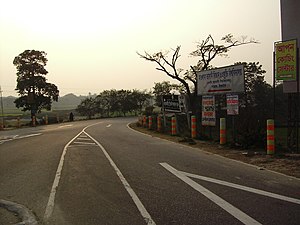
Tangail
City and district headquarter in Tangail District
Distance: Approx. 1612 meters
Latitude and longitude: 24.264423,89.91814
Tangail (Bengali: টাঙ্গাইল, [ʈaŋgail]) is a city of Tangail District in central Bangladesh. A significant city in Bangladesh, Tangail lies on the bank of the Louhajang River, 83 kilometres (52 mi) northwest of Dhaka, the nation's capital. It is the 25th most populous city in Bangladesh.

Tangail Sadar Upazila
Upazila in Dhaka, Bangladesh
Distance: Approx. 1388 meters
Latitude and longitude: 24.257307,89.927783
Tangail Sadar (Bengali: টাঙ্গাইল সদর) is an upazila of Tangail District in the Division of Dhaka, Bangladesh.
Mawlana Bhashani Science and Technology University
Public university in Bangladesh
Distance: Approx. 3017 meters
Latitude and longitude: 24.2352,89.8918
Mawlana Bhashani Science and Technology University (MBSTU) (Bengali: মাওলানা ভাসানী বিজ্ঞান ও প্রযুক্তি বিশ্ববিদ্যালয়) is the 12th oldest public university, and second science and technology specialized PhD granting public university, in Bangladesh. It is named after the political leader Mawlana Abdul Hamid Khan Bhashani. The medium of instruction is English.
Bindu Basini Govt. Boys' High School
Public boys' high school in Tangail, Bangladesh
Distance: Approx. 336 meters
Latitude and longitude: 24.25068,89.913479
Bindu Basini Government Boys' High School is a secondary school in Tangail, Bangladesh. It was established in 1880. The school was patronized and endowed by Bindubasini Chowdhurany.
Kumudini College
Women's College in Tangail, Bangladesh
Distance: Approx. 1110 meters
Latitude and longitude: 24.2575,89.9239
Kumudini Government College (Bengali: কুমুদিনী সরকারী কলেজ), also called Kumudini Mohila College, located in Tangail, is a women's college affiliated with Bangladesh National University. The college was established in 1943 by Ranada Prasad Saha, a businessman and philanthropist, became affiliated with the University of Calcutta in 1944, and was nationalized in 1979. Until 1959 when Muminunnisa Mohila College was established in Mymensingh, it was the only women's college in East Pakistan.
Tangail Stadium
Distance: Approx. 558 meters
Latitude and longitude: 24.25315556,89.91242778
Tangail Stadium also called Tangail Zila Stadium (Bengali: টাঙ্গাইল স্টেডিয়াম) is located at Club Road, north side of Bhashani Hall and Tangail Eid-gah, 200 metres away and west side of Shaheed Sriti Poura Uddan in the district of Tangail, Bangladesh. It is a multipurpose stadium. Football, Cricket, concerts and cultural programs take place here.
Tangail Government Polytechnic Institute
Distance: Approx. 2861 meters
Latitude and longitude: 24.2754,89.921
Tangail Polytechnic Institute (Bengali: টাংগাইল পলিটেকনিক ইন্সটিটিউট) or (TPI) is a polytechnic institute in Tangail, Bangladesh established in 1991.
Tangail Airport
Airport in Bangladesh
Distance: Approx. 2432 meters
Latitude and longitude: 24.22972222,89.90777778
Tangail Airport is an airstrip in Tangail, in central Bangladesh. The airport was built in 1967 to serve Tangail District and other nearby districts, mainly for agricultural purposes. Several cargo airbuses were used in the 1970s to spread pesticides in the local paddy fields.
Govt. Sheikh Fazilatunnesa Mujib Mohila College
Distance: Approx. 439 meters
Latitude and longitude: 24.25325447,89.91425246
Govt. Sheikh Fazilatunnesa Mujib Mohila College (Bengali: সরকারী শেখ ফজিলাতুন নেসা মুজিব মহিলা মহাবিদ্যালয়), also called Govt. Sheikh Fazilatunnesa Mujib Women's College, located in Zila Sadar Road, Tangail, is a government financed women's college affiliated with Bangladesh National University.
Government Maulana Mohammad Ali College
Masters college in Kagmari, Tangail Sadar, Bangladesh
Distance: Approx. 2305 meters
Latitude and longitude: 24.2343,89.9019
Government Maulana Mohammad Ali College also known as Government M. M. Ali College, is a public undergraduate institution in Tangail, Bangladesh. It was established on July 1, 1957, in Kagmari by Maulana Abdul Hamid Khan Bhasani. The college is named after his political mentor, Mohammad Ali Jouhar, a renowned leader of the Indian subcontinent and a key figure in the Khilafat Movement.

Tangail-5
Bangladeshi parliamentary constituency
Distance: Approx. 335 meters
Latitude and longitude: 24.25,89.92
Tangail-5 is a constituency represented in the Jatiya Sangsad (National Parliament) of Bangladesh since 2014 by Sanowar Hossain of the Awami League.
Kandapara
Brothel village in Bangladesh
Distance: Approx. 1079 meters
Latitude and longitude: 24.2421163,89.9105178
Kandapara (Bengali: কান্দাপাড়া পতিতালয়) is a village in the Tangail District of Bangladesh. It is the oldest brothel in the country, being founded about 200 years ago, and was the second largest brothel in Bangladesh until the closure of the Tanbazar in 1999, when it became the largest. The area was demolished in 2014, but was rebuilt with the help of NGOs.
Weather in this IP's area
clear sky
19 Celsius
18 Celsius
19 Celsius
19 Celsius
1016 hPa
54 %
1016 hPa
1014 hPa
10000 meters
3.14 m/s
3.15 m/s
303 degree
6 %