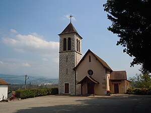
Country:
Region:
City:
Latitude and Longitude:
Time Zone:
Postal Code:
IP information under different IP Channel
ip-api
Country
Region
City
ASN
Time Zone
ISP
Blacklist
Proxy
Latitude
Longitude
Postal
Route
IPinfo
Country
Region
City
ASN
Time Zone
ISP
Blacklist
Proxy
Latitude
Longitude
Postal
Route
MaxMind
Country
Region
City
ASN
Time Zone
ISP
Blacklist
Proxy
Latitude
Longitude
Postal
Route
Luminati
Country
ASN
Time Zone
Europe/Paris
ISP
Alsatis SAS
Latitude
Longitude
Postal
db-ip
Country
Region
City
ASN
Time Zone
ISP
Blacklist
Proxy
Latitude
Longitude
Postal
Route
ipdata
Country
Region
City
ASN
Time Zone
ISP
Blacklist
Proxy
Latitude
Longitude
Postal
Route
Popular places and events near this IP address

Les Abrets
Delegated commune of Les Abrets-en-Dauphiné in Auvergne-Rhône-Alpes, France
Distance: Approx. 4635 meters
Latitude and longitude: 45.5375,5.5858
Les Abrets (French pronunciation: [lez‿abʁɛ]; Arpitan: Los Âbrèts) is a former commune in the Isère department in the Auvergne-Rhône-Alpes region of southeastern France. On 1 January 2016, it was merged into the new commune of Les Abrets-en-Dauphiné, of which it became a delegated commune.

Saint-Genix-sur-Guiers
Part of Saint-Genix-les-Villages in Auvergne-Rhône-Alpes, France
Distance: Approx. 3593 meters
Latitude and longitude: 45.6014,5.6353
Saint-Genix-sur-Guiers is a former commune in the Savoie department in the Auvergne-Rhône-Alpes region in south-eastern France. On 1 January 2019, it was merged into the new commune Saint-Genix-les-Villages. Saint-Genix-sur-Guiers is known for its cakes (gâteau de Saint-Genix) that are filled and decorated with pink pralines.

Chimilin
Commune in Auvergne-Rhône-Alpes, France
Distance: Approx. 427 meters
Latitude and longitude: 45.5781,5.6003
Chimilin (French pronunciation: [ʃimilɛ̃]) is a commune in the Isère department in southeastern France.

Romagnieu
Commune in Auvergne-Rhône-Alpes, France
Distance: Approx. 2941 meters
Latitude and longitude: 45.5708,5.6422
Romagnieu (French pronunciation: [ʁɔmaɲø]) is a commune in the Isère department in southeastern France.
Fitilieu
Part of Les Abrets-en-Dauphiné in Auvergne-Rhône-Alpes, France
Distance: Approx. 4707 meters
Latitude and longitude: 45.5475,5.5619
Fitilieu (French pronunciation: [fitiljø]; Arpitan: Feteliô) is a former commune in the Isère department in southeastern France. On 1 January 2016, it was merged into the new commune of Les Abrets-en-Dauphiné.

Granieu
Commune in Auvergne-Rhône-Alpes, France
Distance: Approx. 2899 meters
Latitude and longitude: 45.6003,5.5894
Granieu (French pronunciation: [ɡʁanjø]) is a commune in the Isère department in southeastern France.

Aoste, Isère
Commune in Auvergne-Rhône-Alpes, France
Distance: Approx. 1386 meters
Latitude and longitude: 45.589,5.609
Aoste (French pronunciation: [aɔst]; Arpitan: Aoûta) is a commune in the Isère department in the Auvergne-Rhône-Alpes region of southeastern France.
Château de Cordon
French fortified castle
Distance: Approx. 5152 meters
Latitude and longitude: 45.62083333,5.62583333
The Château de Cordon is a ruined feudal castle in the commune of Brégnier-Cordon in the Ain département of France.
Les Abrets en Dauphiné
Commune in Auvergne-Rhône-Alpes, France
Distance: Approx. 4683 meters
Latitude and longitude: 45.537,5.586
Les Abrets en Dauphiné (French pronunciation: [lez‿abʁɛ ɑ̃ dofine], literally Les Abrets in Dauphiné; Arpitan: Los Âbrèts-en-Dôfenât) is a commune in the Isère department of southeastern France. The municipality was established on 1 January 2016 and consists of the former communes of Les Abrets, La Bâtie-Divisin and Fitilieu.

Saint-Genix-les-Villages
Commune in Auvergne-Rhône-Alpes, France
Distance: Approx. 3593 meters
Latitude and longitude: 45.6014,5.6353
Saint-Genix-les-Villages is a commune in the Savoie department in the Auvergne-Rhône-Alpes region in south-eastern France. It was established on 1 January 2019 by merger of the former communes of Saint-Genix-sur-Guiers (the seat), Gresin and Saint-Maurice-de-Rotherens.

Guiers
River in eastern France
Distance: Approx. 4184 meters
Latitude and longitude: 45.6126,5.6218
The Guiers (French pronunciation: [ɡje]) is a river in the Isère and Savoie departments of eastern France. It is 49.9 km (31.0 mi) long. It rises in the Chartreuse Mountains.

Mystic (roller coaster)
Steel roller coaster at Walibi Rhône-Alpes
Distance: Approx. 5486 meters
Latitude and longitude: 45.619997,5.571537
Mystic is a steel roller coaster located at Walibi Rhône-Alpes in Les Avenières, France. The coaster marked the park's 40th anniversary as well as a headlining part of a decade-long, €25 million investment plan. The coaster was manufactured by Gerstlauer and traverses a total 1,886.5 feet (575.0 m) of track both forwards and backwards, at a top speed of 52.8 mph (85.0 km/h).
Weather in this IP's area
overcast clouds
14 Celsius
14 Celsius
13 Celsius
15 Celsius
1012 hPa
97 %
1012 hPa
984 hPa
10000 meters
0.65 m/s
0.85 m/s
170 degree
100 %
07:58:05
18:46:56


