Country:
Region:
City:
Latitude and Longitude:
Time Zone:
Postal Code:
IP information under different IP Channel
ip-api
Country
Region
City
ASN
Time Zone
ISP
Blacklist
Proxy
Latitude
Longitude
Postal
Route
Luminati
Country
Region
sa
City
adelaide
ASN
Time Zone
Australia/Adelaide
ISP
Uniti Wireless Pty Ltd
Latitude
Longitude
Postal
IPinfo
Country
Region
City
ASN
Time Zone
ISP
Blacklist
Proxy
Latitude
Longitude
Postal
Route
db-ip
Country
Region
City
ASN
Time Zone
ISP
Blacklist
Proxy
Latitude
Longitude
Postal
Route
ipdata
Country
Region
City
ASN
Time Zone
ISP
Blacklist
Proxy
Latitude
Longitude
Postal
Route
Popular places and events near this IP address

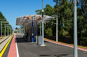
Oaklands railway station
Railway station in Adelaide, South Australia
Distance: Approx. 679 meters
Latitude and longitude: -35.0099,138.5402
Oaklands railway station is located on the Seaford railway line in Adelaide, South Australia. It is in the south-western suburb of Oaklands Park, 13 kilometres from Adelaide station.
Marion, South Australia
Suburb of Adelaide, South Australia
Distance: Approx. 1509 meters
Latitude and longitude: -34.997,138.552
Marion is a suburb in the City of Marion, around 10 kilometres (6.2 mi) south-west of the city centre of Adelaide, the capital of South Australia. Founded as a rural village in 1838 on the banks of the Sturt River, Marion was found to have rich soil and the population expanded rapidly. Colonel William Light laid out the plan for the village, as he had done with the City of Adelaide itself.

City of Marion
Local government area in South Australia
Distance: Approx. 1364 meters
Latitude and longitude: -35,138.552
The City of Marion is a local government area in part of the southern and western suburbs of Adelaide, South Australia. The council offices are in the suburb of Sturt.

Oaklands Park, South Australia
Suburb of City of Marion, South Australia
Distance: Approx. 1278 meters
Latitude and longitude: -35.014,138.545
Oaklands Park is a southern suburb of Adelaide, South Australia in the City of Marion. The Marion Shopping Centre is a major feature of the suburb.
Warradale, South Australia
Suburb of Adelaide, South Australia
Distance: Approx. 323 meters
Latitude and longitude: -35.007,138.538
Warradale is a suburb of Adelaide in the City of Marion. The name Warradale derives from Warripari, an Aboriginal (Kaurna) word for windy place by the (Sturt) River. The suburb is located in the south western part of Adelaide, approximately 12 kilometres from the CBD, and is serviced by the Seaford-Tonsley train line and several main roads.

Marion railway station
Railway station in Adelaide, South Australia
Distance: Approx. 1475 meters
Latitude and longitude: -34.9989538,138.5528014
Marion railway station is located on the Seaford line. Situated in the south-western Adelaide suburb of Marion, it is 11.4 kilometres from Adelaide station.

Warradale railway station
Railway station in Adelaide, South Australia
Distance: Approx. 902 meters
Latitude and longitude: -35.0114,138.5336
Warradale railway station is located on the Seaford line. Situated in the south-western Adelaide suburb of Warradale, it is 13.7 kilometres from Adelaide station. It was gutted by fire and subsequently rebuilt.
Westminster School, Adelaide
School in Marion, South Australia, Australia
Distance: Approx. 1250 meters
Latitude and longitude: -35.002916,138.551534
Westminster School is an independent, Uniting Church, Early Learning to Year 12, coeducational, day and boarding school located at Marion, South Australia, 12 km south of Adelaide. Founded as a Methodist day and boarding school for boys, the school was opened by the Prime Minister Robert Menzies in 1961 and is named after Westminster School in London. The school became co-educational in 1978, and has a current enrolment of around 1150 students.
Hove, South Australia
Suburb of Adelaide, South Australia
Distance: Approx. 1549 meters
Latitude and longitude: -35.009,138.522
Hove is a coastal suburb of Adelaide, South Australia. It is situated north of Brighton, west of Warradale, and south of North Brighton. Running along the west of the suburb is the Esplanade, a street with numerous townhouses with views of the Gulf St Vincent.
Marion Cultural Centre
Building in Adelaide, South Australia
Distance: Approx. 1164 meters
Latitude and longitude: -35.0135,138.5435
Marion Cultural Centre is located in the City of Marion, a local government area and suburb in Adelaide, South Australia, Australia.
South Australia Aquatic and Leisure Centre
Swimming venue in Adelaide, Australia
Distance: Approx. 988 meters
Latitude and longitude: -35.0125,138.54138889
The South Australia Aquatic and Leisure Centre (SAALC), also known as the State Aquatic Centre, is a swimming venue located in the Adelaide suburb of Oaklands Park in South Australia. The centre is managed by the YMCA on behalf of the Government of South Australia. In April 2011 South Australian Premier Mike Rann opened the Centre, the most advanced swimming and diving facilities in Australia, in Marion.

Electoral district of Gibson
Australian electorate
Distance: Approx. 975 meters
Latitude and longitude: -35.01,138.53
Gibson is a single-member electoral district for the South Australian House of Assembly. It was created by the redistribution conducted in 2016, and was contested for the first time at the 2018 state election.: pages 45–46 It replaced the former seat of Bright. Gibson lies southwest of the Adelaide city centre and includes the suburbs of Brighton, Dover Gardens, Hove, Marion, North Brighton, Oaklands Park, Seacombe Gardens, South Brighton, Sturt, Warradale and the southern portion of Somerton Park.
Weather in this IP's area
clear sky
27 Celsius
27 Celsius
26 Celsius
29 Celsius
1003 hPa
36 %
1003 hPa
1001 hPa
10000 meters
6.17 m/s
20 degree
06:08:51
19:50:06

