Country:
Region:
City:
Latitude and Longitude:
Time Zone:
Postal Code:
IP information under different IP Channel
ip-api
Country
Region
City
ASN
Time Zone
ISP
Blacklist
Proxy
Latitude
Longitude
Postal
Route
Luminati
Country
Region
zac
City
guadalupe
ASN
Time Zone
America/Mexico_City
ISP
ATGS-MMD-AS
Latitude
Longitude
Postal
IPinfo
Country
Region
City
ASN
Time Zone
ISP
Blacklist
Proxy
Latitude
Longitude
Postal
Route
db-ip
Country
Region
City
ASN
Time Zone
ISP
Blacklist
Proxy
Latitude
Longitude
Postal
Route
ipdata
Country
Region
City
ASN
Time Zone
ISP
Blacklist
Proxy
Latitude
Longitude
Postal
Route
Popular places and events near this IP address

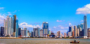
Panama City
Capital and the largest city of Panama
Distance: Approx. 1479 meters
Latitude and longitude: 8.98333333,-79.51666667
Panama City, also known as Panama (or Panamá in Spanish), is the capital and largest city of Panama. It has a total population of 1,086,990, with over 2,100,000 in its urban area. The city is located at the Pacific entrance of the Panama Canal, in the province of Panama.
Faros del Panamá
Mixed-use in Punta Pacífica, Panama City
Distance: Approx. 943 meters
Latitude and longitude: 8.98416667,-79.50861111
The Faros del Panamá is a skyscraper complex currently cancelled in Panama City, Panama. The complex, designed by Chapman Taylor, includes Torre Central (Central Tower), an 84 floor building with a planned height of 346 metres (1,135 feet). As its name states, Torre Central is in the middle of Faros de Panamá's three tower complex.
National Library of Panama
Distance: Approx. 866 meters
Latitude and longitude: 9.0002,-79.5078
The Biblioteca Nacional de Panamá (in English: National Library of Panama), in Panama City, is the legal deposit and copyright library for Panama. The library opened its doors on July 11, 1942, in a room located between 5th and 6th streets, adjacent to the presidency. In January 1961, the venue was moved to a building which had previously served as the Ricardo H. Newman College.

Panamá District
District in Panamá, Panama
Distance: Approx. 1479 meters
Latitude and longitude: 8.98333333,-79.51666667
Panamá is a district (distrito) of Panamá Province in Panama. The population according to the 2010 census was 880,691; the latest official estimate (for 2019) is 1,183,333. The district covers a total area of 2,031 km2.
Hospital Punta Pacifica
Hospital in Panama City, Panama
Distance: Approx. 1281 meters
Latitude and longitude: 8.981402,-79.510104
Pacifica Salud is a hospital in Panama City, Panama. It is the only hospital in Central America to be affiliated with Johns Hopkins Medicine International. Attracting medical tourism is a major component of its operating plan.
Latin American University of Science and Technology
Distance: Approx. 1370 meters
Latitude and longitude: 9.0037,-79.512
The Latin American University of science and Technology-Laureate International Universities (in Spanish: Universidad Latinoamericana de Ciencia y Tecnología) (ULACIT-LIU) was a private university located in Panama City, Panama.

San Francisco, Panamá
Corregimiento in Panamá, Panama
Distance: Approx. 63 meters
Latitude and longitude: 8.9919,-79.5069
San Francisco is a corregimiento within Panama City, in Panamá District, Panamá Province, Panama with a population of 43,939 as of 2010. Its population as of 1990 was 34,262, and its population as of 2000 was 35,751. On 20 March 1998, San Francisco recorded a temperature of 40.0 °C (104.0 °F), which is the highest temperature to have ever been recorded in Panama.

Atlapa Convention Centre
Distance: Approx. 820 meters
Latitude and longitude: 8.9896375,-79.50001872
Atlapa Convention Centre (Spanish: Centro de Convenciones de Atlapa) is located in Panama City, Panama. The convention centre was opened in June 1980. Run by the Panamanian tourist authority, it contains 19 meeting rooms, some of which are capable of hosting up to 600 people.

Fernández de Córdoba metro station
Panama metro station
Distance: Approx. 1476 meters
Latitude and longitude: 8.99638889,-79.51972222
Fernández de Córdoba is a Panama Metro station on Line 1. The tunnels to the station were completed in August 2012 and it was one of the first 11 stations when the metro began operations on 6 April 2014. The station serves the Vista Hermosa neighbourhood.
Torre Global Bank
Skyscraper in Costa del Este, Panama City
Distance: Approx. 1431 meters
Latitude and longitude: 8.98398,-79.516672
The Torre Global Bank is an office skyscraper in the Bella Vista district of Panama City, Panama. Built between 2002 and 2005, the tower stands at 176 m (577 ft) with 43 floors and is the 32nd tallest building in Panama City It was the tallest building in the country between 2005 and 2007.

Credicorp Bank Tower
Skyscraper in Costa del Este, Panama City
Distance: Approx. 1275 meters
Latitude and longitude: 8.98493,-79.51563
The Credicorp Bank Tower, also known as the PH Plaza Credicorp is a high-rise office building in the Bella Vista district of Panama City, Panama. Completed in 1997, the tower stands at 146 m (479 ft) tall with 42 floors and is the 51st tallest building in Panama City. It also serves as the headquarters of the Panamanian filiale of the Credicorp Bank.

Torre Banco General
Skyscraper in Costa del Este, Panama City
Distance: Approx. 1275 meters
Latitude and longitude: 8.98493,-79.51563
The Torre Banco General also known as Plaza Banco General is a high-rise office building in the Bella Vista district of Panama City, Panama. Completed in 1998, the tower stands at 122 m (400 ft) tall with 32 floors, and is the 55th tallest building in Panama City. It serves as the headquarters of the Banco General Panamá.
Weather in this IP's area
light rain
25 Celsius
26 Celsius
24 Celsius
26 Celsius
1010 hPa
85 %
1010 hPa
1008 hPa
10000 meters
2.57 m/s
180 degree
100 %
06:11:10
17:54:08

