Country:
Region:
City:
Latitude and Longitude:
Time Zone:
Postal Code:
IP information under different IP Channel
ip-api
Country
Region
City
ASN
Time Zone
ISP
Blacklist
Proxy
Latitude
Longitude
Postal
Route
Luminati
Country
Region
c
City
buenosaires
ASN
Time Zone
America/Argentina/Buenos_Aires
ISP
ATGS-MMD-AS
Latitude
Longitude
Postal
IPinfo
Country
Region
City
ASN
Time Zone
ISP
Blacklist
Proxy
Latitude
Longitude
Postal
Route
db-ip
Country
Region
City
ASN
Time Zone
ISP
Blacklist
Proxy
Latitude
Longitude
Postal
Route
ipdata
Country
Region
City
ASN
Time Zone
ISP
Blacklist
Proxy
Latitude
Longitude
Postal
Route
Popular places and events near this IP address

Bogotá
Capital and largest city of Colombia
Distance: Approx. 19 meters
Latitude and longitude: 4.71111111,-74.07222222
Bogotá (, also UK: , US: , Spanish pronunciation: [boɣoˈta] ), officially Bogotá, Distrito Capital, abbreviated Bogotá, D.C., and formerly known as Santa Fe de Bogotá (Spanish: [ˌsanta ˈfe ðe βoɣoˈta]; lit. 'Holy Faith of Bogotá') during the Spanish Colonial period and between 1991 and 2000, is the capital and largest city of Colombia, and one of the largest cities in the world. The city is administered as the Capital District, as well as the capital of, though not politically part of, the surrounding department of Cundinamarca. Bogotá is a territorial entity of the first order, with the same administrative status as the departments of Colombia.

Caracol Televisión
Colombian television network
Distance: Approx. 1917 meters
Latitude and longitude: 4.69388889,-74.07416667
Caracol Televisión (Spanish pronunciation: [kˌaɾakˈol tˌeleβisjˈon]) (known as Caracol and previously as Canal Caracol) is a Colombian free-to-air television network owned by Caracol Medios, a unit of Grupo Valorem. It is one of the leading private TV networks in Colombia, alongside Canal RCN and Canal 1. The network distributes and produces 5,000+ programs and has aired in more than 80 countries.

Bogotá Colombia Temple
Distance: Approx. 1794 meters
Latitude and longitude: 4.707801,-74.056247
The Bogotá Colombia Temple is the 57th operating temple of the Church of Jesus Christ of Latter-day Saints (LDS Church).

Avenida Suba
Distance: Approx. 591 meters
Latitude and longitude: 4.70583333,-74.07083333
Avenida Suba is a major road in northern Bogotá, Colombia, connecting the locality of Suba with the rest of the capital.

Colegio Helvetia
Private Swiss school in Bogotá, Colombia
Distance: Approx. 628 meters
Latitude and longitude: 4.71486,-74.07622
Colegio Helvetia is a private multilingual (Spanish, German, French) Swiss school located in Suba, Bogotá, Colombia.
Colegio Agustiniano Norte
Private Catholic school in Bogotá, Colombia
Distance: Approx. 1167 meters
Latitude and longitude: 4.70055556,-74.07111111
Colegio Agustiniano Norte (translated as Agustiniano Norte School or North Augustinian School) is a private Catholic primary and secondary school, located in Bogota, Colombia. Founded in 1969 as a school for boys only, the school is now co-educational, teaching students from kindergarten to Grade 11. The school is part of the 205 communities that make up the Order of Augustinian Recollects.

Bluradio
Colombian radio station
Distance: Approx. 1917 meters
Latitude and longitude: 4.69388889,-74.07416667
Blu Radio is a radio station in Bogotá, Colombia, owned by Caracol TV. In July 2012, Caracol TV leased HJMD (the frequency of Melodía FM Estéreo, an easy listening station) from Cadena Melodía, in order to create a news radio station. Test broadcasts started soon after, with a soft AC format and simulcasting Noticias Caracol. Blu Radio started definitive broadcasts 6 September 2012.
Córdoba (wetland)
Wetland in Bogotá, Colombia
Distance: Approx. 1014 meters
Latitude and longitude: 4.70372222,-74.06658333
Córdoba (Spanish: Humedal de Córdoba) is a wetland, part of the Wetlands of Bogotá in Bogotá, Colombia. It is situated on the Bogotá savanna in the locality Suba between the Avenida Boyacá and Avenida Córdoba and the streets Calle 127 and Calle 116, close to the TransMilenio stations Av. Suba Calle 116 and namesake station Humedal Córdoba.

Santa María del Lago
Distance: Approx. 3045 meters
Latitude and longitude: 4.69472222,-74.09416667
Santa María del Lago (Spanish: Humedal Santa María del Lago) is a wetland, part of the Wetlands of Bogotá, located in the locality Engativá, Bogotá, Colombia. The wetland on the Bogotá savanna covers an area of 12 hectares (30 acres), of which 4 hectares (9.9 acres) water.
Colegio Helvetica de Bogotá
Swiss international school in Bogotá, Colombia
Distance: Approx. 624 meters
Latitude and longitude: 4.7148,-74.07622
Colegio Helvetica de Bogotá (CHB; German: Schweizerschule Bogotá) is a Swiss international school in Bogotá, Colombia. It serves up to grade 12 (final year of Sekundarstufe II). It was founded in 1949.

Chibcha Terrane
Distance: Approx. 1331 meters
Latitude and longitude: 4.72288889,-74.07325
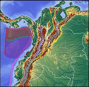
The Chibcha Terrane (Spanish: Terreno Chibcha, TCH), named after Chibcha, is the largest of the geological provinces (terranes) of Colombia. The terrane, the oldest explored domains of which date to the Meso- to Neoproterozoic, is situated on the North Andes Plate. The megaregional Romeral Fault System forms the contact of the terrane with the Tahamí Terrane.

Museum of Contemporary Art of Bogotá
Contemporary art museum in Bogotá
Distance: Approx. 2457 meters
Latitude and longitude: 4.6987,-74.0905
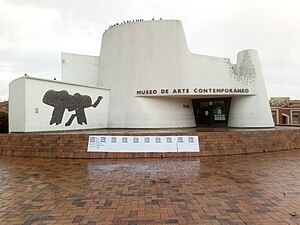
The Museum of Contemporary Art of Bogotá (Spanish: Museo de Arte Contemporáneo de Bogotá), also known by the acronym MAC, is an art museum located Engativá, Bogota. It is considered one of the most important museums in Bogotá.
Weather in this IP's area
scattered clouds
13 Celsius
13 Celsius
12 Celsius
13 Celsius
1014 hPa
94 %
1014 hPa
754 hPa
10000 meters
1.03 m/s
40 %
05:43:41
17:38:09
