Country:
 Colombia
Region:
City:
Latitude and Longitude:
Time Zone:
Postal Code:
IP information under different IP Channel
ip-api
Country
Region
City
ASN
Time Zone
ISP
Blacklist
Proxy
Latitude
Longitude
Postal
Route
IPinfo
Country
Region
City
ASN
Time Zone
ISP
Blacklist
Proxy
Latitude
Longitude
Postal
Route
MaxMind
Country
Region
City
ASN
Time Zone
ISP
Blacklist
Proxy
Latitude
Longitude
Postal
Route
Luminati
Country
 AR
ARRegion
c
City
buenosaires
ASN
Time Zone
America/Argentina/Buenos_Aires
ISP
ATGS-MMD-AS
Latitude
Longitude
Postal
db-ip
Country
Region
City
ASN
Time Zone
ISP
Blacklist
Proxy
Latitude
Longitude
Postal
Route
ipdata
Country
Region
City
ASN
Time Zone
ISP
Blacklist
Proxy
Latitude
Longitude
Postal
Route
Popular places and events near this IP address

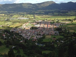
Cota, Cundinamarca
Municipality and town in Cundinamarca, Colombia
Distance: Approx. 8026 meters
Latitude and longitude: 4.81666667,-74.1
Cota is a municipality and town of Colombia in the Central Savanna Province of the department of Cundinamarca. Cota is part of the metropolitan area of Colombian capital Bogotá which centre is 26 kilometres (16 mi) away. The urban centre of Cota is located at an altitude of 2,566 metres (8,419 ft) and the municipality borders Chía in the north, Funza in the south, Suba, part of Bogotá in the east and Tenjo in the west.

Subachoque
Municipality and town in Cundinamarca, Colombia
Distance: Approx. 6913 meters
Latitude and longitude: 4.92805556,-74.17361111
Subachoque is a municipality and town of Colombia in the Western Savanna Province, part of the department of Cundinamarca. The municipality is situated on the Bogotá savanna with the urban centre at an altitude of 2,663 metres (8,737 ft) at a distance of 45 kilometres (28 mi) from the capital Bogotá. Subachoque is part of the Metropolitan Area of Bogotá and borders Zipaquirá, Tabio and Tenjo in the east, Zipaquirá and Pacho in the north, San Francisco and Supatá in the west and Madrid and El Rosal in the south.

Tabio
Municipality and town in Cundinamarca, Colombia
Distance: Approx. 7142 meters
Latitude and longitude: 4.91583333,-74.09833333
Tabio is a municipality and town of Colombia in the department of Cundinamarca. It's located at 45 km (28 mi) from Bogotá. The town was officially founded April 8, 1603, by Diego Gómez de Mena, on grounds that were the property of the native Muisca who inhabited the area.
Tenjo
Municipality and town in Cundinamarca, Colombia
Distance: Approx. 5436 meters
Latitude and longitude: 4.91666667,-74.16666667
Tenjo is a municipality and town of Colombia in the Central Savanna Province, part of the department of Cundinamarca. The urban centre is located at an altitude of 2,587 metres (8,488 ft) on the Bogotá savanna. Tenjo is part of the Metropolitan Area of Bogotá and borders Chía, Madrid, Tabio, Funza, Subachoque and Cota.
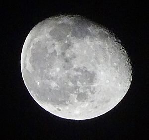
Moon Temple (Chía)
Distance: Approx. 6494 meters
Latitude and longitude: 4.86993333,-74.08730556
The Moon Temple of Chía was a temple constructed by the Muisca as a place of worship for their Moon goddess Chía. The temple was built in Chía, Cundinamarca, Colombia, then part of the Muisca Confederation. It was one of the most important temples in the religion of the Muisca.
Chorrera Formation
Distance: Approx. 7307 meters
Latitude and longitude: 4.925,-74.10627778
The Chorrera Formation (Spanish: Formación Chorrera, N2ch) is a geological formation of the Bogotá savanna, Altiplano Cundiboyacense, Eastern Ranges of the Colombian Andes. The formation consists of coarse to very coarse conglomerates. The Chorrera Formation dates to the Neogene period; Pliocene epoch (Montehermosan to Chapadmalalan in the SALMA classification), and has a maximum thickness of 40 metres (130 ft).
Weather in this IP's area
broken clouds
18 Celsius
17 Celsius
18 Celsius
18 Celsius
1013 hPa
52 %
1013 hPa
756 hPa
10000 meters
5.66 m/s
170 degree
75 %
05:46:16
17:53:30