Country:
Region:
City:
Latitude and Longitude:
Time Zone:
Postal Code:
IP information under different IP Channel
ip-api
Country
Region
City
ASN
Time Zone
ISP
Blacklist
Proxy
Latitude
Longitude
Postal
Route
Luminati
Country
Region
c
City
buenosaires
ASN
Time Zone
America/Argentina/Buenos_Aires
ISP
ATGS-MMD-AS
Latitude
Longitude
Postal
IPinfo
Country
Region
City
ASN
Time Zone
ISP
Blacklist
Proxy
Latitude
Longitude
Postal
Route
db-ip
Country
Region
City
ASN
Time Zone
ISP
Blacklist
Proxy
Latitude
Longitude
Postal
Route
ipdata
Country
Region
City
ASN
Time Zone
ISP
Blacklist
Proxy
Latitude
Longitude
Postal
Route
Popular places and events near this IP address

La Catedral
Prison in Medellín, Colombia
Distance: Approx. 5070 meters
Latitude and longitude: 6.11777778,-75.585
La Catedral was a personal prison overlooking the city of Medellín, in Colombia. The prison was built to specifications ordered by Medellín Cartel leader Pablo Escobar, under a 1991 agreement with the Colombian government in which Escobar would surrender to authorities and serve a maximum term of five full years and the Colombian government would not extradite him to the United States. The prison now is administered as a monastery by Catholic monks of the Benedictine Order.

Itagüí
Municipality and city in Antioquia Department, Colombia
Distance: Approx. 1793 meters
Latitude and longitude: 6.16666667,-75.61666667
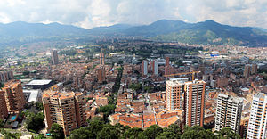
Itagüí (pronounced [itaˈɣwi]) is a city and municipality of Colombia, located in the south of the Aburrá Valley in the Antioquia Department. It is part of the Metropolitan Area of the Aburrá Valley.

Sabaneta, Antioquia
Municipality and town in Antioquia Department, Colombia
Distance: Approx. 1860 meters
Latitude and longitude: 6.15,-75.6
Sabaneta is a municipality of Colombia, located in the Aburrá Valley of the Antioquia department. It is bordered on the north by the municipalities of La Estrella, Itagüí and Envigado, on the east by Envigado, on the south by Caldas, and on the west by La Estrella. It is the smallest municipality in Colombia, with an area of only 15 km2.

Estadio Polideportivo Sur
Distance: Approx. 2423 meters
Latitude and longitude: 6.1641076,-75.5996704
Estadio Polideportivo Sur is a multi-purpose stadium in Envigado, Colombia that is currently used mostly for football matches. The stadium has a capacity of 11,000 people and was built in 1992. Envigado FC play their home matches at this stadium.
Coliseo Cubierto de Itagüí
Coliseum in Itagüí city, Colombia
Distance: Approx. 2523 meters
Latitude and longitude: 6.1703,-75.6056
The Coliseum of Itagüí (in Spanish Coliseo Cubierto de Itagüí) is a multi-use coliseum in Itagüí city, Colombia. It is currently used mostly for Futsal matches, on club level by Águilas Doradas. The coliseum has a capacity of 5,000 spectators.

Envigado bridge
Bridge in Antioquia, Colombia
Distance: Approx. 3714 meters
Latitude and longitude: 6.173569,-75.592504
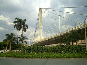
The Los Fundadores Bridge (Spanish: Intercambio Vial Los Fundadores), also known as the Peldar Bridge because of its location, is a concrete cable-stayed bridge in Envigado, Colombia. The bridge carries Las Vegas Avenue and crosses 37th Street. The construction of the bridge was also central to the regeneration plan for the neighborhood.
Challenge Sculpture
Distance: Approx. 3435 meters
Latitude and longitude: 6.1781,-75.6028
The Challenge Sculpture (Spanish: Reto) is a monument of 8 meters located in a park called The Artist in Itagüi, Colombia.

Ayurá station
Medellín metro station
Distance: Approx. 5215 meters
Latitude and longitude: 6.18611111,-75.58611111
Ayurá is the 17th station on line A of the Medellín Metro going south. It is the first stop on line A that is outside the city limits of Medellín, being in the city of Envigado instead. The Carrefour in Envigado is near this stop, on Las Vegas Avenue.

Envigado station
Envigado 1996
Distance: Approx. 3473 meters
Latitude and longitude: 6.17472222,-75.59694444
Envigado is the 18th station on line A of the Medellín Metro going south. It is named after the city where it is located, Envigado. The station was opened on 30 September 1996 as part of the extension of the line from Poblado to Itagüí.
Itagüí station
Medellín metro station
Distance: Approx. 1771 meters
Latitude and longitude: 6.1629,-75.6067
Itagüí is a station on line A of the Medellín Metro going south. It is named after the city where it is located, Itagüí. The station was opened on 30 September 1996 as the terminus of the extension of the line from Poblado.

Sabaneta station
Medellín metro station
Distance: Approx. 810 meters
Latitude and longitude: 6.1578,-75.6161
Sabaneta is a station on line A of the Medellín Metro going south. The station was opened on 17 September 2012 as part of the extension of the line from Itagüí to La Estrella. This station is known for having a more modern appearance than the other stations.
La Estrella station
Medellín metro station
Distance: Approx. 1111 meters
Latitude and longitude: 6.1527,-75.6266
La Estrella (English: "The Star"), also known as Ancón, is a station on line A of the Medellín Metro going south. It is located in the La Estrella municipality of Colombia. It was inaugurated on September 17, 2012 as part of the extension of the line from Itagüí in a ceremony attended by the current president of Colombia, Juan Manuel Santos; Governor of Antioquia, Sergio Fajardo; and Medellin Mayor Aníbal Gaviria.
Weather in this IP's area
overcast clouds
17 Celsius
18 Celsius
15 Celsius
18 Celsius
1015 hPa
98 %
1015 hPa
843 hPa
3544 meters
4.92 m/s
180 degree
100 %
05:51:30
17:42:21

