Country:
Region:
City:
Latitude and Longitude:
Time Zone:
Postal Code:
IP information under different IP Channel
ip-api
Country
Region
City
ASN
Time Zone
ISP
Blacklist
Proxy
Latitude
Longitude
Postal
Route
Luminati
Country
Region
c
City
buenosaires
ASN
Time Zone
America/Argentina/Buenos_Aires
ISP
ATGS-MMD-AS
Latitude
Longitude
Postal
IPinfo
Country
Region
City
ASN
Time Zone
ISP
Blacklist
Proxy
Latitude
Longitude
Postal
Route
db-ip
Country
Region
City
ASN
Time Zone
ISP
Blacklist
Proxy
Latitude
Longitude
Postal
Route
ipdata
Country
Region
City
ASN
Time Zone
ISP
Blacklist
Proxy
Latitude
Longitude
Postal
Route
Popular places and events near this IP address

Chía, Cundinamarca
Municipality and city in Cundinamarca, Colombia
Distance: Approx. 7280 meters
Latitude and longitude: 4.85,-74.05
Chía is a city and municipality in the department of Cundinamarca in Colombia, located 10 km north of Bogotá on the main road to Zipaquira. Due to its proximity to Bogotá, Chía has effectively become a suburb of the capital. Its history dates back to the pre-Columbian era.
Escuela Colombiana de Ingeniería
Distance: Approx. 7122 meters
Latitude and longitude: 4.78222222,-74.04388889
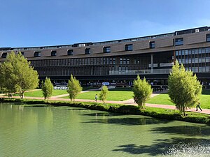
The Escuela Colombiana de Ingeniería (Spanish for Colombian School of Engineering) Julio Garavito is a private engineering-based university. The school is located on a 70-acre (280,000 m2) campus in a beautiful natural environment in the north part of Bogotá and has approximately 4,600 students in undergraduate and graduate programs. It includes laboratories, computer systems, one of the largest collections of engineering texts and journals in Colombia as well as international and national access to information via the internet.

Cota, Cundinamarca
Municipality and town in Cundinamarca, Colombia
Distance: Approx. 785 meters
Latitude and longitude: 4.81666667,-74.1
Cota is a municipality and town of Colombia in the Central Savanna Province of the department of Cundinamarca. Cota is part of the metropolitan area of Colombian capital Bogotá which centre is 26 kilometres (16 mi) away. The urban centre of Cota is located at an altitude of 2,566 metres (8,419 ft) and the municipality borders Chía in the north, Funza in the south, Suba, part of Bogotá in the east and Tenjo in the west.

Guaymaral Airport
Airport
Distance: Approx. 4062 meters
Latitude and longitude: 4.8125,-74.06527778
Guaymaral Airport (ICAO: SKGY) is a high-elevation airport in the north of Bogotá, Colombia, also serving the towns of Cota and Chía. The runway is 15 kilometres (9.3 mi) northeast of Bogota's El Dorado International Airport.

Suba, Bogotá
Locality of Bogotá in Bogotá D.C., Colombia
Distance: Approx. 7915 meters
Latitude and longitude: 4.741,-74.084
Suba is the 11th locality of Bogotá, capital of Colombia. It is located in the northwest of the city, bordering to the north the municipality of Chía in Cundinamarca, to the west the municipality of Cota, to the east the locality Usaquén and to the south the localities Engativá and Barrios Unidos. This district is inhabited by residents of all social classes.
Club Campestre El Rancho
Distance: Approx. 7360 meters
Latitude and longitude: 4.774472,-74.045749
The Club Campestre El Rancho is a tennis and golf venue in Bogotá, Colombia. Until 2012, the club was the host of the Copa Colsanitas, a WTA Tour Tier-III event (2001–2008), and from 2009 a WTA International tournament. The club previously hosted an ATP Tour event from 1994–2001.
La Conejera
Distance: Approx. 5361 meters
Latitude and longitude: 4.76169444,-74.10255556
La Conejera (Spanish: Humedal La Conejera) is a wetland, part of the Wetlands of Bogotá, located in the locality Suba, Bogotá, Colombia. The wetland, in the Juan Amarillo River basin on the Bogotá savanna covers an area of 58.9 hectares (146 acres).

Moon Temple (Chía)
Distance: Approx. 6879 meters
Latitude and longitude: 4.86993333,-74.08730556
The Moon Temple of Chía was a temple constructed by the Muisca as a place of worship for their Moon goddess Chía. The temple was built in Chía, Cundinamarca, Colombia, then part of the Muisca Confederation. It was one of the most important temples in the religion of the Muisca.

Thomas van der Hammen Natural Reserve
Distance: Approx. 4085 meters
Latitude and longitude: 4.77388889,-74.09444444
The Thomas van der Hammen Natural Reserve or Thomas van der Hammen Forest Reserve is an area of the Bogotá savanna that is under environmental protection. The natural reserve was declared as such in year 2000 by the Ministry of Environment and Sustainable development. It takes its name from the Dutch-Colombian geologist Thomas van der Hammen who devoted his life to the research of the region.
Guaymaral y Torca
Distance: Approx. 6761 meters
Latitude and longitude: 4.80491667,-74.04105556
Guaymaral y Torca (Spanish: Humedal Guaymaral y Torca) is a combined wetland, part of the Wetlands of Bogotá, located in the north of the Colombian capital in the localities Suba and Usaquén, Bogotá, Colombia. The wetlands on the Bogotá savanna cover an area of about 73 hectares (180 acres). Guaymaral y Torca, the northernmost wetlands of Bogotá at the foot of the Eastern Hills, is composed of three parts, Guaymaral in the west in Suba (49 hectares (120 acres)), Torca in the east in Usaquén (24 hectares (59 acres)) and a small strip along the dividing Autopista Norte between the two main wetlands.

La Conejera Hill
Distance: Approx. 5521 meters
Latitude and longitude: 4.77444444,-74.06694444
La Conejera Hill is a 2,680-metre (8,790 ft) high hill located in the north of Bogotá, Colombia. It has an area of 161.4 ha (399 acres), a prominence of 115 m (377 ft), and a height of 2,680 m (8,790 ft). It is an extended hill in a south-north direction, occupying the area between Calles 170 and 200, and Carreras 80 and 90.

Autódromo Ricardo Mejía
Distance: Approx. 7185 meters
Latitude and longitude: 4.77833333,-74.04527778
Autódromo Ricardo Mejía was a 3.925 km (2.439 mi) motor racing circuit located in Bogotá, Colombia. The circuit was inaugurated on 7 February 1971 with the Gran Premio República de Colombia, the first track competition held in the country. It hosted various national and international speed and endurance championships, as well as hosting a round of the 1972 American Formula 2 season.
Weather in this IP's area
scattered clouds
12 Celsius
12 Celsius
12 Celsius
13 Celsius
1014 hPa
94 %
1014 hPa
754 hPa
10000 meters
1.03 m/s
40 %
05:43:56
17:38:08